
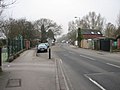
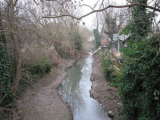
Ferry Hinksey Road is a road in west Oxford, England, leading south from the Botley Road. [1] The road leads to the Osney Mead Industrial Estate to the east, started in 1961. [2] To the east is Osney Ditch.
Ferry Hinksey Road is a road in west Oxford, England, leading south from the Botley Road. [1] The road leads to the Osney Mead Industrial Estate to the east, started in 1961. [2] To the east is Osney Ditch.
The road is named after the village of Ferry Hinksey, now known as North Hinksey, on the other side of Hinksey Stream, one of the branches of the River Thames in Oxford. There was once a punt ferry that operated over Bulstake Stream. [3]
The most notable path between Oxford and North Hinksey, a continuation of Ferry Hinksey Road, is a metalled bridleway and cycle track, variously known as Willow Walk and Ruskin's Ride. The latter is named after John Ruskin (1819–1900) who used to pass this way between Ferry Hinksey and Oxford, where he was the first Slade Professor of Fine Art from 1869. [4] The path was originally built in 1876–77 by Aubrey Harcourt (1852–1904), a major local landowner, [5] but was not made open to the public until 1922. There is also a smaller unmade path which begins alongside the large back garden of The Fishes and crosses Hinksey Stream by a bridge at the site of the old ferry, which linked Ferry Hinksey with Oxford. The ferry ceased operation in 1928. The various streams are now crossed by small bridges. A 'Ferry Cottage' still remains.
A poem called Ferry Hinksey by Laurence Binyon (1869–1943) describes the bucolic nature of the area before Osney Mead Industrial Estate was developed. [3]
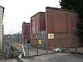
Arup Associates designed the building for the Oxford Mail and Times in 1970–2. [6] West Oxford Community Primary School, [7] formerly West Oxford First School, [8] is also located here. Holywell Press moved to Ferry Hinksey Road in 1989. Oxford Open Learning, a distance learning company, is at King's Meadow off Ferry Hinksey Road. [9]


Botley is a village in the civil parish of North Hinksey in the ceremonial county of Oxfordshire, just west of the Oxford city boundary. Historically part of Berkshire, it stands on the Seacourt Stream, a stream running off the River Thames. The intersection of the A34 and A420 is to the village's north.
North Hinksey is a village and civil parish in Oxfordshire, England, immediately west of Oxford. The civil parish includes the large settlement of Botley, effectively a suburb of Oxford. North Hinksey was part of Berkshire until the 1974 boundary changes transferred it to Oxfordshire. The village of North Hinksey has a manor house, The Fishes public house, a Church of England primary school and a Church of England parish church, St. Lawrence's, which dates back to at least the 12th century. Four of the older houses have thatched roofs.

Oxford West and Abingdon is a constituency represented in the House of Commons of the UK Parliament since 2017 by Layla Moran, a Liberal Democrat.

The Thames Path is a National Trail following the River Thames from its source near Kemble in Gloucestershire to the Woolwich foot tunnel, south east London. It is about 185 miles (298 km) long. A path was first proposed in 1948 but it only opened in 1996.

Cumnor is a village and civil parish 3½ miles (5.6 km) west of the centre of Oxford, England. The village is about 2 miles (3.2 km) south-west of Botley and its centre is west of the A420 road to Swindon. The parish includes Cumnor Hill,, Chawley, the Dean Court area on the edge of Botley and the outlying settlements of Chilswell, Farmoor, Filchampstead and Swinford. It was within Berkshire until the 1974 local government boundary changes transferred it to Oxfordshire. The 2011 Census recorded the parish population as 5,755.

Osney or Osney Island is a riverside community in the west of the city of Oxford, England. In modern times the name is applied to a community also known as Osney Town astride Botley Road, just west of the city's main railway station, on an island surrounded by the River Thames, Osney Ditch and another backwater connecting the Thames to Osney Ditch.

South Hinksey is a village and civil parish just over 1 mile (1.6 km) south of the centre of Oxford. The parish includes the residential area of Hinksey Hill about 0.5 miles (800 m) south of the village. The parish was part of Berkshire until the 1974 boundary changes transferred it to Oxfordshire.
New Hinksey is a suburb in the south of the city of Oxford.
Hinksey is a place name associated with Oxford and Oxfordshire. In 1974, many of the places associated with the name were transferred from the county of Berkshire in the county boundary changes.

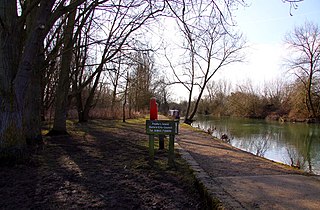
Hinksey Stream is a branch of the River Thames to the west of the city of Oxford, England. It starts as Seacourt Stream, which leaves the Thames at a bifurcation north of the village of Wytham, and rejoins the river south of the city near Kennington.
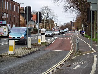
Botley Road is the main road into the centre of Oxford, England from the west. It stretches between Botley, on the Oxford Ring Road (A34) to the west of the city, and Frideswide Square at the junction with Oxford railway station, close to central Oxford.

Osney Lock is a lock on the River Thames in Oxford, England, where the village or island of Osney is next to the river.

Godstow Lock is a lock on the River Thames in Oxfordshire, England. It is between the villages of Wolvercote and Wytham on the outskirts of Oxford. The first lock was built of stone by Daniel Harris for the Thames Navigation Commission in 1790. It is the lock furthest upstream on the river which has mechanical (electro-hydraulic) operation - every lock upstream of Godstow utilises manual beam operation instead.
Fiddler's Island is an island in the River Thames at Oxford in England. It is situated south of Port Meadow on the reach above Osney Lock.

The Carfax Conduit was a water conduit that supplied the city of Oxford with water from 1610 until 1869.

Bulstake Stream, also spelt Bullstake Stream, is a backwater of the River Thames at Oxford, England.

Sheepwash Channel connects the River Thames to the west and the Castle Mill Stream next to the Oxford Canal to the east, in west Oxford, England. To the north are Cripley Meadow and Fiddler's Island. To the south are Osney Island and the Botley Road.
The Osney Ditch is a side channel of the River Thames at Oxford, England. It is one of the principal watercourses in west Oxford.

Holywell Press Ltd is a family printing and publishing company based in Oxford, England.
Coordinates: 51°45′02″N1°16′35″W / 51.75054°N 1.27643°W
| | This Oxfordshire location article is a stub. You can help Wikipedia by expanding it. |
| | This England road or road transport-related article is a stub. You can help Wikipedia by expanding it. |