North Hinksey

Last updated

North Hinksey
St Lawrence's Church, North Hinksey, Oxon. - geograph.org.uk - 53751.jpg
Location map United Kingdom Oxford.svg
Red pog.svg
North Hinksey
Oxfordshire UK location map.svg
Red pog.svg
North Hinksey
Location within Oxfordshire
Population4,316 (2001 census) [1]
OS grid reference SP4905
Civil parish
District
Shire county
Region
Country England
Sovereign state United Kingdom
Post town Oxford
Postcode district OX2
Dialling code 01865
Police Thames Valley
Fire Oxfordshire
Ambulance South Central
UK Parliament
Website North Hinksey Parish Council
List of places
UK
England
Oxfordshire
51°44′56″N1°17′31″W / 51.749°N 1.292°W / 51.749; -1.292

North Hinksey is a village in the civil parish of Botley and North Hinksey, in the Vale of White Horse district, in Oxfordshire, England, on the west side of the Thames flood plain immediately opposite the city of Oxford. The civil parish includes the large settlement of Botley, effectively an isolated suburb of Oxford, with the Botley Road as the sole highway link across the flood plain. North Hinksey was in all respects part of Berkshire until the 1974 boundary changes transferred administration of the Vale of White Horse district to Oxfordshire County Council; it remains part of the historic county of Berkshire however, since the 1974 act did not change the ancient county boundaries. The village of North Hinksey has a manor house, The Fishes public house, a Church of England primary school [2] and a Church of England parish church, St. Lawrence's, which dates back to at least the 12th century. Four of the older houses have thatched roofs.

Contents

There was also the administrative offices of the Church of England Diocese of Oxford (Diocesan Church House) in the enlarged former vicarage. This, as of September 2016 is to be converted to housing. Harcourt Hill and Raleigh Park lie to the southwest of the village. All the shopping and other facilities in the parish are now found in Botley. The centre of the old village is now effectively cut off from much of the newer part of Botley by the busy Oxford Ring Road, part of the A34 trunk road, though there are two pedestrian underpasses. The parish has a cemetery which includes 671 identified Commonwealth war graves. [3]

History

Also called Hengestesige (10th century); Hengsteseia (12th century); Henxtesey (13th century); Northengseye (15th century); Laurence Hinksey, Ferry Hinksey, Ivy Hinksey, (passim). [4] North Hinksey was anciently called Hengestseigge, and was given in 955 to Abingdon Abbey. [5] This place was settled in the Saxon era. Its toponym is thought to mean 'stallion's isle'. Along with the neighbouring village of South Hinksey, it was once part of the estate of the Benedictine abbey at Abingdon, and was in Berkshire until the boundary changes of 1974. The village appears on the 1610 John Speed map as 'Laurence Hinksey', after the church's dedication, while a 1670s map shows 'Ivy Hinksey'.

It was also at one time called Ferry Hinksey, being linked to the eastern side of Hinksey Stream by a small ferry, reached from west Oxford by way of Ferry Hinksey Road. The ferry ceased operation in 1928, and the various streams are now crossed by small bridges, though a 'Ferry Cottage' remains that matches the period and has access to the river. Ferry Hinksey (as it was then) is also the burial place of Thomas and Rachael Willis [6] (died 1648 and 1631 respectively) the parents of the physician Dr Thomas Willis. He played an important part in the history of anatomy, neurology, and psychiatry, and was a founding member of the Royal Society.

The parish church of Saint Lawrence's contains two war memorials commemorating the twenty-three men of North Hinksey and Botley who died in the two world wars. [7]

On 1 April 2023 the civil parish was renamed from "North Hinksey" to "Botley and North Hinksey". [8]

John Ruskin and the diggers

The critic John Ruskin was fond of riding out from Oxford, and his trips often took him westwards to North Hinksey, whose rustic charm he admired. (There is a plaque to this effect on one of the old thatched cottages.) [9] He noted the poor state of the village road, and in 1874, he thought of a scheme which would give Oxford students the benefits of manual labour, and also improve conditions for the villagers. He organised a group of undergraduates to help him in the building of an improved road, bordered with banks of flowers. The episode might have vanished into historical obscurity, except that the students in his road-building gang included Oscar Wilde, Alfred Milner, Hardwicke Rawnsley, William Gershom Collingwood and Arnold Toynbee. Wilde later wrote of the episode in Art and the Handicraftsman, (published in Essays, 1879):

We were coming down the street—a troop of young men, some of them like myself only nineteen, going to river or tennis-court or cricket-field—when Ruskin going up to lecture in cap and gown met us. He seemed troubled and prayed us to go back with him to his lecture, which a few of us did, and there he spoke to us not on art this time but on life, saying that it seemed to him to be wrong that all the best physique and strength of the young men in England should be spent aimlessly on cricket ground or river, without any result at all except that if one rowed well one got a pewter-pot, and if one made a good score, a cane-handled bat. He thought, he said, that we should be working at something that would do good to other people, at something by which we might show that in all labour there was something noble. Well, we were a good deal moved, and said we would do anything he wished. So he went out round Oxford and found two villages, Upper and Lower Hinksey, and between them there lay a great swamp, so that the villagers could not pass from one to the other without many miles of a round. And when we came back in winter he asked us to help him to make a road across this morass for these village people to use. So out we went, day after day, and learned how to lay levels and to break stones, and to wheel barrows along a plank—a very difficult thing to do. And Ruskin worked with us in the mist and rain and mud of an Oxford winter, and our friends and our enemies came out and mocked us from the bank. We did not mind it much then, and we did not mind it afterwards at all, but worked away for two months at our road. And what became of the road? Well, like a bad lecture it ended abruptly—in the middle of the swamp. Ruskin going away to Venice, when we came back for the next term there was no leader, and the 'diggers', as they called us, fell asunder. [10]

Local topography

It remains difficult to travel from North Hinksey to South Hinksey, although the Oxford Ring Road now links the two villages. The most notable path between Oxford and North Hinksey is a metalled bridleway and cycle track variously known as Willow Walk and Ruskin's Ride. This path was built in 1876–77 by Aubrey Harcourt (1852–1904), a major local landowner, [11] but not open to the public until 1922. There is also a smaller unmade path which begins alongside the large back garden of The Fishes and crosses Hinksey Stream by a bridge at the site of the old ferry.

Footpath and cycleway between Oxford via Ferry Hinksey Road and North Hinksey. Footpath and Cycleway to North Hinksey - geograph.org.uk - 854706.jpg
Footpath and cycleway between Oxford via Ferry Hinksey Road and North Hinksey.

Raleigh Park

Raleigh Park, comprising woodland, grassland and unusual alkaline boggy areas, lies in North Hinksey just west of the Oxford ring road. It is managed by Oxford City Council and conservation work is done by the Friends of Raleigh Park and the Oxford Conservation Volunteers.

See also

Related Research Articles

<span class="mw-page-title-main">Botley, Oxfordshire</span> Human settlement in England

Botley is a village in the civil parish of Botley and North Hinksey, in the Vale of White Horse district, in the county of Oxfordshire, England, just west of the Oxford city boundary. Historically part of Berkshire, it stands on the Seacourt Stream, a stream running off the River Thames. The intersection of the A34 and A420 is to the village's north.

<span class="mw-page-title-main">Wytham</span> Human settlement in England

Wytham is a village and civil parish on the Seacourt Stream, a branch of the River Thames, about 3 miles (5 km) northwest of the centre of Oxford. It is just west of the Western By-Pass Road, part of the Oxford Ring Road (A34). The nearest village is Godstow. Wytham was the northernmost part of Berkshire until the 1974 boundary changes transferred it to Oxfordshire. The toponym is first recorded as Wihtham around 957, and comes from the Old English for a homestead or village in a river-bend.

<span class="mw-page-title-main">Cumnor</span> Village west of Oxford, England

Cumnor is a village and civil parish 3½ miles (5.6 km) west of the centre of Oxford, England. The village is about 2 miles (3.2 km) south-west of Botley and its centre is west of the A420 road to Swindon. The parish includes Cumnor Hill,, Chawley, the Dean Court area on the edge of Botley and the outlying settlements of Chilswell, Farmoor, Filchampstead and Swinford. It was within Berkshire until the 1974 local government boundary changes transferred it to Oxfordshire. The 2011 Census recorded the parish population as 5,755.

Abingdon was a rural district in the administrative county of Berkshire from 1894 to 1974.

<span class="mw-page-title-main">Osney</span> Human settlement in England

Osney or Osney Island is a riverside community in the west of the city of Oxford, England. In modern times the name is applied to a community also known as Osney Town astride Botley Road, just west of the city's main railway station, on an island surrounded by the River Thames, Osney Ditch and another backwater connecting the Thames to Osney Ditch.

<span class="mw-page-title-main">South Hinksey</span> Human settlement in England

South Hinksey is a village and civil parish just over 1 mile (1.6 km) south of the centre of Oxford. The parish includes the residential area of Hinksey Hill about 0.5 miles (800 m) south of the village. The parish was part of Berkshire until the 1974 boundary changes transferred it to Oxfordshire.

New Hinksey is a suburb in the south of the city of Oxford.

Hinksey is a place name associated with Oxford and Oxfordshire. In 1974, many of the places associated with the name were transferred from the county of Berkshire in the county boundary changes.

<span class="mw-page-title-main">Hinksey Stream</span> Stream in Oxfordshire, England

Hinksey Stream is a branch of the River Thames to the west of the city of Oxford, England. It starts as Seacourt Stream, which leaves the Thames at a bifurcation north of the village of Wytham, and rejoins the river south of the city near Kennington.

<span class="mw-page-title-main">Botley Road</span> Road in Oxford, England

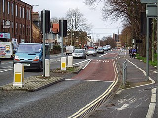
Botley Road is the main road into the centre of Oxford, England from the west. It stretches between Botley, on the Oxford Ring Road (A34) to the west of the city, and Frideswide Square at the junction with Oxford railway station, close to central Oxford.

<span class="mw-page-title-main">Kennington, Oxfordshire</span> Human settlement in England

Kennington is a village and civil parish in the Vale of White Horse district of Oxfordshire, just south of Oxford. The village occupies a narrow stretch of land between the River Thames and the A34 dual carriageway. It was in Berkshire until the 1974 boundary changes transferred it to Oxfordshire.

Harcourt Hill is a hill and community in North Hinksey in Oxfordshire, England, west of the city of Oxford. There is a good view of the city from the hill. It lies between Hinksey Hill to the southeast, Boars Hill to the south and Botley to the north. Until 1974 it was in Berkshire, but was transferred to Oxfordshire in that year.

<span class="mw-page-title-main">Seacourt</span> Deserted medieval village in Oxfordshire, UK

<span class="mw-page-title-main">Lyford, Oxfordshire</span> Village and civil parish in Vale, England

Lyford is a village and civil parish on the River Ock about 4 miles (6.4 km) north of Wantage. Historically it was part of the ecclesiastical parish of Hanney. Lyford was part of Berkshire until the 1974 boundary changes transferred the Vale of White Horse to Oxfordshire. The 2001 Census recorded the parish's population as 44. Lyford's toponym refers to a former ford the Ock, now replaced with a bridge on the road to Charney Bassett. "Ly" is derived from the Old English lin, meaning "flax". In 1034 it was recorded as Linford.

Raleigh Park is a park of about 27 acres (110,000 m2) in North Hinksey, Oxfordshire, just west of Oxford. The land was formerly part of the estates of the Harcourt family. The land was sold in 1924 to Raymond ffennell, then owner of Wytham Abbey, who gave it to the City of Oxford for use as a park. It was named in honour of Professor Sir Walter Raleigh, who lived nearby on Harcourt Hill and died in 1922.

Dean Court is a suburb 2 miles (3.2 km) west of the centre of Oxford, England. Dean Court was part of Berkshire until the 1974 local government boundary changes transferred it to Oxfordshire.

<span class="mw-page-title-main">Ferry Hinksey Road</span> Road in west Oxford, England

Ferry Hinksey Road is a road in west Oxford, England, leading south from the Botley Road. The road leads to the Osney Mead Industrial Estate to the east, started in 1961. To the east is Osney Ditch.

<span class="mw-page-title-main">St Lawrence's Church, North Hinksey</span> Church in Oxon. , England

St Lawrence's Church is a Church of England church in North Hinksey, West Oxford, England. The church is dedicated to St Lawrence, a Christian martyr. It is a Grade II* Listed Building. The church has a chancel, nave and tower.

References

  1. "Area: North Hinksey CP (Parish): Parish Headcounts". Neighbourhood Statistics. Office for National Statistics . Retrieved 23 March 2010.
  2. North Hinksey (Church of England) Primary School
  3. Commonwealth War Graves Commission website
  4. "Parishes: North Hinksey | British History Online".
  5. "You searched for north hinksey - Berkshire Family History Society".
  6. "Thomas Willis".
  7. "The War Dead of North Hinksey".
  8. "Vale of White Horse District Council (Reorganisation of Community Governance) Order 2023" (PDF). Local Government Boundary Commission for England . Retrieved 4 July 2023.
  9. McKnight, Owen Massey (25 September 2010). "Ruskin Cottage, North Hinksey". Flickr . Retrieved 6 August 2021.
  10. Wilde, Oscar (1908). "Art and the Handicraftsman". In Ross, Robert (ed.). Essays and Lectures. Methuen and Co.
  11. Hanson, W. J. (1996). A Thousand Years: a study of the interaction between people and environment in the Cumnor, Wytham and North Hinksey Area. Wytham Publications.

Further reading