Denchworth

Last updated • 9 min readFrom Wikipedia, The Free Encyclopedia

Denchworth
Denchworth StJames northwest.JPG
St James' parish church
Oxfordshire UK location map.svg
Red pog.svg
Denchworth
Location within Oxfordshire
Population171 (2011 Census)
OS grid reference SU3891
Civil parish
  • Denchworth
District
Shire county
Region
Country England
Sovereign state United Kingdom
Post town Wantage
Postcode district OX12
Dialling code 01235
Police Thames Valley
Fire Oxfordshire
Ambulance South Central
UK Parliament
Website Denchworth Parish Meeting
List of places
UK
England
Oxfordshire
51°37′23″N1°27′04″W / 51.623°N 1.451°W / 51.623; -1.451

Denchworth is a village and civil parish about 2.5 miles (4 km) north of Wantage. It was part of Berkshire until the 1974 boundary changes transferred the Vale of White Horse to Oxfordshire. The 2011 Census recorded the parish's population as 171. [1] The parish is bounded by the Land Brook in the west and the Childrey Brook in the east. The Great Western Main Line between Reading and Swindon runs through the parish just south of the village, but there is no station.

Contents

Manors

The Abingdon Chronicle claims that Cædwalla of Wessex granted Deniceswurth to Abingdon Abbey late in the seventh century, and that this was confirmed by Coenwulf of Mercia early in the ninth century. [2] The Domesday Book records that by 1086 Henry de Ferrers held the manor of Denchesworde: [2]

"The same Henry de Ferrers holds Denchworth and Reiner holds of him. Aethelric held it TRE. [3] Then assessed at 7 hides now at five and a half hides. There is land for five ploughs. In demesne is one plough and five villans and five cottars with one plough and 30 acres (12 ha) of meadow and there is a church. TRE it was worth 70 shillings and afterwards 60 shillings. Now 4 pounds." [4]

Overlordship of the manor remained with the Ferrers family until Denecheswrth was granted to the Earls of Lancaster along with the Honour of Tutbury, [2] presumably starting with Edmund, 1st Earl of Lancaster in the latter part of the 13th century. Denchworth manor was assessed at half a knight's fee and had been let to Henry de Tubney by the middle of the 13th century. It remained with his manor of Tubney until 1428. Somewhen between then and 1448 the half fee was sold to a member of the Hyde family.

The Hydes kept the manor until 1617, when George Hyde sold it to Sir William Cockayne. Sir Wiliam's son Charles Cokayne, Charles inherited Denchworth in 1626. Charles Cokayne was created 1st Viscount Cullen in 1642, and was succeeded by Brien Cokayne, 2nd Viscount Cullen in 1661. In 1663 the 2nd Viscount sold Denchworth to Gregory Geering. Denchworth remained with the Geering family until 1758, when William Geering sold it to Worcester College, Oxford. The college still held the manor in the early 1920s. [2] The landowning Fettiplace family had a home at North Denchworth. [2]

Circourt

Denchworth parish also included a manor that in the 12th century was called Suthcote — a toponym derived from the fact that it is south of the village. The name evolved via Sudecote in the 13th century and Southcote or Circote in the 17th century to the present "Circourt". This manor existed by 947, when King Eadred granted an estate of five hides there to one Wulfric, who conveyed it to Abingdon Abbey. In 1221 the manor was assessed at seven hides. The Abbey retained the overlordship of Circourt until the Dissolution of the Monasteries in the 16th century, [2] when it was forced to surrender all its estates to the Crown.

In 1166 Circourt was assessed at one knight's fee. It descended with the families of de Aura, de l'Orti, Whittock, atte Ya, Saumon and others until the 15th century, and by 1442 it was held by John Hyde. Along with Denchworth, Circourt was bought by Sir William Cockayne in 1617 and Gregory Geering in 1663. The Geerings sold Circourt to the Matthews family of Goosey, who sold it to Edward Saxton of Abingdon. His heir Charles Saxton was commissioner for the Royal Navy, and in 1794 was created first Saxton Baronet. His son Sir Charles Saxton, 2nd Baronet was Member of Parliament for Cashel 1812–18 and held the manor in 1824. On his death in 1838 the baronetcy became extinct, but Circourt passed to his nephew Charles Oliver. In the early 1920s the Oliver family still held the manor. [2]

Cleets

The Domesday Book records a manor of six hides at South Denchworth held by one Laurence of Wilbrighton in Staffordshire. His heirs became the Wilbrighton family, and by 1241 they had divided the manor and granted half to the Augustinian Poughley Priory. David Martyn, Bishop of St David's held this tenancy early in the 14th century, and in 1328 left it to his nephew Thomas de Carew. In 1333 de Carew granted the tenancy of two parts of the Poughley holding to Richard Cleet of Chipping Lambourn, and this holding came to be known as Cleets. Later the Hyde family leased Cleets from one of his heirs, and in 1408 they bought the tenancy. Cleets seems to have been included with the other lands sold to Sir William Cockayne in 1617. [2]

The earliest recorded ancestor of the Hyde family in Denchworth parish was one Warin, who lived there in the middle of the 13th century. The family's land was in the manor of Circourt and was assessed at one hide, wherefrom the family derived its surname. In 1327 de la Hyde held a messuage and four virgates in Circourt. With the other Hyde estates this land was sold to Sir William Cockayne in 1617 and Gregory Geering in 1663. One of the Geerings then sold it to the Moyer family, from whom it passed by marriage to John Heathcote of Connington Castle. It then passed by marriage to William Dawnay, 6th Viscount Downe. It was still in the Dawnay family in the early 1920s. [2]

Lovedays

A messuage and seven virgates at South Denchworth seems to have come from the estate held by the Wilbrighton family in about 1250 and was the subject of legal disputes involving the Wilbrightons in 1305 and 1307. By 1310 it was held by Sir John de Charlton, who granted it to Richard de la Rivere. In 1327 Robert de la Rivere granted seisin of all the family's lands at South Denchworth to John Loveday. In 1382 Loveday's son-in-law and daughter granted this estate to John atte Hyde and it became part of the Hyde estates, but it retained the name "Lovedays". [2]

Manor houses

There are two moated sites in the parish, both of which are on Childrey Brook. Denchworth's medieval manor house in the village had a large moat, part of which is still in water. The oldest part of the present house is late 15th or early 16th century. A three-bay wing was added to one side of the house early in the 17th century, and a second wing added to the other side later in the 17th century. The manor house is a Grade II* listed building. [5] Denchworth's other moated site is in the northeast corner of the parish. It is a small, rectangular site about 440 yards (400 m) southeast of Hyde Farm. Just north of the Manor House in the village were Brook Lane Barns; an 18th-century five-bayed barn flanked by shelter sheds. The barn and sheds were timber-framed, had weatherboarded walls and thatched roofs [6] and had been converted into offices. [7] Brook Lane Barns were destroyed by fire in the early hours of 11 March 2012. [7]

The Archway is the western entrance lodge for the Manor House Denchworth TheArchway.JPG
The Archway is the western entrance lodge for the Manor House

Parish church

St James' parish church: late medieval south window of the south transept Denchworth StJames STransept SWindow inside.jpg
St James' parish church: late medieval south window of the south transept
St James' parish church from the southeast, showing the chancel, south transept and churchyard cross Denchworth StJames SSE2.jpg
St James' parish church from the southeast, showing the chancel, south transept and churchyard cross

Denchworth had a parish church by 1086, but the oldest part of the present Church of England parish church of Saint James is 12th century. This is a small part of the south wall of the nave, which seems to have been rebuilt and extended westwards in the 13th century. [2] The south doorway is a plain late Norman arch. [8] Later in the 13th century the north chapel and the north-west tower were added. The south transept was added in the 14th century and was originally Decorated Gothic. [8] The chancel, north chapel and possibly the south transept were rebuilt in the 15th century, [2] mostly with Perpendicular Gothic windows. [8] The church was restored from 1852 onwards. [2] It is a Grade II* listed building. [9] The Perpendicular Gothic font is also 15th-century. [2]

The Perpendicular-style pulpit is neo-Gothic and was made in 1889. [8] The south porch is neo-Gothic and was added during the 19th-century restoration. It replaces a two-storey south porch, in whose upper room Gregory Geering and the then vicar established an antiquarian chained library. [2] Its contents included a 1483 edition of the Golden Legend that is now in the Bodleian Library in Oxford and other rare volumes that were transferred to Denchworth vicarage. [2] The library also held curiosities such as a "mermaid's rib".[ citation needed ] The church has monumental brasses to Oliver Hyde (died 1516) and his wife Agnes, to William Hyde (died 1557), his wife Margery and their children, [8] and to another William Hyde (died 1567) and his wife Alice. One of the inscriptions for William and Margery Hyde has a commemorative plaque for the foundation of Bisham Priory in 1333 on the back. In the south transept is a memorial tablet to Gregory Geering (died 1690) and four more to members of the Geering family who died in the 18th century. [2] [8]

The tower has a ring of four bells, but they are currently unringable. [10] Ellis I Knight of Reading, Berkshire cast the treble bell in 1624. [10] Henry III Bagley, who had bellfoundries at Chacombe in Northamptonshire and Witney in Oxfordshire, cast the second bell in 1733. [10] The remaining bells are from the Whitechapel Bell Foundry: the third bell cast by Robert Stainbank in 1868 and the tenor bell by Mears and Stainbank in 1869. [10] St James' also has a Sanctus bell cast by an unknown founder in about 1699. [10] St James' parish is now a member of the Vale Benefice, along with the parishes of East Challow, Grove and West Hanney. [11]

Economy and amenities

At the junction of Brook Lane and Hyde Road is the base and broken shaft of a 14th or 15th century preaching cross. [12] The village has a 17th-century [13] public house, the Fox Inn, [14] controlled by Greene King Brewery. In 1729 Richard Gilgrasse left £50 to be invested in land and for the income from the investment to fund the teaching of poor children in Denchworth parish. A sum of £53 13s 2d in British government consols was added to this after Denchworth's common lands were enclosed in 1806. A National School in Denchworth was established in 1858. The school building and schoolteacher's house were designed by the Oxford Diocesan Architect George Edmund Street and built in 1853. The interest from the consols was put towards the upkeep of the building. [2] The former school building is now a private house. [15] The village used to have a post office, which was in a 17th-century former farmhouse in Hyde Road. It is now a private house. [16]

Related Research Articles

<span class="mw-page-title-main">Stanford in the Vale</span> Human settlement in England

Stanford in the Vale is a village and civil parish in the Vale of White Horse about 3+12 miles (5.6 km) southeast of Faringdon and 5 miles (8 km) northwest of Wantage. It is part of the historic county of Berkshire, however since 1974, it has been administered as a part of Oxfordshire. The 2011 Census recorded the parish's population 2,093.

<span class="mw-page-title-main">Stowe, Buckinghamshire</span> Human settlement in England

Stowe is a civil parish and former village about two miles northwest of Buckingham in the unitary authority area of Buckinghamshire, England. The parish includes the hamlets of Boycott, Dadford and Lamport.

<span class="mw-page-title-main">Little Missenden</span> Human settlement in England

Little Missenden is a village and civil parish on the River Misbourne in Buckinghamshire, England. It is in the Chiltern Hills, about 3 miles (5 km) southeast of Great Missenden and 3 miles (5 km) west of Amersham. The village lies on the River Misbourne in the Misbourne valley.
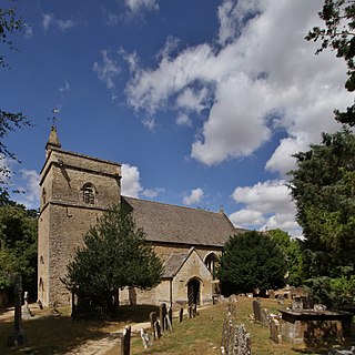
<span class="mw-page-title-main">Bletchingdon</span> Human settlement in England

Bletchingdon is a village and civil parish 2 miles (3 km) north of Kidlington and 6 miles (10 km) southwest of Bicester in Oxfordshire, England. Bletchingdon parish includes the hamlet of Enslow just over 1 mile (1.6 km) west of the village. The 2011 Census recorded the parish's population as 910.

<span class="mw-page-title-main">Sunningwell</span> Human settlement in England

Sunningwell is a village and civil parish about 3+12 miles (6 km) south of Oxford, England. The parish includes the village of Bayworth and the eastern part of Boars Hill. The parish was part of Berkshire until the 1974 boundary changes transferred it to Oxfordshire. The 2011 Census recorded the parish population as 904.

<span class="mw-page-title-main">Dinton, Wiltshire</span> Village in Wiltshire, England

Dinton is a village, civil parish and former manor in Wiltshire, England, in the Nadder valley on the B3089 road about 8 miles (13 km) west of Salisbury. The parish population was 696 at the 2011 census, estimated at 733 in 2019. The civil parish includes the village of Baverstock, about 1 mile (1.6 km) east of Dinton village.

<span class="mw-page-title-main">Stourton with Gasper</span> Civil parish in Wiltshire, England

Stourton with Gasper is a civil parish in the southwest of the English county of Wiltshire. Its main settlement is the village of Stourton, along with the hamlets of Bonham and Gasper. The village is about 2+12 miles (4 km) northwest of the small town of Mere, and is part of the Stourhead estate, which includes much of the west of the parish. The estate is in the ownership of the National Trust, and the entrance to the estate's famous house and garden is through the village.
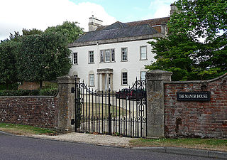
<span class="mw-page-title-main">Seend</span> Human settlement in England

Seend is a village and civil parish about 3 miles (5 km) southeast of the market town of Melksham, Wiltshire, England. It lies about 3.5 miles (6 km) west of Devizes and 5.5 miles (9 km) northeast of the county town of Trowbridge. The parish includes the sub-village of Seend Cleeve and the hamlets of Inmarsh, Martinslade, Seend Head, Sells Green and The Stocks.
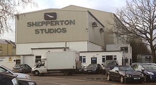
<span class="mw-page-title-main">Littleton, Spelthorne</span> Village in England

Littleton is a village in the borough of Spelthorne, approximately 16 mi (26 km) west of central London. Historically part of the county of Middlesex, it was transferred to Surrey in 1965. It is the location of Shepperton Studios.

<span class="mw-page-title-main">Garford</span> Village in Oxfordshire, England

Garford is a village and civil parish about 4 miles (6.4 km) west of Abingdon. It was part of Berkshire until the 1974 boundary changes transferred it to Oxfordshire. The parish is bounded by the River Ock to the north, by two tributaries of the Ock to the south, and by field boundaries and the road between Kingston Bagpuize and West Hanney to the west. The 2011 Census recorded the parish's population as 229.

<span class="mw-page-title-main">Shalden</span> Village and parish in Hampshire, England

Shalden is a village and civil parish in the East Hampshire district of Hampshire, England. It is 2.3 miles (3.7 km) northwest of Alton and 1.9 miles (3.1 km) northeast of Bentworth, just off the A339 road. The parish covers an area of 1,536 acres (622 ha) and has an average elevation of 600 feet (180 m) above sea level. The nearest railway station is Alton, 2.5 miles (4.0 km) southeast of the village. According to the 2011 census, it had a population of 435.

<span class="mw-page-title-main">Somerton, Oxfordshire</span> Village in Oxfordshire, England

Somerton is a village and civil parish in Oxfordshire, England, in the Cherwell valley about 6 miles (10 km) northwest of Bicester. The 2011 Census recorded the parish's population as 305.

<span class="mw-page-title-main">Chesterton, Oxfordshire</span> Village in Oxfordshire, England

Chesterton is a village and civil parish on Gagle Brook, a tributary of the Langford Brook in north Oxfordshire. The village is about 1+12 miles (2.4 km) southwest of the market town of Bicester. The village has sometimes been called Great Chesterton to distinguish it from the hamlet of Little Chesterton, about 34 mile (1.2 km) to the south in the same parish. The 2011 Census recorded the parish population as 850.

<span class="mw-page-title-main">Great Coxwell</span> Village in Oxfordshire, England

Great Coxwell is a village and civil parish 2 miles (3 km) southwest of Faringdon in the Vale of White Horse, England. It was in Berkshire until the 1974 boundary changes transferred it to Oxfordshire. The 2021 Census recorded the parish's population as 295 in 124 households.

<span class="mw-page-title-main">Hanwell, Oxfordshire</span> Village in Oxfordshire, England

Hanwell is a village and civil parish in Oxfordshire, about 2 miles (3 km) northwest of Banbury. Its area is 1,240 acres (500 ha) and its highest point is about 500 feet (150 m) above sea level. The 2011 Census recorded the parish's population as 263.

<span class="mw-page-title-main">Sydenham, Oxfordshire</span> Human settlement in England

Sydenham is a village and civil parish about 3 miles (5 km) southeast of Thame in Oxfordshire. To the south the parish is bounded by the ancient Lower Icknield Way, and on its other sides largely by brooks that merge as Cuttle Brook, a tributary of the River Thame. The 2011 Census recorded the parish's population as 451.

<span class="mw-page-title-main">Cottisford</span> Village in Oxfordshire, England

Cottisford is a village and civil parish in Oxfordshire, about 3.5 miles (5.6 km) south of Brackley in neighbouring Northamptonshire. The parish's northern and northwestern boundaries form part of the boundary between the two counties. The parish includes the hamlet of Juniper Hill about 1 mile (1.6 km) northwest of Cottisford. The 2011 Census recorded the parish's population as 216.
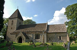
<span class="mw-page-title-main">Fritwell</span> Village in Oxfordshire, England

Fritwell is a village and civil parish about 5+12 miles (9 km) northwest of Bicester in Oxfordshire. The 2011 Census recorded the parish's population as 736.
<span class="mw-page-title-main">Sparsholt, Oxfordshire</span> Human settlement in England

Sparsholt is a village and civil parish about 3 miles (5 km) west of Wantage in the Vale of White Horse district of Oxfordshire. The parish includes the hamlet of Westcot about 12 mile (800 m) west of the village. Sparsholt was part of Berkshire until the 1974 boundary changes transferred the Vale of White Horse to Oxfordshire.

<span class="mw-page-title-main">Goosey</span> Human settlement in England

Goosey is a village and civil parish in England, about 4.5 miles (7 km) northwest of Wantage in the Vale of White Horse. Goosey was part of Berkshire until 1974, when the Vale of White Horse was transferred to Oxfordshire.
References

  1. "Area: Denchworth (Parish): Key Figures for 2011 Census: Key Statistics". Neighbourhood Statistics . Office for National Statistics . Retrieved 2 July 2015.
  2. 1 2 3 4 5 6 7 8 9 10 11 12 13 14 15 16 17 18 Page & Ditchfield 1924, pp. 280–284.
  3. TRE in Latin is Tempore Regis Edwardi, meaning in the reign of Edward the Confessor before the Norman conquest of England.
  4. Domesday Book: A Complete Transliteration. London: Penguin Books. 2003. p. 148. ISBN   0-14-143994-7.
  5. Historic England. "Denchworth Manor (Grade II*) (1048583)". National Heritage List for England . Retrieved 12 March 2012.
  6. Historic England. "Denchworth Manor, Barn and Shelter Sheds Approximately 15 Metres North (Grade II) (1048584)". National Heritage List for England . Retrieved 12 March 2012.[ dead link ]
  7. 1 2 "Village landmark destroyed in blaze". Oxford Mail . Newsquest. 12 March 2012. Retrieved 12 March 2012.
  8. 1 2 3 4 5 6 Pevsner 1966, p. 127.
  9. Historic England. "Church of St James (Grade II*) (1048582)". National Heritage List for England . Retrieved 12 March 2012.
  10. 1 2 3 4 5 Davies, Peter (24 November 2006). "Denchworth S James". Dove's Guide for Church Bell Ringers . Central Council of Church Bell Ringers . Retrieved 12 March 2012.
  11. Archbishops' Council. "Benefice of Vale". A Church Near You . Church of England. Archived from the original on 3 July 2015. Retrieved 2 July 2015.
  12. Historic England. "Village Cross Stump, Hyde Road (Grade II) (1048588)". National Heritage List for England . Retrieved 13 March 2012.
  13. Historic England. "The Fox Inn Public House (Grade II) (1048585)". National Heritage List for England . Retrieved 12 March 2012.
  14. The Fox
  15. Historic England. "The Old Schoolhouse (Grade II) (1368440)". National Heritage List for England . Retrieved 13 March 2012.
  16. Historic England. "The Old Post Office (Grade II) (1368441)". National Heritage List for England . Retrieved 13 March 2012.

Sources