East Lockinge

Last updated

East Lockinge
All Saints, Lockinge - geograph.org.uk - 1779367.jpg
All Saints' parish church
Oxfordshire UK location map.svg
Red pog.svg
East Lockinge
Location within Oxfordshire
OS grid reference SU4287
Civil parish
District
Shire county
Region
Country England
Sovereign state United Kingdom
Post town Wantage
Postcode district OX12
Dialling code 01235
Police Thames Valley
Fire Oxfordshire
Ambulance South Central
UK Parliament
Website Ardington and Lockinge Parish Council
List of places
UK
England
Oxfordshire
51°35′02″N1°23′17″W / 51.584°N 1.388°W / 51.584; -1.388

East Lockinge is a village and former civil parish, now in the parish of Lockinge, in the Vale of White Horse district, in the county of Oxfordshire, England. It was part of Berkshire until the 1974 local authority boundary changes transferred the Vale of White Horse to Oxfordshire. It is about 1.5 miles (2.4 km) east of Wantage, the village is included within the North Wessex Downs Area of Outstanding Natural Beauty (AONB). In 1931 the parish had a population of 227. [1] On 1 April 1934 the parish was abolished to form "Lockinge". [2]

Contents

Manor

In 868 Queen Æthelswith of Mercia granted 15 hides of land to her thegn Cuthwulf. [3] This land became the manor of East Lockinge, which during the Anglo-Saxon era came to be held by the Benedictine Abingdon Abbey. After the Norman Conquest of England the manor was granted to the Norman soldier Henry de Ferrers. [3] In the Dissolution of the Monasteries in the 1530s the Abbey surrendered all its property to the Crown, which sold East Lockinge in 1546. [3]

Matthew Wymondsold (died 1757), a speculator in the South Sea Bubble, bought the manor in 1718 and settled here. [3] In 1750 he had Lockinge House built: a three-storey Georgian country house with two wings that was later enlarged. [3] Matthew was a descendant of Sir Robert Wymondsold (died 1687) of Welbeck Place, Putney, and Deeping St. James, Lincolnshire, whom James II knighted in 1684. [4] Matthew Wymondsold had three sons by his wife Sara who outlived him: Francis, William and Charles, the latter who married and divorced Henrietta Knight, daughter of Robert Knight, 1st Earl of Catherlough, who married secondly Josiah Child, younger son of Richard Child, 1st Earl Tylney. [5] The Wymondsold family retained East Lockinge until 1853, when it was sold to Lord Overstone.

In 1858 Overstone gave East Lockinge as a wedding present to his daughter Harriet Sarah Jones-Loyd upon her marriage to Colonel Loyd-Lindsay VC. [3] East Lockinge is now a village of estate cottages that Colonel Loyd-Lindsay had built in the 1860s. [6] Loyd-Lindsay was ennobled on 23 July 1885 taking the name, style and title of Baron Wantage of Lockinge in the County of Berks. He died at Lockinge House on 10 June 1901. [7] Lockinge House was demolished in 1947. [8] Its early Georgian orangery was still standing in the 1960s. [6]

Parish church

The Church of England parish church of All Saints was built in about the middle of the 12th century. [3] The Norman north door of the nave survives from this time. [3] [9] The chancel and the south chapel parallel with it were built in the 13th century [3] but the chancel was rebuilt early in the 14th century. [9] A south aisle was added in the 13th or early in the 14th century. [3] A window in the north wall of the nave was added in the 15th century, but was altered to accommodate the west belltower that was added in 1564. [3] [6] In 1886 [6] the south aisle and chapel were demolished, the three-bay arcade between the south aisle and the nave was rebuilt and a new nave and chancel were built in place of the demolished aisle and chapel. [3] This became the main body of the church, leaving the earlier nave and chancel as a north aisle and chapel.

The reredos paintings are by the Arts and Crafts movement artist Kate Bunce and their beaten metal frames are by her sister Myra Bunce. [9] Lady Jane Lindsay, presumably a relative of the Colonel, designed the glass of the east window. [6] The tower has a ring of four bells. [10] The oldest is the treble, cast in 1578 by Joseph Carter [10] of Reading, Berkshire, who later became the master founder of the Whitechapel Bell Foundry in London. [11] The third bell was cast at Reading in about 1599. [10] Robert II Wells of Aldbourne, [11] Wiltshire cast the tenor bell in 1793 and he and James Wells cast the small Sanctus bell in about 1795. [10] William Taylor cast the second bell in 1852, [10] presumably at the foundry that the Taylor family then had in Oxford. [11] Currently for technical reasons the bells are unringable. [10]

Related Research Articles

<span class="mw-page-title-main">Wantage</span> Human settlement in England

Wantage is a historic market town and civil parish in Oxfordshire, England. Although within the boundaries of the historic county of Berkshire, it has been administered as part of the Vale of White Horse district of Oxfordshire since 1974. The town is on Letcombe Brook, 8 miles (13 km) south-west of Abingdon, 24 miles (39 km) north-west of Reading, 15 miles (24 km) south-west of Oxford and 14 miles (23 km) north-west of Newbury.

<span class="mw-page-title-main">Blewbury</span> Human settlement in England

Blewbury is a village and civil parish at the foot of the Berkshire Downs section of the North Wessex Downs about 4 miles (6.4 km) south of Didcot, 14 miles (23 km) south of Oxford and 50 miles (80 km) west of London. It was part of Berkshire until the 1974 boundary changes transferred it to Oxfordshire. The 2011 Census recorded the parish's population as 1,581. A number of springs rise at the foot of the escarpment of the downs. Some springs feed a small lake called the Watercress Beds, where watercress used to be grown. From here and elsewhere tributaries feed the Mill Brook which carries the water to the river Thames at Wallingford. The A417 road runs along below the escarpment above the springs and through the south of the village. The Blewbury citizens are often called Blewbarians.

<span class="mw-page-title-main">Beedon</span> Human settlement in England

Beedon is a village and civil parish about 6+12 miles (10.5 km) north of Newbury in West Berkshire, England.

<span class="mw-page-title-main">Farnborough, Berkshire</span> Village in England

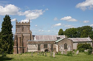
Farnborough is a village and civil parish in West Berkshire, about 4 miles (6.4 km) south of Wantage. The village is 720 feet (220 m) above sea level on a ridge aligned east – west in the Berkshire Downs. It is the highest village in Berkshire.

<span class="mw-page-title-main">Shilton, Oxfordshire</span> Human settlement in England

Shilton is a village and civil parish about 1+12 miles (2.4 km) northwest of Carterton, Oxfordshire. The 2011 Census recorded the parish's population as 626.

<span class="mw-page-title-main">Ardington</span> Human settlement in England

Ardington is a village and civil parish about 2 miles (3 km) east of Wantage in the Vale of White Horse. It was part of Berkshire until the 1974 boundary changes transferred it to Oxfordshire. Since 2012 responsibility for Ardington and the neighbouring parish of Lockinge has been combined in a joint single parish council for Ardington and Lockinge.

<span class="mw-page-title-main">Aston Tirrold</span> Human settlement in England

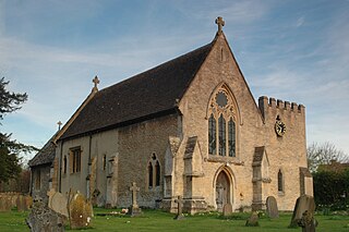
Aston Tirrold is a village and civil parish at the foot of the Berkshire Downs about 3 miles (5 km) southeast of Didcot. It was part of Berkshire until the 1974 boundary changes transferred it to Oxfordshire. The 2011 Census recorded the parish's population as 373.

<span class="mw-page-title-main">Robert Loyd-Lindsay, 1st Baron Wantage</span> British soldier, politician and philanthropist

Brigadier General Robert James Loyd-Lindsay, 1st Baron Wantage, was a British soldier, politician, philanthropist, benefactor to Wantage, and first chairman and co-founder of the British National Society for Aid to the Sick and Wounded in War, for which he crucially obtained the patronage of Queen Victoria.

<span class="mw-page-title-main">East Hagbourne</span> Village in England

East Hagbourne is a village and civil parish about 1 mile (1.6 km) south of Didcot and 11 miles (18 km) south of Oxford. It was part of Berkshire until the 1974 boundary changes transferred it to Oxfordshire. The 2011 Census recorded the parish's population as 1,882.

<span class="mw-page-title-main">Upton, Vale of White Horse</span> Human settlement in England

Upton is a spring line village and civil parish at the foot of the Berkshire Downs, about 2 miles (3 km) south of Didcot in the Vale of the White Horse district. Historically in Berkshire, it has been administered as part of Oxfordshire, England, since the 1974 boundary changes. The 2011 Census recorded the parish's population as 421.

<span class="mw-page-title-main">Fulbrook, Oxfordshire</span> Human settlement in England

Fulbrook is a village and civil parish immediately northeast of Burford in West Oxfordshire. The 2011 Census recorded the parish's population as 437.

<span class="mw-page-title-main">Childrey</span> Human settlement in England

Childrey is a village and civil parish about 2+12 miles (4 km) west of Wantage in the Vale of White Horse. The parish was part of the Wantage Rural District in Berkshire until the 1974 boundary changes transferred the Vale of White Horse to Oxfordshire. The 2011 Census recorded the parish population as 582.

<span class="mw-page-title-main">Warborough</span> Village in Oxfordshire, England

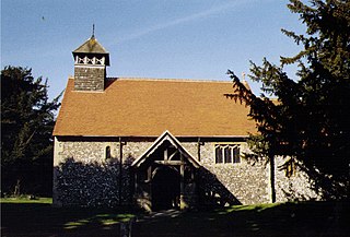
Warborough is a village and civil parish in South Oxfordshire, about 2.5 miles (4 km) north of Wallingford and about 9 miles (14 km) south of Oxford. The parish also includes the hamlet of Shillingford, south of Warborough beside the River Thames.

<span class="mw-page-title-main">Appleton, Oxfordshire</span> Human settlement in England

Appleton is a village in the civil parish of Appleton-with-Eaton, about 4 miles (6.4 km) northwest of Abingdon. Appleton was part of Berkshire until the 1974 boundary changes transferred it to Oxfordshire. The 2011 Census recorded Appleton-with-Eaton's parish population as 915.

<span class="mw-page-title-main">Milton, Vale of White Horse</span> Human settlement in England

Milton is a village and civil parish about 3 miles (5 km) west of Didcot and a similar distance south of Abingdon. The 2011 Census recorded the parish's population as 1,290.

<span class="mw-page-title-main">Wickham, Berkshire</span> Village in England

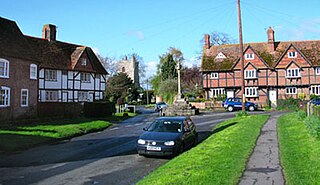
Wickham is a village about 5.5 miles (8.9 km) north-west of Newbury, Berkshire, England. The M4 motorway passes just north of it. It is in the civil parish of Welford.

<span class="mw-page-title-main">Shellingford</span> Human settlement in England

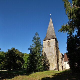
Shellingford, historically also spelt Shillingford, is a village and civil parish about 2+12 miles (4 km) south-east of Faringdon in the Vale of White Horse in Oxfordshire, England. It was part of Berkshire until the 1974 Local Government Act transferred it to Oxfordshire. The 2011 Census recorded the parish's population as 173.

<span class="mw-page-title-main">East Challow</span> Human settlement in England

East Challow is a village and civil parish about 1 mile (1.6 km) west of Wantage in the Vale of White Horse, England. Historically it was part of the ecclesiastical parish of Letcombe Regis, but since 1852 East and West Challow have formed their own single ecclesiastical parish. The civil parish was part of Berkshire until the 1974 boundary changes transferred the Vale of White Horse to Oxfordshire.

<span class="mw-page-title-main">Sparsholt, Oxfordshire</span> Human settlement in England

Sparsholt is a village and civil parish about 3 miles (5 km) west of Wantage in the Vale of White Horse district of Oxfordshire. The parish includes the hamlet of Westcot about 12 mile (800 m) west of the village. Sparsholt was part of Berkshire until the 1974 boundary changes transferred the Vale of White Horse to Oxfordshire.

<span class="mw-page-title-main">Lockinge Estate</span>

The Lockinge Estate is a 3,035-hectare (7,500-acre) agricultural and housing estate near Wantage that today includes most of the land and property encompassing the villages of West Lockinge, East Lockinge and Ardington. The current manager of the Lockinge Estate is Thomas Loyd. Almost the entire estate is included within the North Wessex Downs Area of Outstanding Natural Beauty (AONB).

References

  1. "Population statistics East Lockinge CP/AP through time". A Vision of Britain through Time . Retrieved 19 August 2023.
  2. "Relationships and changes East Lockinge CP/AP through time". A Vision of Britain through Time. Retrieved 19 August 2023.
  3. 1 2 3 4 5 6 7 8 9 10 11 12 Page & Ditchfield 1924, pp. 307–311.
  4. Lysons 1792, pp. 404–435.
  5. Crisp 1905, p. 165.
  6. 1 2 3 4 5 Pevsner 1966, p. 170.
  7. Ford, David Nash (2008). "Col. Sir Robert James Loyd-Lindsay, Baron Wantage of Lockinge (1832-1901)". Royal Berkshire History. Nash Ford Publishing. Retrieved 11 June 2011.
  8. Ford, David Nash (2004). "Lockinge House". Royal Berkshire History. Nash Ford Publishing. Retrieved 11 June 2011.
  9. 1 2 3 Pevsner 1966, p. 169.
  10. 1 2 3 4 5 6 Davies, Peter (26 November 2006). "Lockinge All Saints". Dove's Guide for Church Bell Ringers . Retrieved 27 December 2011.
  11. 1 2 3 Dovemaster (25 June 2010). "Bellfounders". Dove's Guide for Church Bell Ringers . Retrieved 27 December 2011.

Sources

Commons-logo.svg Media related to East Lockinge at Wikimedia Commons