This article lists the islands in the River Thames, or at the mouth of a tributary, in England. It excludes human-made islands built as part of the building of forty-five two-gate locks which each accompany a weir, and islets subordinate to and forming part of the overall shape of another. The suffix -ey is common across England and Scotland and cognate with ait and meaning island, a term – as ait or eyot – unusually well-preserved on the Thames. A small minority of list entries are referred to as Island, Ait or Eyot and are vestiges, separated by a depression in the land or high-water-level gully.

Botley is a village in the civil parish of North Hinksey in the ceremonial county of Oxfordshire, just west of the Oxford city boundary. Historically part of Berkshire, it stands on the Seacourt Stream, a stream running off the River Thames. The intersection of the A34 and A420 is to the village's north.
North Hinksey is a village and civil parish in Oxfordshire, England, immediately west of Oxford. The civil parish includes the large settlement of Botley, effectively a suburb of Oxford. North Hinksey was part of Berkshire until the 1974 boundary changes transferred it to Oxfordshire.

Wytham is a village and civil parish on the Seacourt Stream, a branch of the River Thames, about 3 miles (5 km) northwest of the centre of Oxford. It is just west of the Western By-Pass Road, part of the Oxford Ring Road (A34). The nearest village is Godstow. Wytham was the northernmost part of Berkshire until the 1974 boundary changes transferred it to Oxfordshire. The toponym is first recorded as Wihtham around 957, and comes from the Old English for a homestead or village in a river-bend.

Cumnor is a village and civil parish 3½ miles (5.6 km) west of the centre of Oxford, England. The village is about 2 miles (3.2 km) south-west of Botley and its centre is west of the A420 road to Swindon. The parish includes Cumnor Hill,, Chawley, the Dean Court area on the edge of Botley and the outlying settlements of Chilswell, Farmoor, Filchampstead and Swinford. It belonged to Berkshire until the 1974 local government boundary changes transferred it to Oxfordshire. The 2011 Census recorded the parish population as 5,755.
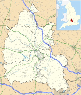
Abingdon was a rural district in the administrative county of Berkshire from 1894 to 1974.

Osney or Osney Island is a riverside community in the west of the city of Oxford, England. In modern times the name is applied to a community also known as Osney Town astride Botley Road, just west of the city's main railway station, on an island surrounded by the River Thames, Osney Ditch and another backwater connecting the Thames to Osney Ditch.
South Hinksey is a village and civil parish just over 1 mile (1.6 km) south of the centre of Oxford. The parish includes the residential area of Hinksey Hill about 0.5 miles (800 m) south of the village. The parish was part of Berkshire until the 1974 boundary changes transferred it to Oxfordshire.
New Hinksey is a suburb in the south of the city of Oxford.
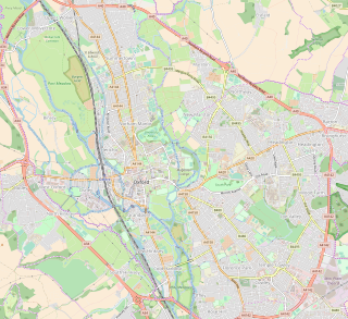
Hinksey is a place name associated with Oxford and Oxfordshire. In 1974, many of the places associated with the name were transferred from the county of Berkshire in the county boundary changes.
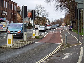
Botley Road is the main road into the centre of Oxford, England from the west. It stretches between Botley, on the Oxford Ring Road (A34) to the west of the city, and Frideswide Square at the junction with Oxford railway station, close to central Oxford.
Harcourt Hill is a hill and community in North Hinksey in Oxfordshire, England, west of the city of Oxford. There is a good view of the city from the hill. It lies between Hinksey Hill to the southeast, Boars Hill to the south and Botley to the north. Until 1974 it was in Berkshire, but was transferred to Oxfordshire in that year.
Seacourt is a deserted medieval village near Botley in Oxfordshire. It was part of Berkshire until the 1974 boundary changes transferred it to Oxfordshire.

Bulstake Stream, also spelt Bullstake Stream, is a backwater of the River Thames at Oxford, England.
Hormer was an ancient hundred of Berkshire, England. It consisted of the area immediately west of Oxford within the bend of the River Thames, all of which was transferred to Oxfordshire on 1 April 1974 in accordance with the Local Government Act 1972. It included the ancient parishes of

Ferry Hinksey Road is a road in west Oxford, England, leading south from the Botley Road. The road leads to the Osney Mead Industrial Estate to the east, started in 1961. To the east is Osney Ditch.

Botley Bridge is a road bridge across Seacourt Stream, a branch of the River Thames in Oxford, England.

Bulstake Bridge is a road bridge across the Bulstake Stream, a branch of the River Thames in Oxford, England.

