Libya, officially the State of Libya, is a country in the Maghreb region of North Africa. Libya borders Mediterranean Sea to the north, Egypt to the east, Sudan to the southeast, Chad to the south, Niger to the southwest, Algeria to the west, and Tunisia to the northwest. Libya comprises three historical regions: Tripolitania, Fezzan, and Cyrenaica. With an area of almost 1.8 million km2 (700,000 sq mi), it is the fourth-largest country in Africa and the Arab world, and the 16th-largest in the world. The country's official religion is Islam, with 96.6% of the Libyan population being Sunni Muslims. The official language of Libya is Arabic, with vernacular Libyan Arabic being spoken most widely. The majority of Libya's population is Arab. The largest city and capital, Tripoli, is located in north-western Libya and contains over a million of Libya's seven million people.

Libya is the fourth largest country in Africa and the sixteenth largest country in the world. It is on the Mediterranean with Egypt to the east, Tunisia to the northwest, Algeria to the west, Niger and Chad to the south, and Sudan to the southeast. Although the oil discoveries of the 1960s have brought immense wealth, at the time of its independence it was an extremely poor desert state whose only important physical asset appeared to be its strategic location at the midpoint of Africa's northern rim.

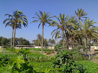
Awjila is an oasis town in the Al Wahat District in the Cyrenaica region of northeastern Libya. Since classical times it has been known as a place where high quality dates are farmed. From the Arab conquest in the 7th century, Islam has played an important role in the community. The oasis is located on the east-west caravan route between Egypt and Tripoli, Libya, and on the north-south route between Benghazi and the Sahel between Lake Chad and Darfur, and in the past was an important trading center. It is the place after which the Awjila language, an Eastern Berber language, is named. The people cultivate small gardens using water from deep wells. Recently, the oil industry has become an increasingly important source of employment.

Wadi, alternatively wād, Maghrebi Arabic Oued, is the Arabic term traditionally referring to a river valley. In some instances, it may refer to a wet (ephemeral) riverbed that contains water only when heavy rain occurs.

In Libya there are currently 106 districts, second level administrative subdivisions known in Arabic as baladiyat. The number has varied since 2013 between 99 and 108. The first level administrative divisions in Libya are currently the governorates (muhafazat), which have yet to be formally deliniated, but which were originally tripartite as: Tripolitania in the northwest, Cyrenaica in the east, and Fezzan in the southwest; and later divided into ten governorates.

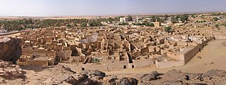
Fezzan is the southwestern region of modern Libya. It is largely desert, but broken by mountains, uplands, and dry river valleys (wadis) in the north, where oases enable ancient towns and villages to survive deep in the otherwise inhospitable Sahara Desert. The term originally applied to the land beyond the coastal strip of Africa proconsularis, including the Nafusa and extending west of modern Libya over Ouargla and Illizi. As these Berber areas came to be associated with the regions of Tripoli, Cirta or Algiers, the name was increasingly applied to the arid areas south of Tripolitania.

The Garamantes were an ancient peoples, who may have descended from Berber tribes, Toubou tribes, and Saharan pastoralists that settled in the Fezzan region by at least 1000 BC and established a civilization that flourished until its end in the late 7th century AD. The Garamantes first emerged as a major regional power in the mid-2nd century AD and established a kingdom that spanned roughly 180,000 km2 (70,000 sq mi) in the Fezzan region of southern Libya. Their growth and expansion was based on a complex and extensive qanat irrigation system, which supported a strong agricultural economy and a large population. They subsequently developed the first urban society in a major desert that was not centered on a river system; their largest town, Garama, had a population of around four thousand, with an additional six thousand living in surrounding suburban areas. At its pinnacle, the Garamantian kingdom established and maintained a "standard of living far superior to that of any other ancient Saharan society" and was composed of "brilliant farmers, resourceful engineers, and enterprising merchants who produced a remarkable civilization."

Ghat is the capital of the Ghat District in the Fezzan region of southwestern Libya, located just east of the Algerian border.

The Acacus Mountains or Tadrart Akakus form a mountain range in the desert of the Ghat District in western Libya, part of the Sahara. They are situated east of the city of Ghat, Libya, and stretch north from the border with Algeria, about 100 kilometres (62 mi). The area has a particularly rich array of prehistoric rock art.

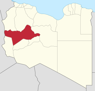
Wadi al Shati, sometimes referred to as Ashati, is one of the districts of Libya in the central-west part of the country. The area is mostly desert. Wadi al Shati District is named after the depression of the same name, Wadi Ashati.
The Wadi ash-Shati' is a valley in west-central Libya, arising out of the Sawda Mountains, situated between the towns Wanzarik and Umm al-'Abid in the west and east, respectively. It is known for iron ore and manganese deposits.

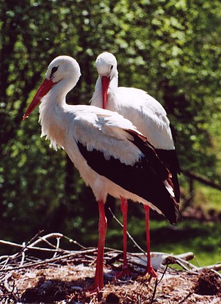
The wildlife of Libya is spread over the Mediterranean coastline and encompasses large areas of the Saharan desert. The protection of wildlife is provided through appropriate legislation in seven national parks, five reserves, 24 protected areas, two wetlands under Ramsar Convention, and also in other areas. Apart from these, there are also five UNESCO World Heritage Sites related to culture. The most important national parks are the El-Kouf National Park and Karabolli National Park. The well known nature reserves are the Benghazi Reserve and the Zellaf Reserve. The wildlife species recorded in the country are 87 mammals and 338 species of birds.

Waddan is an oasis town of the Sahara Desert in the northeast Fezzan region of southwest Libya, in the Jufra District. It was an important town on the ancient trade routes across the Sahara.

This is a survey of the postage stamps and postal history of Fezzan and Ghadames, both now part of Libya.

The Allied administration of Libya was the control of the ex-colony of Italian Libya by the Allies from 13 May 1943 until Libyan independence was granted in 1951. It was divided into two parts:
Protected areas of Libya include any geographical area protected for a specific use.

El Kouf National Park, established in 1975, is one of the seven national parks of Libya. El Kouf is located along Libya's northeastern Mediterranean coastline and has both marine and terrestrial biodiversity. Libya also has five other reserves, twenty four protected areas and two wetlands, Ain Elshakika Wetland and Ain Elzarga Wetland, protected under the Ramsar Convention since 2000.

The mining industry of Libya does not contribute significantly to its economy. Mining resources are located in remote regions with limited accessibility. The fuel sector, including oil reserves and natural gas is the major revenue-generating industry.
On 18 May 2017, an attack was launched by militia men of the town of Misrata and Benghazi Defense Brigades against the Brak al-Shati Airbase controlled by LNA forces. LNA sources claimed 141 people, including 103 soldiers and numerous civilians were killed as a result of the raid. The base was completely overrun and partially destroyed along with numerous aircraft in the base. Accusations of executions of surrendering forces lead to international condemnation of GNA forces.

Fezzan province is one of the three traditional Provinces of Libya. It was a formal province from 1934 until 1963, when it was subdivided into the Governorates of Libya. Its capital was the city of Sabha.


