Related Research Articles

A Ramsar site is a wetland site designated to be of international importance under the Ramsar Convention, also known as "The Convention on Wetlands", an intergovernmental environmental treaty established on 2nd February 1971 in Ramsar, Iran by UNESCO, which came into force from 21st December,1975. It provides for national action and international cooperation regarding the conservation of wetlands, and wise sustainable use of their resources. Ramsar identifies wetlands of international importance, especially those providing waterfowl habitat.

The Hokersar is a wetland conservation area in Zainakote, near Srinagar city in Srinagar district of Jammu and Kashmir, India. It lies in the Kashmir Valley, 10 kilometres (6.2 mi) northwest of Srinagar. The Hokersar, which spreads over 1,375 hectares (13.75 km2), is a designated bird sanctuary.
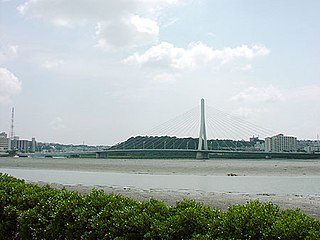
Lake Man is an area of wetlands in Okinawa that is located between the cities of Naha and Tomigusuku, and within Manko Park. Despite being called "Lake Man", it is in fact a wetland and not a lake. Lake Man covers .11 square kilometres (0.042 sq mi).

The wildlife of Libya is spread over the Mediterranean coastline and encompasses large areas of the Saharan desert. The protection of wildlife is provided through appropriate legislation in seven national parks, five reserves, 24 protected areas, two wetlands under Ramsar Convention, and also in other areas. Apart from these, there are also five UNESCO World Heritage Sites related to culture. The most important national parks are the El-Kouf National Park and Karabolli National Park. The well known nature reserves are the Benghazi Reserve and the Zellaf Reserve. The wildlife species recorded in the country are 87 mammals and 338 species of birds.
Hay-Zama Lakes is a 586-square-kilometre (226 sq mi) inland wetland and wildland park in northwestern Alberta, Canada. It was designated a Ramsar wetland of international importance on May 24, 1982, and is recognized as an Important Bird Area. It "constitutes one of the most extensive sedge wetlands in western North America".
The Vasse-Wonnerup Estuary is an estuary in the South West region of Western Australia close to the town of Busselton. The estuary is listed with DIWA. It was also recognised as a wetland of international importance under the Ramsar Convention on 7 June 1990 when an area of 1,115 ha was designated Ramsar Site 484 as an important dry-season habitat for waterbirds. It is also the main part of the 2,038 ha (5,040-acre) Busselton Wetlands Important Bird Area.

The Barmah National Park, formerly Barmah State Park, is a national park located in the Hume region of the Australian state of Victoria. The park is located adjacent to the Murray River near the town of Barmah, approximately 225 kilometres (140 mi) north of Melbourne. The park consists of river red gum floodplain forest, interspersed with treeless freshwater marshes. The area is subject to seasonal flooding from natural and irrigation water flows.

Reedy Lake, historically also known as Lake Reedy, is a shallow 5.5-square-kilometre (2.1 sq mi) intermittent freshwater lake or swamp on the lower reaches of the Barwon River, on the Bellarine Peninsula southeast of Geelong in the Australian state of Victoria.
The Forrestdale and Thomsons Lakes Ramsar Site comprises two separate nature reserves, totalling 754 ha in area, protecting two shallow fresh to brackish, seasonal lakes in a suburban and agricultural landscape in south-western Western Australia. It lies in the Swan Coastal Plain bioregion and is used mainly for birdwatching and walking. The site is recognised as being of international importance under the Ramsar Convention on Wetlands, under which it was designated Ramsar Site 481 on 7 June 1990.

The Lakes Argyle and Kununurra Ramsar Site comprises an extensive system of artificial freshwater reservoirs, with their associated permanent wetlands, formed by damming the Ord River in the eastern part of the Kimberley region of northern Western Australia. The reservoirs include Lake Argyle and Lake Kununurra. There are numerous endemic plants and a rich fauna. The 1,500 km2 (580 sq mi) site was designated a wetland of international importance under the Ramsar Convention on 7 June 1990, making it Ramsar Site 478.

The Ord River floodplain is the floodplain of the lower Ord River in the Shire of Wyndham-East Kimberley, in the Kimberley region of northern Western Australia. It lies within the Victoria Bonaparte IBRA bioregion and contains river, seasonal creek, tidal mudflat and floodplain wetlands, with extensive stands of mangroves, that support saltwater crocodiles and many waterbirds. It is recognised as an internationally important wetland area, with 1,384 square kilometres (534 sq mi) of it designated on 7 June 1990 as Ramsar Site 477 under the Ramsar Convention on Wetlands.
Fivebough and Tuckerbil Wetlands are two wetland sites within the Riverina and Murrumbidgee Irrigation Area (MIA), near Leeton in New South Wales, Australia. Both Fivebough and Tuckerbil sites form Crown reserve number 1030008 managed by NSW Department of Industry, for ecological conservation and public recreation. The reserve was recognised as being a Wetland of International Importance through designation under the Ramsar Convention on 21 October 2002 as Ramsar Site 1224
The North Victorian Wetlands, also known as the Kerang Wetlands, comprise an extensive series of over 100 freshwater, brackish and saline lakes and swamps on the floodplain of the Loddon River where it enters the Murray valley, in the vicinity of the town of Kerang, in northern Victoria, south-eastern Australia. They are important for a variety, and sometimes large numbers, of waterbirds.
Protected areas of Libya include any geographical area protected for a specific use.
Jubho Lagoon is a large shallow brackish lagoon located in Sindh, Pakistan. In May 2011 Jubhoo lagoon was inducted into the list of Ramsar sites, consisting of wetlands of international importance.
Ain Elzarga Wetland is a Ramsar-protected wetland of Libya. It was established in 2000 and covers an area of 33 hectares. Ramsar says of it: "A small natural sebkha or depression with at least one natural connection to the sea, wet all year round but with increasing water levels and salinity during summer. The sebkha, with mudflats and salt marsh community, is surrounded by dunes from east to west and rocky hills to the south and east. The site is one of the most important wetlands in the area of the El Kouf National Park for migratory waterbirds. The birdwatching and ecotourism potential is considerable but undeveloped. Unsustainable hunting and destruction of vegetation, especially during summer, are considered threats."

The Flood Plain Lower Ringarooma River wetlands is a wetland site comprises the floodplain of the lower Ringarooma River in north-eastern Tasmania, Australia. In 1982 it was designated a wetland of international importance under the Ramsar Convention.
The Sakumo Ramsar Site also known as the Sakumo Lagoon is a wetland of international importance. It covers an area of 1,400 hectares and is situated along the coastal road between Accra and Tema in the Greater Accra Region of Ghana. It is about 3 km (1.9 mi) west of Tema. Activities ongoing within the site include farming, fishing, recreation, urban and industrial development.
References
- ↑ "Ain Elshakika". Ramsar Sites Information Service. Retrieved 25 April 2018.
- ↑ "Ain Elshakika Wetlands of International Importance (Ramsar)". Protectedplanet.net. Retrieved 26 March 2013.
- 1 2 3 "The Annotated Ramsar List: Libya" . Retrieved 26 March 2013.
- 1 2 "Ain Elshakika". Ramsar. Retrieved 21 April 2016.
- ↑ Etayeb, K.S., Bourass E., Berbash A., Bashimam W., Essghaier, M. F. (April 2015). "Human disturbance affecting sensitive components(waterbirds) of wetlands; A case study onwaterbirds in Libyan Ramsar sites". Libyan Journal of Marine Science. 14: 16–28.
{{cite journal}}: CS1 maint: multiple names: authors list (link) - ↑ "Atlas of wintering birds of Libya 2005-2010" (PDF).
Coordinates: 32°46′N21°21′E / 32.767°N 21.350°E
| | This Libya location article is a stub. You can help Wikipedia by expanding it. |
| | This Africa protected areas related article is a stub. You can help Wikipedia by expanding it. |