The Food and Agriculture Organization of the United Nations (FAO) is a specialized agency of the United Nations that leads international efforts to defeat hunger and improve nutrition and food security. Its Latin motto, fiat panis, translates to "let there be bread". Founded in October 1945, the FAO is the oldest existing agency of the U.N.

Libya, officially the State of Libya, is a country in the Maghreb region in North Africa, bordered by the Mediterranean Sea to the north, Egypt to the east, Sudan to the southeast, Chad to the south, Niger to the southwest, Algeria to the west, and Tunisia to the northwest. The sovereign state is made of three historical regions: Tripolitania, Fezzan and Cyrenaica. With an area of almost 1.8 million square kilometres (700,000 sq mi), Libya is the fourth largest country in Africa, and is the 16th largest country in the world. Libya has the 10th-largest proven oil reserves of any country in the world. The largest city and capital, Tripoli, is located in western Libya and contains over one million of Libya's six million people. The second-largest city is Benghazi, which is located in eastern Libya. The Latin name Libya is based on the name the region west of the Nile (Λιβύη) used by the Ancient Greeks and Romans for all of North Africa, and was again adopted during the period of Italian colonization beginning in 1911.
The Politics of Libya is in an uncertain state due to the collapse of the Libyan Arab Jamahiriya in 2011 and an ongoing civil war between the House of Representatives in Tobruk and its supporters, the New General National Congress in Tripoli and its supporters, and various jihadists and tribal elements controlling parts of the country.

Niger is a landlocked nation in West Africa located along the border between the Sahara and Sub-Saharan regions. Its geographic coordinates are longitude 16°N and latitude 8°E. Its area is 1.267 million square kilometers, of which 1 266 700 km² is land and 300 km² water, making Niger slightly less than twice the size of France.

Benghazi is a city in Libya. Located on the Gulf of Sidra in the Mediterranean, Benghazi is a major seaport and the second-most populous city in the country, as well as the largest city in Cyrenaica, with an estimated population of 631,555 in 2011.

Generally, a fishery is an entity engaged in raising or harvesting fish which is determined by some authority to be a fishery. According to the FAO, "...a fishery is an activity leading to harvesting of fish. It may involve capture of wild fish or raising of fish through aquaculture." It is typically defined in terms of the "people involved, species or type of fish, area of water or seabed, method of fishing, class of boats, purpose of the activities or a combination of the foregoing features". The definition often includes a combination of fish and fishers in a region, the latter fishing for similar species with similar gear types. Some government and private organizations, especially those focusing on recreational fishing include in their definitions not only the fishers, but the fish and habitats upon which the fish depend.
The flag of Libya was originally introduced in 1951, following the creation of the Kingdom of Libya. It was designed by Omar Faiek Shennib and approved by King Idris Al Senussi who comprised the UN delegation representing the three regions of Cyrenaica, Fezzan, and Tripolitania at UN unification discussions.
Gypsisols in the World Reference Base for Soil Resources (WRB) are soils with substantial secondary accumulation of gypsum (CaSO4.2H2O). They are found in the driest parts of the arid climate zone.In the USDA soil taxonomy they are classified as Gypsids (USDA Soil Taxonomy), in the Russian soil classification they are called Desert soils (USSR).

Artisanal fishing are various small-scale, low-technology, low-capital, fishing practices undertaken by individual fishing households. Many of these households are of coastal or island ethnic groups. These households make short fishing trips close to the shore. Their produce is usually not processed and is mainly for local consumption. Artisan fishing uses traditional fishing techniques such as rod and tackle, fishing arrows and harpoons, cast nets, and small traditional fishing boats.

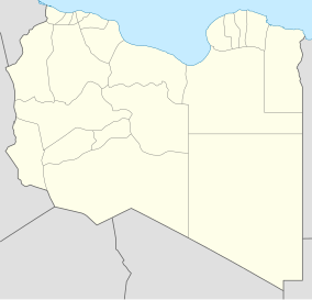
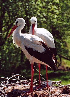
The wildlife of Libya is spread over the Mediterranean coastline and encompasses large areas of the Saharan desert. The protection of wildlife is provided through appropriate legislation in seven national parks, five reserves, 24 protected areas, two wetlands under Ramsar Convention, and also in other areas. Apart from these, there are also five UNESCO World Heritage Sites related to culture. The most important national parks are the El-Kouf National Park and Karabolli National Park. The well known nature reserves are the Benghazi Reserve and the Zellaf Reserve. The wildlife species recorded in the country are 87 mammals and 338 species of birds.

An anchovy is a small, common forage fish of the family Engraulidae. Most species are found in marine waters, but several will enter brackish water and some in South America are restricted to fresh water.
The Lake Chad Basin Commission is an intergovernmental organization that oversees water and other natural resource usage in the basin. There are eight member governments—i.e., Cameroon, Chad, Niger, Nigeria, Algeria, the Central African Republic, Libya, and Sudan—chosen for their proximity to Lake Chad.
Protected areas of Libya include any geographical area protected for a specific use.
El Kouf National Park, established in 1975, is one of the seven national parks of Libya. El Kouf is located along Libya's northeastern Mediterranean coastline and has both marine and terrestrial biodiversity. Libya also has five other reserves, twenty four protected areas and two wetlands, Ain Elshakika Wetland and Ain Elzarga Wetland, protected under the Ramsar Convention since 2000.

Algharabolli National Park, also Karabolli National Park, is a national park of Libya close to Tripoli, and right next to Al-Garabulli. It was established in 1992 and covers an area of 8,000 hectares .
El Naggaza National Park is a national park of Libya in the Murqub district close to Tipoli. It was established in 1993 and covers an area of 4,000 hectares.
Surman National Park or Sirman National Park is a national park of Libya. It was established in 1992 and covers an area of 400 hectares . It lies about 50 kilometres (31 mi) west of Tripoli, not far from the archaeological ruins of Sabratha.

The Libyan Crisis refers to the ongoing conflicts in Libya, beginning with the Arab Spring protests of 2011, which led to a civil war, foreign military intervention, and the ousting and death of Muammar Gaddafi. The civil war's aftermath and proliferation of armed groups led to violence and instability across the country, which erupted into renewed civil war in 2014. The ongoing crisis in Libya has so far resulted in tens of thousands of casualties since the onset of violence in early 2011. During both civil wars, the output of Libya's economically crucial oil industry collapsed to a small fraction of its usual level, with most facilities blockaded or damaged by rival groups, despite having the largest oil reserves of any African country. U.S. President Barack Obama stated on 11 April 2016 that not preparing for a post-Gaddafi Libya was probably the "worst mistake" of his presidency.

For a small country, Albania is characterised by a considerable wealth of terrestrial and marine ecosystems and habitats with contrasting floral and faunal species, defined in an area of 28,748 square kilometres. Most of the country is predominantly of mediterranean character, comprehending the country's center and south, while the alpine affinity is more visible in the northeast.

Khadim NagarNational Park is a major national park and nature reserve in Bangladesh. The park is located at Sylhet Sadar Upazila, Sylhet District in the North-East region of the country. It is located mainly on the Hills and is surrounded by Kalagool, Bhurjan and Goolni tea estates. Khadim Nagar National Park covers approximately 679 ha (6.79 km2) of evergreen forests Biome. The British colonial people cleared the land for extensive tea plantations. After 1950 tree plantations of teak, Garjan, Bamboo, Champa, Agar, Akashmoni, Eucalyptus and Acacia Mangium was carried out by Forest Department. The Forest was declared as national park by the Bangladesh government on 13 April 2006 under the Bangladesh wildlife (Preservation) Amendment Act of 1947. The present forest is divided into 6 forest working circles.The forest area has LR plantations- 380 Ha, SR Plantations-10 Ha, Bamboo Plantations-150Ha, Cane plantations-258Ha and Agar Plantations-40ha.