Fiesso Umbertiano | |
---|---|
Comune | |
Comune di Fiesso Umbertiano | |
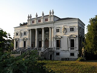
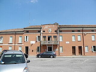
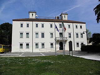
Villa Morosini Vendramin Calergi, actually the Town Hall | |
Coordinates: 44°58′N11°36′E / 44.967°N 11.600°E Coordinates: 44°58′N11°36′E / 44.967°N 11.600°E | |
Country | Italy |
Region | Veneto |
Province | Province of Rovigo (RO) |
Frazioni | Fornace Carotta, La Foscarina, Roncala |
Area | |
• Total | 27.3 km2 (10.5 sq mi) |
Population (Dec. 2004) | |
• Total | 4,207 |
• Density | 150/km2 (400/sq mi) |
Time zone | CET (UTC+1) |
• Summer (DST) | CEST (UTC+2) |
Postal code | 45024 |
Dialing code | 0425 |
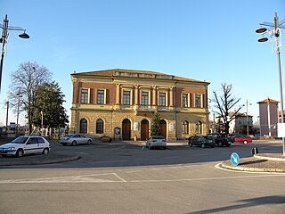
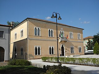
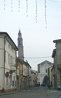
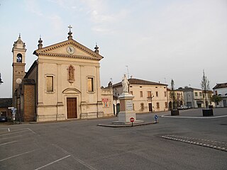
Fiesso Umbertiano is a comune (municipality) in the Province of Rovigo in the Italian region Veneto, located about 80 kilometres (50 mi) southwest of Venice and about 20 kilometres (12 mi) southwest of Rovigo. As of 31 December 2004, it had a population of 4,207 and an area of 27.3 square kilometres (10.5 sq mi). [1]
The comune is a basic administrative division in Italy, roughly equivalent to a township or municipality.
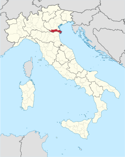
The Province of Rovigo is a province in the Veneto region of Italy. Its capital is the city of Rovigo. It borders on the north with the provinces of Verona, Padua and Venice, on the south with the province of Ferrara, on the west with the province of Mantua, and on the east with the Adriatic Sea.
Italy, officially the Italian Republic, is a country in Southern Europe. Located in the middle of the Mediterranean Sea, Italy shares open land borders with France, Switzerland, Austria, Slovenia and the enclaved microstates San Marino and Vatican City. Italy covers an area of 301,340 km2 (116,350 sq mi) and has a largely temperate seasonal and Mediterranean climate. With around 61 million inhabitants, it is the fourth-most populous EU member state and the most populous country in Southern Europe.
The municipality of Fiesso Umbertiano contains the frazioni (subdivisions, mainly villages and hamlets) Fornace Carotta, La Foscarina, Roncala, Capitello and Piacentina.
"Frazione" is the Italian name given in administrative law to a type of territorial subdivision of a comune; for other administrative divisions, see municipio, circoscrizione, quartiere. It is cognate to the English word fraction, but in practice is roughly equivalent to "parishes" or "wards" in other countries.
Fiesso Umbertiano borders the following municipalities: Canaro, Castelguglielmo, Frassinelle Polesine, Occhiobello, Pincara, Stienta.
Canaro is a comune (municipality) in the Province of Rovigo in the Italian region Veneto, located about 80 kilometres (50 mi) southwest of Venice and about 15 kilometres (9 mi) southwest of Rovigo. As of 31 December 2004, it had a population of 2,885 and an area of 32.7 square kilometres (12.6 sq mi).
Castelguglielmo is a comune (municipality) in the Province of Rovigo in the Italian region Veneto, located about 80 kilometres (50 mi) southwest of Venice and about 20 kilometres (12 mi) southwest of Rovigo. As of 31 December 2004, it had a population of 1,730 and an area of 22.1 square kilometres (8.5 sq mi).
Frassinelle Polesine is a comune (municipality) in the Province of Rovigo in the Italian region Veneto, located about 70 kilometres (43 mi) southwest of Venice and about 10 kilometres (6 mi) southwest of Rovigo. As of 31 December 2004, it had a population of 1,559 and an area of 21.9 square kilometres (8.5 sq mi).
Bosaro is a comune (municipality) in the Province of Rovigo in the Italian region Veneto, located about 60 kilometres (37 mi) southwest of Venice and about 8 kilometres (5 mi) south of Rovigo.
Calto is a comune (municipality) in the Province of Rovigo in the Italian region Veneto, located about 90 kilometres (56 mi) southwest of Venice and about 35 kilometres (22 mi) west of Rovigo.
Canda is a comune (municipality) in the Province of Rovigo in the Italian region Veneto, located about 80 km southwest of Venice and about 20 kilometres (12 mi) west of Rovigo. As of 31 December 2004, it had a population of 958 and an area of 14.4 square kilometres (5.6 sq mi).
Ceregnano is a comune (municipality) in the Province of Rovigo in the Italian region Veneto, located about 60 kilometres (37 mi) southwest of Venice and about 8 kilometres (5 mi) southeast of Rovigo. As of 31 December 2004, it had a population of 3,951 and an area of 30.0 square kilometres (11.6 sq mi).
Costa di Rovigo is a comune (municipality) in the Province of Rovigo in the Italian region Veneto, located about 60 kilometres (37 mi) southwest of Venice and about 7 kilometres (4 mi) southwest of Rovigo.
Ficarolo is a comune (municipality) in the Province of Rovigo in the Italian region Veneto, located about 90 kilometres (56 mi) southwest of Venice and about 30 kilometres (19 mi) southwest of Rovigo.
Fratta Polesine is a comune (municipality) in the Province of Rovigo in the Italian region Veneto, located about 70 kilometres (43 mi) southwest of Venice and about 11 kilometres (7 mi) southwest of Rovigo. Its main attraction is Andrea Palladio's Villa Badoer.
Gaiba is a comune (municipality) in the province of Rovigo in the Italian region Veneto, located about 80 kilometres (50 mi) southwest of Venice and about 25 kilometres (16 mi) southwest of Rovigo.
Gavello is a comune (municipality) in the Province of Rovigo in the Italian region Veneto, located about 60 kilometres (37 mi) southwest of Venice and about 12 kilometres (7 mi) southeast of Rovigo. As of 31 December 2004, it had a population of 1,616 and an area of 24.4 square kilometres (9.4 sq mi).
Melara is a comune (municipality) in the Province of Rovigo in the Italian region Veneto, located about 100 kilometres (62 mi) southwest of Venice and about 45 kilometres (28 mi) west of Rovigo. As of 31 December 2004, it had a population of 1,927 and an area of 17.6 square kilometres (6.8 sq mi).
Occhiobello is a comune (municipality) in the Province of Rovigo in the Italian region Veneto, located about 80 kilometres (50 mi) southwest of Venice and about 25 kilometres (16 mi) southwest of Rovigo.
Pettorazza Grimani is a comune (municipality) in the Province of Rovigo in the Italian region Veneto, located about 40 kilometres (25 mi) southwest of Venice and about 20 kilometres (12 mi) northeast of Rovigo.
Pincara is a comune (municipality) in the Province of Rovigo in the Italian region Veneto, located about 70 kilometres (43 mi) southwest of Venice and about 15 kilometres (9 mi) southwest of Rovigo. As of 31 December 2004, it had a population of 1,298 and an area of 17.8 square kilometres (6.9 sq mi).
Salara is a comune (municipality) in the Province of Rovigo in the Italian region Veneto, located about 90 kilometres (56 mi) southwest of Venice and about 30 kilometres (19 mi) southwest of Rovigo.
San Martino di Venezze is a comune (municipality) in the Province of Rovigo in the Italian region Veneto, located about 50 kilometres (31 mi) southwest of Venice and about 10 kilometres (6 mi) northeast of Rovigo.
Stienta is a comune (municipality) in the Province of Rovigo in the Italian region Veneto, located about 80 kilometres (50 mi) southwest of Venice and about 25 kilometres (16 mi) southwest of Rovigo. As of 31 December 2004, it had a population of 3,118 and an area of 24.1 square kilometres (9.3 sq mi).
Villanova del Ghebbo is a comune (municipality) in the Province of Rovigo in the Italian region Veneto, located about 70 kilometres (43 mi) southwest of Venice and about 10 kilometres (6 mi) west of Rovigo. As of 31 December 2004, it had a population of 2,209 and an area of 11.8 square kilometres (4.6 sq mi).
This article on a location in Veneto is a stub. You can help Wikipedia by expanding it. |