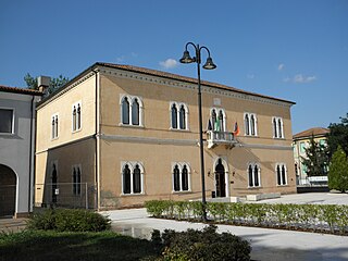
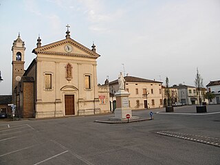
Vescovana is a comune (municipality) in the Province of Padua in the Italian region Veneto, located about 60 kilometres (37 mi) southwest of Venice and about 35 kilometres (22 mi) southwest of Padua. As of 31 December 2004, it had a population of 1,601 and an area of 22.3 square kilometres (8.6 sq mi).
Arquà Polesine is a comune (municipality) in the Province of Rovigo in the Italian region Veneto, located about 70 kilometres (43 mi) southwest of Venice and about 7 kilometres (4 mi) southwest of Rovigo.

Bosaro is a comune (municipality) in the Province of Rovigo in the Italian region Veneto, located about 60 kilometres (37 mi) southwest of Venice and about 8 kilometres (5 mi) south of Rovigo.
Calto is a comune (municipality) in the Province of Rovigo in the Italian region Veneto, located about 90 kilometres (56 mi) southwest of Venice and about 35 kilometres (22 mi) west of Rovigo.

Canaro is a comune (municipality) in the Province of Rovigo in the Italian region Veneto, located about 80 kilometres (50 mi) southwest of Venice and about 15 kilometres (9 mi) southwest of Rovigo. As of 31 December 2004, it had a population of 2,885 and an area of 32.7 square kilometres (12.6 sq mi).
Canda is a comune (municipality) in the Province of Rovigo in the Italian region Veneto, located about 80 km southwest of Venice and about 20 kilometres (12 mi) west of Rovigo. As of 31 December 2004, it had a population of 958 and an area of 14.4 square kilometres (5.6 sq mi).
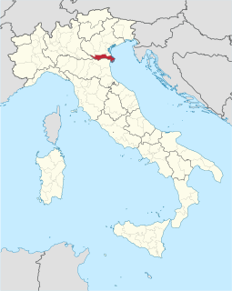
Ceregnano is a comune (municipality) in the Province of Rovigo in the Italian region Veneto, located about 60 kilometres (37 mi) southwest of Venice and about 8 kilometres (5 mi) southeast of Rovigo. As of 31 December 2004, it had a population of 3,951 and an area of 30.0 square kilometres (11.6 sq mi).

Costa di Rovigo is a comune (municipality) in the Province of Rovigo in the Italian region Veneto, located about 60 kilometres (37 mi) southwest of Venice and about 7 kilometres (4 mi) southwest of Rovigo.
Crespino is a comune (municipality) in the Province of Rovigo in the Italian region Veneto, located about 60 kilometres (37 mi) southwest of Venice and about 12 kilometres (7 mi) southeast of Rovigo. As of 31 December 2004, it had a population of 2,111 and an area of 31.9 square kilometres (12.3 sq mi).
Ficarolo is a comune (municipality) in the Province of Rovigo in the Italian region Veneto, located about 90 kilometres (56 mi) southwest of Venice and about 30 kilometres (19 mi) southwest of Rovigo.
Fiesso Umbertiano is a comune (municipality) in the Province of Rovigo in the Italian region Veneto, located about 80 kilometres (50 mi) southwest of Venice and about 20 kilometres (12 mi) southwest of Rovigo. As of 31 December 2004, it had a population of 4,207 and an area of 27.3 square kilometres (10.5 sq mi).

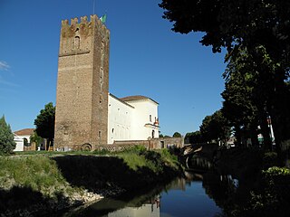
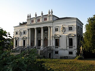
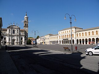
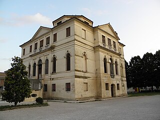
Fratta Polesine is a comune (municipality) in the Province of Rovigo in the Italian region Veneto, located about 70 kilometres (43 mi) southwest of Venice and about 11 kilometres (7 mi) southwest of Rovigo. Its main attraction is Andrea Palladio's Villa Badoer.
Gaiba is a comune (municipality) in the province of Rovigo in the Italian region Veneto, located about 80 kilometres (50 mi) southwest of Venice and about 25 kilometres (16 mi) southwest of Rovigo.
Gavello is a comune (municipality) in the Province of Rovigo in the Italian region Veneto, located about 60 kilometres (37 mi) southwest of Venice and about 12 kilometres (7 mi) southeast of Rovigo. As of 31 December 2004, it had a population of 1,616 and an area of 24.4 square kilometres (9.4 sq mi).

Papozze is a comune (municipality) in the Province of Rovigo in the Italian region Veneto, located about 50 kilometres (31 mi) southwest of Venice and about 20 kilometres (12 mi) southeast of Rovigo.
Pettorazza Grimani is a comune (municipality) in the Province of Rovigo in the Italian region Veneto, located about 40 kilometres (25 mi) southwest of Venice and about 20 kilometres (12 mi) northeast of Rovigo.

Salara is a comune (municipality) in the Province of Rovigo in the Italian region Veneto, located about 90 kilometres (56 mi) southwest of Venice and about 30 kilometres (19 mi) southwest of Rovigo.
San Martino di Venezze is a comune (municipality) in the Province of Rovigo in the Italian region Veneto, located about 50 kilometres (31 mi) southwest of Venice and about 10 kilometres (6 mi) northeast of Rovigo.
Stienta is a comune (municipality) in the Province of Rovigo in the Italian region Veneto, located about 80 kilometres (50 mi) southwest of Venice and about 25 kilometres (16 mi) southwest of Rovigo. As of 31 December 2004, it had a population of 3,118 and an area of 24.1 square kilometres (9.3 sq mi).

Villadose is a comune (municipality) in the Province of Rovigo in the Italian region Veneto, located about 50 kilometres (31 mi) southwest of Venice and about 8 kilometres (5 mi) east of Rovigo. As of 31 December 2004, it had a population of 5,303 and an area of 32.5 square kilometres (12.5 sq mi).