The Semi-Automatic Ground Environment (SAGE) was a system of large computers and associated networking equipment that coordinated data from many radar sites and processed it to produce a single unified image of the airspace over a wide area. SAGE directed and controlled the NORAD response to a possible Soviet air attack, operating in this role from the late 1950s into the 1980s. Its enormous computers and huge displays remain a part of cold war lore, and after decommissioning were common props in movies such as Dr. Strangelove and Colossus, and on science fiction TV series such as The Time Tunnel.

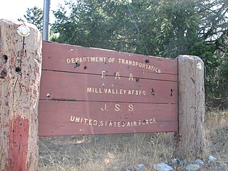
Ground Equipment Facility J-33 is a Federal Aviation Administration (FAA) radar station of the Joint Surveillance System's Western Air Defense Sector (WADS) with an Air Route Surveillance Radar (ARSR-4). The facility was previously a USAF general surveillance radar station during the Cold War.
Thomasville Air Force Station is a closed United States Air Force General Surveillance Radar station. It is located 1.9 miles (3.1 km) north-northwest of Thomasville, Alabama. It was closed in 1969.

Highlands Air Force Station was a military installation in Middletown Township near the borough of Highlands, New Jersey. The station provided ground-controlled interception radar coverage as part of the Lashup Radar Network and the Semi-Automatic Ground Environment network, as well as providing radar coverage for the Highlands Army Air Defense Site. The site's 240 acres (97 ha) is now the Rocky Point section in Hartshorne Woods Park of the Monmouth County Parks System.

Ground Equipment Facility QRC is an FAA radar station that was part of a Cold War SAGE radar station for aircraft control and warning "from Massachusetts to southern Virginia, and as far out to sea as possible." Benton AFS was also the first operational "regional data processing center" for the GE 477L Nuclear Detection and Reporting System.

Fort Heath was a US seacoast military installation for defense of the Boston and Winthrop Harbors with an early 20th-century Coast Artillery fort, a 1930s USCG radio station, prewar naval research facilities, World War II batteries, and a Cold War radar station. The fort was part of the Harbor Defenses of Boston and was garrisoned by the United States Army Coast Artillery Corps. The fort's military structures have been replaced by a residential complex, including the luxurious Forth Heath Apartments, and recreation facilities of Small Park, which has both a commemorative wall and an historical marker for Fort Heath.
The SAGE radar stations of Air Defense Command were the military installations operated by USAF squadrons using the first automated air defense environment and networked by the SAGE System, a computer network. Most of the radar stations used the Burroughs AN/FST-2 Coordinate Data Transmitting Set (CDTS) to automate the operator environment and provide radar tracks to sector command posts at SAGE Direction Centers (DCs), e.g., the Malmstrom Z-124 radar station was co-located with DC-20. The sector/division radar stations were networked by DCs and Manual Control Centers to provide command, control, and coordination for ground-controlled interception of enemy aircraft by interceptors such as the F-106 developed to work with the SAGE System.

Kirksville Air Force Station is a closed United States Air Force General Surveillance Radar station. It is located 7.1 miles (11.4 km) north of Kirksville, Missouri. It was closed by the Air Force in 1968. Today the radar site is used by the Federal Aviation Administration (FAA) as a Joint Surveillance System (JSS) site.

Ground Equipment Facility J-31 is a Joint Surveillance System radar site of the Western Air Defense Sector (WADS) and the Federal Aviation Administration's air traffic control radar network for the Los Angeles Air Route Traffic Control Center. The facility's Air Route Surveillance Radar Model 1E with an ATCBI-6 beacon interrogator system are operated by the FAA and provide sector data to North American Aerospace Defense Command. The site provided Semi-Automatic Ground Environment data to the 1959-66 Norton AFB Direction Center for the USAF Los Angeles Air Defense Sector. The site also provided Project Nike data to the 1960-74 Fort MacArthur Direction Center ~3 mi (4.8 km) away for the smaller US Army Los Angeles Defense Area—as well as gap-filler radar coverage for the 1963-74 Integrated Fire Control area of Malibu Nike battery LA-78 on San Vicente Mountain.

Keno Air Force Station is a closed United States Air Force General Surveillance Radar station. It is located 4.6 miles (7.4 km) south-southwest of Keno, Oregon. It was closed in 1979 by the Air Force, and turned over to the Federal Aviation Administration (FAA).

Kalispell Air Force Station is a closed United States Air Force General Surveillance Radar station. It is located 13.3 miles (21.4 km) south of Kalispell, Montana near the community of Lakeside.

Fort Lawton Air Force Station is a closed United States Air Force General Surveillance Radar station. It is located on Fort Lawton in the Magnolia neighborhood of northwest Seattle, Washington. The Air Force inactivated its unit in 1963; while the site remained under Army control until 1974. Today the Federal Aviation Administration (FAA) operates the site as part of the Joint Surveillance System (JSS).
The Martin AN/FSG-1 Antiaircraft Defense System, better known as Missile Master, was an electronic fire distribution center for United States Army surface-to-air missiles. It aimed to computerize Cold War air defense (AD) command posts from manual plotting board operations to automated command and control.

Missile Master was a US Army surface-to-air missile control complex/facility. It controlled Project Nike missiles. Virtually all Missile Masters had a bunker housing the Martin AN/FSG-1 Antiaircraft Defense System, as well as additional structures for "an AN/FPS-33 defense acquisition radar (DAR) or similar radar, two height-finder radars," and identification friend or foe secondary radar. The radars, along with Automated Data Links (ADL) from remote Nike firing units, provided data into the AN/FSG-1 tracking subsystem with the DAR providing surveillance coverage to about 200 mi (320 km).
The GE AN/GPA-37 Course Directing Group was a USAF Cold War air defense command, control, and coordination system for weapons direction. During Air Defense Command's "Control Capability Improvement Program" to improve command guidance of manned aircraft, the AN/GPA-37 was "developed by the General Electric Heavy Military Electronic Equipment Department at Syracuse in conjunction with...Rome Air Development Center and the Electronics Research Laboratories of Columbia University." Used to process radar data, the system was to "track a potential enemy aircraft and direct intercepters [sic] into a position from which they can make their automatic firing runs", the system included the:

A Super Combat Center (SCC) was a planned Cold War command and control facility for ten NORAD regions/Air Divisions in Canada and the United States. For installation in nuclear bunkers, the command posts were to replace the last of the planned Air Defense Command Combat Centers to be built for vacuum tube AN/FSQ-8 Combat Control Centrals.
An Air Defense Direction Center (ADDC) was a type of United States command post for assessing Cold War radar tracks, assigning height requests to available height-finder radars, and for "Weapons Direction": coordinating command guidance of aircraft from more than 1 site for ground-controlled interception. As with the World War II Aircraft Warning Service CONUS defense network, a "manual air defense system" was used through the 1950s Along with 182 radar stations at "the end of 1957, ADC operated … 17 control centers", and the Ground Observation Corps was TBD on TBD. With the formation of NORAD, several types of ADDCs were planned by Air Defense Command:
NORAD Control Centers (NCCs) were Cold War "joint direction centers" for command, control, and coordination of ground-controlled interception by both USAF Air Defense Command (ADC) and Army Air Defense Command (ARADCOM). The Joint Manual Steering Group was "formed by the Army and Air Force in July 1957 to support…collocation" of USAF Air Defense Direction Centers and Army Air Defense Command Posts, which began after a January 28, 1958, ADC/ARADCOM meeting with NORAD to "collocate the Fairchild-Geiger facilities" Army contracts for 5 NCCs had been let by August 17, 1958, after 1956 DoD approval for collocation of interim "pre-SAGE semiautomatic intercept systems" and radar squadrons at 10 planned Army Missile Master AADCPs
The Experimental Semi-Automatic Ground Environment (SAGE) Sector was a prototype Cold War Air Defense Sector for developing the Semi Automatic Ground Environment. The Lincoln Laboratory control center in a new building was at Lexington, Massachusetts.

Continental Air Defense Command (CONAD) was a Unified Combatant Command of the United States Department of Defense, tasked with air defense for the Continental United States. It comprised Army, Air Force, and Navy components. It included Army Project Nike missiles anti-aircraft defenses and USAF interceptors. The primary purpose of continental air defense during the CONAD period was to provide sufficient attack warning of a Soviet bomber air raid to ensure Strategic Air Command could launch a counterattack without being destroyed. CONAD controlled nuclear air defense weapons such as the 10 kiloton W-40 nuclear warhead on the CIM-10B BOMARC. The command was disestablished in 1975, and Aerospace Defense Command became the major U.S. component of North American Air Defense Command (NORAD).


