Southeastward view with the face of Grovers Cliff along foreground shore, large rectangular white area[specify] on west (right). Pictured items not on the 1921 map include the roads through the barracks area connecting to the off-post intersection that is now the Highland Av & Pond St intersection (right).
The Grover Cliff geodetic survey station marker was emplaced in 1847 (42°23′22.79″N070°58′08.643″W / 42.3896639°N 70.96906750°W / 42.3896639; -70.96906750, lost by 1922),[4] and the military site was renamed Grover's Cliff Military Reservation in 1895.[5] November 1890 planning for the military site was for 3 artillery rifles and 16 mortars,[6] and by spring 1898 Lieutenant Sewail was in charge of construction.[1] A spur of the Boston, Revere Beach and Lynn Railroad was built to the site by 29 March,[7] bids for lumber were received in April,[8] and the "Winthrop Mortar Batteries" of the regular army[9] (Battery F and Battery M) were ordered to Grovers Cliff in May 1898[10] for the 16 mortars, with the batteries encamping 16 May on Cherry Street in Boston.[9] Constructed during the Endicott modernization period for fortifications, "the first concrete foundation for one of the disappearing guns at Grovers Cliff" was complete in May 1898, and in 1900 the installation was renamed Fort Heath.[5]
Battery Theodore Winthrop
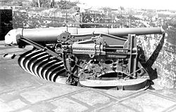
This disappearing carriage at Battery Alexander or Battery Bloomfield at Fort Hancock, New Jersey (above) was the same model (M1896) as at Ft Heath, and the recessed gun pits were similar. The 12-in gun (top) is an M1888.
Fort Heath was a secondary station for a 1907 naval exercise,[19] and in 1908 the Massachusetts Volunteer Militia had a Fort Heath unit.[20] In 1908 the fort had a "range-finders house" and a sea wall was considered[21] (constructed on the south shore by February 1921).[17] In 1917 a "duct line" between Fort Banks and Fort Heath was contracted to New England Telephone and Telegraph,[22] and for 3 batteries—Winthrop and Battery Kellogg & Battery Lincoln at Ft Banks—Ft Heath had the primary base end stations and the Battery Commanders' stations[23] (a commander's station was atop the Fort Heath parapet).[24]
Fort Heath map of "FEB. 17, 1921" with added modern annotation to "roughly" indicate a former survey marker in the roof of the southernmost of the "BC" buildings (top—6 small adjoining blocks).
After the 1925 renaming of the Coast Defenses of Boston to the Harbor Defenses of Boston,[25] the fort's ammunition hoists were authorized for disposal in January 1932.[citation needed] A federal survey marker ("MY0121—GROVERS") was set in the roof of the southernmost of the three fire control buildings at the fort in line at the northern end of Battery Winthrop. The marker on the "BC" (battery control) structure is roughly indicated on the 1921 map. Gun No. 3 (the most westerly[clarification needed] one) of Battery Winthrop was about 120ft. southeast of this marker, and the line between this gun and Gun No. 1 (the most easterly one) was 270ft. in length.[failed verification]
Coast Guard radio station
The United States Coast Guard radio station at Fort Heath (call sign "NMF") opened on 12 November 1931, and was initially used for testing "traffic…relayed from Point Bonita, California." The station had three 50-foot masts in 1934 (e.g., "Heath Northwest Radio Mast")[26] but as a trial for determining if Navy facilities could instead handle USCG radio traffic, the "station at Winthrop" closed from 1934 to 1936.[27] Subsequently, operating "until 1939 when the site was taken over by the Army", the USCG equipment "relocated to a former intelligence monitoring station at North Truro, Massachusetts."[27]
AA Battery No. 4
Antiaircraft Battery No. 4 was designated in 1935 after the third gun pad was constructed in 1934 for 3-inch (76 mm) AA guns.[5] The first two gun pads were built during World War I. The three emplacements were south of a surveillance radar and west of the "Theo. Winthrop"[17] foundations, and the three guns were approved on 8 January 1942 to be moved to Fort Ruckman.[5]
Navy Field Test Station
This section needs expansion. You can help by adding to it. (March 2013)
The FAA operated the ARSR-1 until the mid-to-late[specify] 1990s,[37] and by 2005, the "Fort Heath property" acquired by the town had been converted to a municipal park.[38] The fort land is a Formerly Used Defense Site (MA19799F184300).[39]
↑Wing, Betty (19 July 2012). "Fort Heath and Fort Dawes – Winthrop MA". The Pye Plate. Fort Heath was in a section of the town called the Highlands. This area was hilly compared to the rest of the town. Winthrop Beach ended its northward trek as the land began to get hillier and rockier, ending in a headland in the Highlands known as Grover's Cliff
1234"Fort Heath". FortWiki.com. 11 June 2012. Retrieved 13 March 2013.
↑"Boston to Become a Fortified Port". Chicago Tribune. 2 November 1890. Archived from the original(Newspaper Archive image) on 11 April 2013. Retrieved 7 March 2013. On the high land in Winthrop, back of Grover's Cliff, three batteries will be built, one [with] three 10-inch breech rifles, and two with 12-inch mortars, sixteen in all.
12"Fortifying Grover's Cliff"(Google News archive). Boston Evening Transcript. 17 May 1898. Retrieved 13 March 2013. Excavations Will Be Completed by the End of This Month—Regulars at Winthrop Mortar Battery Comfortably Settled … The excavations for the platform for the first or lower gun is completed and the masonry for the platform has taken shape and will soon be completed. Yesterday [May 16] the regulars came in to man the sixteen guns in the mortar battery. Cherry street, a private way leading in to the battery, has been turned into a camp.
↑Extracts from Reports by Regular and Militia Officers on the Joint (Report). War Department Division of Militia Affairs. 1908. Retrieved 7 March 2013. Capt. H. D. Todd, Jr., Coast Artillery Corps, fire commander (northern battle command), Fort Heath, Mass. … Col. Charles P. Nutter, commanding Coast Artillery Corps, Massachusetts Volunteer Militia, Fort Heath, Mass.
↑Kaufmann (13 December 2004). Fortress America. Hachette Books. ISBN9780306812941. Retrieved 7 March 2013. Harbor Defense Command was the name given after 1925 to the coastal
12"title tbd"(Google Viewer display of Word doc). United States Coast Guard. Retrieved 7 March 2013. "After negotiations with the War Department in 1930, the Coast Guard was granted permission to erect a radio station [at Fort Heath, and it] was placed in commission at 10:00 a.m. on 12 November 1931. …call sign "NMF"… On the initial test, stations along the east coast were worked with ease, and traffic was relayed from Point Bonita, California. The station at Winthrop was closed experimentally from 1 September 1934 until 17 September 1936 and an attempt was made to pass all Coast Guard messages through Navy facilities. The experiment clearly indicated a need for the Coast Guard to provide its own radio facilities.
↑Army Engineers in New England…. p.130. The instructor was First Lieutenant Walter Krotee, sent from the faculty of the Engineer School at Fort Belvoir, Virginia.
↑title tbd (geographical report). publisher tbd.[full citation needed] Report describes the transformation using the 2010 Jerry L. Wahl model applied to the WW2 grid coordinates of Gun No. 1 supplied by Paul Grigorieff from the 1945 Army Engineers' report[specify] on the Boston Harbor Defenses.
↑"Harbor Defenses of Boston (Massachusetts)". keyhole.com. Retrieved 13 September 2011. Became a MISSILE MASTER control site in the 1950s (demolished 1969). The FAA obtained a radar site here from 1965 to 1986
↑Butler, Gerald W; Shaner, Mary; Shaner, Richard (12 December 2001). The Guns of Boston Harbor. AuthorHouse. ISBN9780759647305. Retrieved 1 March 2013. In 1958, the Federal Aviation Administration (FAA) constructed long-range acquisition radar at Fort Heath. Commissioned in 1959, the ARSR-1 radar was used to track aircraft 220 miles distant for flight-following" purposes. …the army and air force also used this surveillance radar for Air Defense Control and Coordination Systems (ADCCS).
↑McMaster, B. N.; etal. (December 1984). Historical Overview of the Nike Missile System(PDF) (Report). Environmental Science and Engineering, Inc. Archived from the original(PDF) on 2 April 2012. Retrieved 16 September 2011.NOTE: The annual 1 July maps in McMaster's report show 6 AN/TSQ-51 Missile Mentors in 1966 at former AN/FSG-1 sites, with Ft Heath instead shown with the following: an AN/FSG-1 Missile Master in 1964 (near a separate Massachusetts BIRDIE), then a Ft Heath BIRDIE in 1966 & 1967, a Ft Heath Missile Mentor in 1968 & 1969, and no Ft Heath AADCP in 1970 (a Rhode Island Missile Mentor was depicted in 1970; but not in 1971.)
↑Open Space Plan Final – Winthrop, MA (Report). Town of Winthrop. January 2005. Retrieved 7 March 2013. The acquisition of the Fort Heath property and its conversion to a magnificent park with an unequaled view was truly a milestone
This page is based on this Wikipedia article Text is available under the CC BY-SA 4.0 license; additional terms may apply. Images, videos and audio are available under their respective licenses.


