Fort Dawes

Last updated
Fort Dawes
Part of Harbor Defenses of Boston
Deer Island, Boston, Massachusetts
USA Massachusetts location map.svg
Red pog.svg
Fort Dawes
Location in Massachusetts
Coordinates 42°20′56.02″N70°57′23.36″W / 42.3488944°N 70.9564889°W / 42.3488944; -70.9564889
Type Coastal Defense
Site information
Owner Massachusetts
Controlled by Deer Island Waste Water Treatment Plant
Open to
the public
no
Site history
Built1942
Built byUnited States Army
In use1942-1946
Demolishedca 1991
Battles/wars World War II
A 1945 map of the mine fields protecting Boston Harbor during World War II. Fort Dawes is on Deer Island in the upper center. Boston-Mines-1945.jpg
A 1945 map of the mine fields protecting Boston Harbor during World War II. Fort Dawes is on Deer Island in the upper center.
16-inch casemated gun, similar to Battery 105. 16-inch-Casemated.jpg
16-inch casemated gun, similar to Battery 105.
6-inch gun at Fort Columbia State Park, Washington state, similar to Battery 207. Coastal artillery gun at Fort Columbia State Park.jpg
6-inch gun at Fort Columbia State Park, Washington state, similar to Battery 207.

Fort Dawes was a World War II Coast Artillery fort located on Deer Island in Winthrop/Boston, Massachusetts. It was part of the Harbor Defenses of Boston. [1]

Contents

History

The site's military history began in 1906 as the Deer Island Military Reservation, acquired for fire control and mine field control as part of the Taft program. [2]

During World War II, Fort Dawes was initially the site of a target detection radar for the harbor defenses and Battery Taylor (two 3-inch M1902 guns moved from nearby Fort Strong), both completed by late 1942. [2] Also in 1942, construction began on Anti-Motor Torpedo Boat Battery (AMTB) 944, with two fixed and two towed 90 mm guns, along with the Harbor Entrance Control Post (HECP) for Boston Harbor--the installation that kept track of all vessels entering and leaving the harbor. [3] AMTB 944 replaced Battery Taylor in October 1943, whose guns were placed in storage at that time. [2] [4] By 1945 Fort Dawes had a mine casemate controlling some of the mines guarding the northern approach to Boston Harbor.

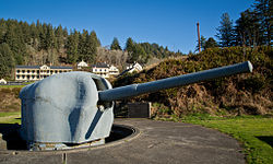
Fort Dawes can also lay claim to the largest collection of "artillery that never was" in the harbor defenses of Boston. Battery 105 and Battery 207 began construction in 1942. Battery 105 was completed as a large bunker housing magazines and fire control for two 16-inch guns, like those at Battery Murphy in Nahant and generally similar to the guns of Battery Long at Fort Duvall. By the time the emplacements had been finished, however, WW2 was being won, and the need for the battery was deemed to have passed, so it was never armed. The nearby battery of two 6-inch guns, Battery 207, was also never equipped with guns, for the same reason. [3] [2] [4]

In 1946 AMTB 944 was disarmed, and within a few years the site was abandoned.

However, in the summer of 1956 or perhaps a bit longer, the airfield was used to run flights testing the new ideas of air traffic control. A small radar was installed there and used to track flights to determine if an airplane could be directed to follow a predetermined path. Prof. Eugenio Calabi was advisor on the project.

In the early 1990s all of the military facilities on Deer Island were demolished and the earth stripped away for the construction of the Deer Island Waste Water Treatment Plant. All vestiges of Fort Dawes were destroyed. [3]

See also

Related Research Articles

<span class="mw-page-title-main">Fort Miles</span>

Fort Miles was a United States Army World War II installation located on Cape Henlopen near Lewes, Delaware. Although funds to build the fort were approved in 1934, it was 1938 before construction began on the fort. On 3 June 1941 it was named for Lieutenant General Nelson A. Miles.

<span class="mw-page-title-main">Fort Strong</span>

Fort Strong is a former U.S. Army Coast Artillery fort that occupied the northern third of Long Island in Boston Harbor. The island had a training camp during the American Civil War, and a gun battery was built there in the 1870s. The fort was built in 1893-1906 during the Endicott period of expansion in U.S. coast defense, and was part of the Coast Defenses of Boston. Formerly, it was also known as Long Island Military Reservation. Before World War I, a large station for handling submarine mines was added to the fort's defenses. Prior to World War I the fort was probably manned by over 1,000 soldiers. During World War II, two batteries of 3-inch guns defended channel minefields, but the big guns and other 3-inch batteries were decommissioned. Declared surplus in 1947, the fort served as a Nike missile site until 1961, and was redeveloped in 2005-2009 for a children's summer camp and later a homeless shelter. However, in 2014 the island's bridge was demolished due to safety concerns, and all activity ended.

<span class="mw-page-title-main">Fort Rodman</span> United States historic place

Fort Taber District or the Fort at Clark's Point is a historic American Civil War-era military fort on Wharf Road within the former Fort Rodman Military Reservation in New Bedford, Massachusetts. The fort is now part of Fort Taber Park, a 47-acre town park located at Clark's Point. Fort Taber was an earthwork built nearby with city resources and garrisoned 1861-1863 until Fort Rodman was ready for service.

<span class="mw-page-title-main">Odiorne Point State Park</span> Public recreation area in New Hampshire, U.S.

Odiorne Point State Park is a public recreation area located on the Atlantic seacoast in the town of Rye near Portsmouth, New Hampshire. Among the park's features are the Seacoast Science Center and the remains of the World War II Fort Dearborn. The park offers opportunities for hiking, cycling, picnicking, fishing, and boating.

<span class="mw-page-title-main">Brewster Islands Military Reservation</span> Coastal defense site in Boston Harbor, Massachusetts, USA

Brewster Islands Military Reservation was a coastal defense site located on Great Brewster Island and Outer Brewster Island in Boston Harbor, Massachusetts as part of the Harbor Defenses of Boston.

East Point Military Reservation was a World War I and World War II coastal defense site located in Nahant, Massachusetts. In 1955–62 it was a Nike missile launch site. In 1967 the site was converted into the Marine Science Center of Northeastern University.

<span class="mw-page-title-main">Jewell Island</span>

Jewell Island is a small island in Casco Bay, Maine, United States. Approximately 1 mile (1.6 km) long from southwest to northeast, it is located off the coast of Cliff Island, approximately eight miles from downtown Portland. It is a state-owned island with a small but protected harbor as well as camping and walking paths. Jewell Island was part of the Harbor Defenses of Portland fort network. The island is part of the city of Portland. Jewell Island can be reached by private or charter boats. There is no ferry service to the island.

<span class="mw-page-title-main">Fort Heath</span> US seacoast military installation for defense

Fort Heath was a US seacoast military installation for defense of the Boston and Winthrop Harbors with an early 20th-century Coast Artillery fort, a 1930s USCG radio station, prewar naval research facilities, World War II batteries, and a Cold War radar station. The fort was part of the Harbor Defenses of Boston and was garrisoned by the United States Army Coast Artillery Corps. The fort's military structures have been replaced by a residential complex, including the luxurious Forth Heath Apartments, and recreation facilities of Small Park, which has both a commemorative wall and an historical marker for Fort Heath.

<span class="mw-page-title-main">Fort Duvall</span>

Fort Duvall was a Coast Artillery fort, part of the Harbor Defenses of Boston, in Massachusetts. What was then called Hog Island in Hull, Massachusetts was acquired by the U.S. government in 1917, and the fort was constructed in the early 1920s. It had only one gun battery, Battery Long, but it mounted the largest caliber weapons in the entire harbor defense system: a pair of 16-inch guns. These were the 16-inch gun M1919, of which only seven were deployed; 16-inch weapons deployed later were supplied by the Navy.

<span class="mw-page-title-main">Fort Ruckman</span>

Fort Ruckman was a U.S. Coast Artillery fort located in Nahant, Massachusetts. Originally called the Nahant Military Reservation, the fort was laid out in 1904-1907 and covered an area of about 45 acres just northwest of Bass Point, on the southwest side of the Nahant peninsula. During the 1920s, this area was renamed in honor of Maj. Gen. John Wilson Ruckman, a former Colonel in the Coast Artillery.

<span class="mw-page-title-main">Fort Williams (Maine)</span>

Fort Williams is a former United States Army fort in Cape Elizabeth, Maine which operated from 1872 to 1964. It was part of the Coast Defenses of Portland, later renamed the Harbor Defenses of Portland, a command which protected Portland's port and naval anchorage 1904–1950. After its closure, it was redeveloped into Fort Williams Park.

<span class="mw-page-title-main">Battery Steele</span>

Battery Steele is a United States military fortification on Peaks Island, Portland, Maine in Casco Bay. Completed in 1942 as part of World War II, it is located on 14 acres (5.7 ha) on the oceanside area of the island, formerly part of the Peaks Island Military Reservation. It is named for Harry L. Steele, who was a Coast Artillery officer during World War I. It was armed with two 16-inch MkIIMI guns and, with a 12-inch gun battery at Fort Levett on Cushing Island, replaced all previous heavy guns in the Harbor Defenses of Portland. It was built to protect Casco Bay, particularly Portland harbor, from Kennebunk to Popham Beach in Phippsburg. According to Kim MacIsaac and historian Joel Eastman in An Island at War, “Battery Steele is not only the largest gun battery built on Peaks Island, but also an example of the largest battery ever built anywhere in the United States.” In 1995, after decades of non-use, the Peaks Island Land Preserve, a community land preservation group, formed to purchase the area and forever preserve it as a public space. On October 20, 2005, the property was listed on the National Register of Historic Places. Other coast defense structures on the island include fire control towers and the counterweight for a disappearing searchlight tower.

<span class="mw-page-title-main">Fort Standish (Boston, Massachusetts)</span>

Fort Standish was a coastal fort completed in 1907 and located on Lovell's Island in Massachusetts. Named after Myles Standish, the fort would serve to host up to 7 batteries until it was disarmed and deactivated in 1947. It was also named Lovell's Island Military Reservation during the early part of its existence. It was part of the Coast Defenses of Boston.

<span class="mw-page-title-main">Fort Stark</span>

Fort Stark is a former military fortification in New Castle, New Hampshire, United States. Located at Jerry's Point on the southeastern tip of New Castle Island, most of the surviving fort was developed in the early 20th century, following the Spanish–American War, although there were several earlier fortifications on the site, portions of which survive. The fort was named for John Stark, a New Hampshire officer who distinguished himself at the Battle of Bennington in the American Revolution. The purpose of Fort Stark was to defend the harbor of nearby Portsmouth and the Portsmouth Naval Shipyard. The fort remained in active use through the Second World War, after which it was used for reserve training by the US Navy. The property was partially turned over to the state of New Hampshire in 1979, which established Fort Stark Historic Site, and the remainder of the property was turned over in 1983. The grounds are open to the public during daylight hours.

<span class="mw-page-title-main">Fort Foster (Kittery, Maine)</span>

Fort Foster, now part of Fort Foster Park, is a historic fort active 1901–1946 on the southwest tip of Gerrish Island in the Kittery Point area of Kittery, Maine. The park includes beaches and trails. Battery Bohlen and Battery Chapin were the major parts of the fort.

<span class="mw-page-title-main">Camp Varnum</span>

Camp Varnum is a Rhode Island Army National Guard training facility in the Boston Neck area of Narragansett, Rhode Island. During World War II it was Fort Varnum, a coastal defense fort.

The Harbor Defenses of Portsmouth was a United States Army Coast Artillery Corps harbor defense command. It coordinated the coast defenses of Portsmouth, New Hampshire and the nearby Portsmouth Naval Shipyard in Kittery, Maine from 1900 to 1950, both on the Piscataqua River, beginning with the Endicott program. These included both coast artillery forts and underwater minefields. The command originated circa 1900 as the Portsmouth Artillery District, was renamed Coast Defenses of Portsmouth in 1913, and again renamed Harbor Defenses of Portsmouth in 1925.

<span class="mw-page-title-main">Harbor Defenses of Boston</span> Military unit

The Harbor Defenses of Boston was a United States Army Coast Artillery Corps harbor defense command. It coordinated the coast defenses of Boston, Massachusetts from 1895 to 1950, beginning with the Endicott program. These included both coast artillery forts and underwater minefields. The command originated circa 1895 as the Boston Artillery District, was renamed Coast Defenses of Boston in 1913, and again renamed Harbor Defenses of Boston in 1925.

<span class="mw-page-title-main">Harbor Defenses of New Bedford</span> Military unit

The Harbor Defenses of New Bedford was a United States Army Coast Artillery Corps harbor defense command. It coordinated the coast defenses of New Bedford, Massachusetts and the nearby Cape Cod Canal from 1900 to 1950, beginning with the Endicott program. These included a coast artillery fort and an underwater minefield. The command originated circa 1900 as the New Bedford Artillery District, was renamed Coast Defenses of New Bedford in 1913, and again renamed Harbor Defenses of New Bedford in 1925.

<span class="mw-page-title-main">Harbor Defenses of Argentia and St. John's</span>

The Harbor Defenses of Argentia and St. John's was a United States Army Coast Artillery Corps harbor defense command in World War II. It was part of Newfoundland Base Command, established as a result of the 1940 Destroyers for Bases Agreement with the United Kingdom. It coordinated the US Army coast defenses of Naval Station Argentia and the port of St. John's, Newfoundland from January 1941 to 8 September 1945. These included coast artillery at Fort McAndrew in Argentia and Fort Pepperrell in St. John's.

References

  1. Harbor Defenses of Boston at NorthAmericanForts.com
  2. 1 2 3 4 Fort Dawes at FortWiki.com
  3. 1 2 3 Grigorieff, Paul. "Fort Dawes". Coastaldefense.com. Retrieved 11 August 2013.
  4. 1 2 Berhow, p. 205