Fort Washington (Massachusetts)

Last updated
Fort Washington
Fort Washington (Cambridge, MA).JPG
Fort Washington
USA Massachusetts location map.svg
Red pog.svg
Usa edcp location map.svg
Red pog.svg
Location95 Waverly St., Cambridge, Massachusetts
Coordinates 42°21′23.6″N71°6′15.4″W / 42.356556°N 71.104278°W / 42.356556; -71.104278
Area0.7 acres (0.28 ha)
Architect Richard Gridley
Architectural styleThree Gun Half Moon Battery
NRHP reference No. 73000284 [1]
Added to NRHPApril 3, 1973
Gate of the Fort Washington Park Gate of Fort Washington (Cambridge, Massachusetts) (2).jpg
Gate of the Fort Washington Park
Fort Washington Park US Flag in Fort Washington (Cambridge, Massachusetts) (2).jpg
Fort Washington Park

Fort Washington, also known as Fort Washington Park, is a historic site at 95 Waverly Street in Cambridge, Massachusetts. It was built by soldiers of the Continental Army under the orders of George Washington in November 1775. It is the oldest surviving fortification from the American Revolutionary War and the only surviving fortification from the Siege of Boston. Fort Washington was placed on the List of Registered Historic Places in Massachusetts on April 3, 1973. [1]

Contents

History

American Revolution

In a letter to Joseph Reed written at Cambridge in November 1775, George Washington wrote, "I have caused two three gun half moon batteries to be thrown up for occasional use." [2]

At the time these small fortifications were constructed, Henry Knox was on his way to Fort Ticonderoga to get the best of the cannons which were there and at Fort Crown Point, a three-month exercise known as the noble train of artillery . The troops needed to be trained in constructing works in which the guns could be mounted promptly.

Post war

The property was acquired by the City of Cambridge and restored in 1857, at which time three 18-pounder cannons from the old Fort Winthrop, located on Governor's Island, were installed, and an elaborate granite and iron fence was designed by architect John R. Hall to protect the site. [3]

A description of the property at the time of that transfer was later compiled by local historians: [2]

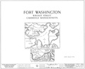
The three gun battery at the foot of Allston Street retains the semblance of a fort, and is called Fort Washington. The land where this battery was thrown up had been held in common from the close of the Revolution till 1857, when it was deeded to the city by the following persons: Edmund T. and Elizabeth Hastings, Mary E. Dana, Joseph A. and Penelope Willard, John and Hannah B. Bartlett. A fund of $800 was also turned over to the city, by these people who cared for this plot of historic land. The conditions named include "that the above premises when suitably enclosed and adorned by said city, shall forever remain open for light, air, and adornment, for the convenience and accommodation of the owners of estates in said Pine Grove, and of the Public generally." The city accepted this gift and with the assistance of Commonwealth of Massachusetts proceeded to restore the battery to its original condition, to build a substantial fence around it and to erect a flag-staff. The Secretary of War gave three 30-pounder guns (actually, Eighteen Pound American guns), and the Secretary of the Navy gave the gun carriages. The Massachusetts State Legislature voted to appropriate the sum of $2,000 "provided the city of Cambridge shall appropriate a sum sufficient to complete the said fence at a cost of not less than four thousand dollars and said Fort Washington shall always be accessible to the public, and that said city shall always keep the fence proposed to built,[ sic?] in good repair."

The Cambridge city directory of 1861 reported the earthworks to be five years old in appearance and in excellent condition; the total cost of Fort Washington Park, was $9,504.05. [4] In 1965 the state passed legislation authorizing the city of Cambridge to transfer the park to the United States government as a historic landmark. [5]

The property remains a city park and is designated an historic district of the City of Cambridge. [6] The park was rededicated on October 3, 2009, Cambridgeport History Day, following restoration work. [7] What remains today are only grassy embankments, not substantial fortifications. [8]

Cannons

The guns standing in the embrasures are 18-pounders and were cast during or shortly after the Revolution. The two 18-pound cannon at Stonington were cast in 1781 in Salisbury, Connecticut [9] during the Revolution. There are also two 18-pound cannon at Mount Defiance in Ticonderoga, New York which are also from the Revolution and of a similar cast.

The three 18-pounders were among those over-age cannon that were removed from the original Fort Warren on Governor's Island, when a new Fort Warren was built on George's Island. Mr. Marcus Morton, of Cambridge, learned by correspondence with the Historical Section of the Chief of Ordnance in Washington, in 1942, that the gun carriages were cast by the West Point Foundry on the Hudson River, and he discovered in the city records that it cost the city $13.50 to bring these guns from Governor's Island to Cambridge. [10]

These cannon are identical, except for the numbers and weights marked upon them. They are numbered 45, 36, and 40; and their weighs are shown as 30-0-13, 30-0-17, and 30-0-16, respectively, (in cwt., qrs., and lbs.). Those figures correspond to 3375, 3377, and 3376 pounds. The bore is approximately 5 5/8 inches; the diameter of an 18-pound sphere of cast iron is 5.1 inches; the excess diameter of the bore (called windage) was usually about ¼ inch, or a little bit more, to allow for irregularities in the bore of the guns and the casting of the balls. The next larger standard size for cannon of that period was 24 lb., which would require a bore of at least 5.9 inches.[ citation needed ]

The following images are from the Library of Congress, Historic American Buildings Survey, Survey number HABS MA-2-48, MARCH 1934:. [11]

See also

Related Research Articles

<span class="mw-page-title-main">Fort Schuyler</span>

Fort Schuyler is a preserved 19th century fortification in the New York City borough of the Bronx. It houses a museum, the Stephen B. Luce Library, and the Marine Transportation Department and Administrative offices of the State University of New York Maritime College. It is considered one of the finest examples of early 19th century fortifications. The fort was named in honor of Major General Philip Schuyler of the Continental Army.

<span class="mw-page-title-main">Fort Knox (Maine)</span> Fort in Maine, United States

Fort Knox, now Fort Knox State Park or Fort Knox State Historic Site, is located on the western bank of the Penobscot River in the town of Prospect, Maine, about 5 miles (8.0 km) from the mouth of the river. Built between 1844 and 1869, it was the first fort in Maine built entirely of granite; most previous forts used wood, earth, and stone. It is named after Major General Henry Knox, the first U.S. Secretary of War and Commander of Artillery during the American Revolutionary War, who at the end of his life lived not far away in Thomaston. As a virtually intact example of a mid-19th century granite coastal fortification, it was added to the National Register of Historic Places in 1969 and declared a National Historic Landmark on December 30, 1970. Fort Knox also serves as the entry site for the observation tower of the Penobscot Narrows Bridge that opened to the public in 2007.

<span class="mw-page-title-main">Rodman gun</span> Type of American Civil War–era cannon

The Rodman gun is any of a series of American Civil War–era columbiads designed by Union artilleryman Thomas Jackson Rodman (1815–1871). The guns were designed to fire both shot and shell. These heavy guns were intended to be mounted in seacoast fortifications. They were built in 8-inch, 10-inch, 13-inch, 15-inch, and 20-inch bore. Other than size, the guns were all nearly identical in design, with a curving bottle shape, large flat cascabels with ratchets or sockets for the elevating mechanism. Rodman guns were true guns that did not have a howitzer-like powder chamber, as did many earlier columbiads. Rodman guns differed from all previous artillery because they were hollow cast, a new technology that Rodman developed that resulted in cast-iron guns that were much stronger than their predecessors.

<span class="mw-page-title-main">Fort McClary</span> United States historic place

Fort McClary is a former defensive fortification of the United States military located along the southern coast at Kittery Point, Maine at the mouth of the Piscataqua River. It was used throughout the 19th century to protect approaches to the harbor of Portsmouth, New Hampshire and the Portsmouth Naval Shipyard in Kittery. The property and its surviving structures are now owned and operated by the State of Maine as Fort McClary State Historic Site, including a blockhouse dating from 1844.

<span class="mw-page-title-main">Parrott rifle</span> Muzzle loading artillery weapon

The Parrott rifle was a type of muzzle-loading rifled artillery weapon used extensively in the American Civil War.

<span class="mw-page-title-main">House Island (Maine)</span> Private island in Maine, United States

House Island is a private island in Portland Harbor in Casco Bay, Maine, United States. It is part of the City of Portland. The island is accessible only by boat. Public access is prohibited, except for an on-request tour sanctioned by the island's owners. House Island includes three buildings on the east side and Fort Scammell on the west side. The buildings are used as vacation rentals and other summer residences. The island's name derives from the site of an early European house, believed that built by Capt. Christopher Levett, an English explorer of the region.

<span class="mw-page-title-main">Columbiad</span> Type of large-caliber cannon from the 19th century

The columbiad was a large-caliber, smoothbore, muzzle-loading cannon able to fire heavy projectiles at both high and low trajectories. This feature enabled the columbiad to fire solid shot or shell to long ranges, making it an excellent seacoast defense weapon for its day. Invented by Colonel George Bomford, United States Army, in 1811, columbiads were used in United States seacoast defense from the War of 1812 until the early years of the 20th century. Very few columbiads were used outside of the U.S. and Confederate Armies; nevertheless, the columbiad is considered by some as the inspiration for the later shell-only cannons developed by Frenchman Henri-Joseph Paixhans some 30 years later.

<span class="mw-page-title-main">Board of Fortifications</span>

Several boards have been appointed by US presidents or Congress to evaluate the US defensive fortifications, primarily coastal defenses near strategically important harbors on the US shores, its territories, and its protectorates.

<span class="mw-page-title-main">Fort Washington Park</span> Historic fort and military reservation in Fort Washington, Maryland, US

Fort Washington, located near the community of Fort Washington, Maryland, was for many decades the only defensive fort protecting Washington, D.C. The original fort, overlooking the Potomac River, was completed in 1809, and was begun as Fort Warburton, but renamed in 1808. During the War of 1812, the fort was destroyed by its own garrison during a British advance.

<span class="mw-page-title-main">York Redoubt</span> Historic site in Nova Scotia, Canada

York Redoubt is a redoubt situated on a bluff overlooking the entrance to Halifax Harbour at Ferguson's Cove, Nova Scotia, Canada, originally constructed in 1793. It was designated a National Historic Site of Canada in 1962.

<span class="mw-page-title-main">Fort Foote</span> Historical fort in Prince Georges County, Maryland, US

Fort Foote was an American Civil War-era wood and earthwork fort that was part of the wartime defenses of Washington, D.C., which helped defend the Potomac River approach to the city. It operated from 1863 to 1878, when the post was abandoned, and was used briefly during the First and Second World Wars. The remnants of the fort are located in Fort Foote Park, which is maintained by the National Park Service as part of the National Capital Parks-East system. The area's mailing address is Fort Washington, Maryland.

<span class="mw-page-title-main">Fort Independence (Massachusetts)</span> United States historic place

Fort Independence is a granite bastion fort that provided harbor defenses for Boston, Massachusetts, located on Castle Island. Fort Independence is one of the oldest continuously fortified sites of English origin in the United States. The first primitive fortification was called "The Castle", placed on the site in 1634. It was rebuilt twice, then replaced around 1692 with a more substantial structure known as Castle William. It was abandoned by the British during the American Revolution, but the Americans renamed it Fort Adams and then Fort Independence. The existing granite fort was constructed between 1833 and 1851. Today it is preserved as a state park and fires occasional ceremonial salutes. Fort Independence was added to the National Register of Historic Places in 1970.

<span class="mw-page-title-main">Seacoast defense in the United States</span> Coastal forts construction and maintenance in the U.S.

Seacoast defense was a major concern for the United States from its independence until World War II. Before airplanes, many of America's enemies could only reach it from the sea, making coastal forts an economical alternative to standing armies or a large navy. After the 1940s, it was recognized that fixed fortifications were obsolete and ineffective against aircraft and missiles. However, in prior eras foreign fleets were a realistic threat, and substantial fortifications were built at key locations, especially protecting major harbors.

<span class="mw-page-title-main">Siege artillery in the American Civil War</span>

Siege artillery is heavy artillery primarily used in military attacks on fortified positions. At the time of the American Civil War, the U.S. Army classified its artillery into three types, depending on the gun's weight and intended use. Field artillery were light pieces that often traveled with the armies. Siege and garrison artillery were heavy pieces that could be used either in attacking or defending fortified places. Seacoast artillery were the heaviest pieces and were intended to be used in permanent fortifications along the seaboard. They were primarily designed to fire on attacking warships. The distinctions are somewhat arbitrary, as field, siege and garrison, and seacoast artillery were all used in various attacks and defenses of fortifications. This article will focus on the use of heavy artillery in the attack of fortified places during the American Civil War.

<span class="mw-page-title-main">Fort Rodman</span> United States historic place

Fort Taber District or the Fort at Clark's Point is a historic American Civil War-era military fort on Wharf Road within the former Fort Rodman Military Reservation in New Bedford, Massachusetts. The fort is now part of Fort Taber Park, a 47-acre town park located at Clark's Point. Fort Taber was an earthwork built nearby with city resources and garrisoned 1861-1863 until Fort Rodman was ready for service.

<span class="mw-page-title-main">Fort Willard</span>

Fort Willard is a former Union Army installation now located in the Belle Haven area of Fairfax County in the U.S. state of Virginia. It is currently undergoing preservation treatment to protect its earthen walls and trenches.

Blakely rifle or Blakely gun is the name of a series of rifled muzzle-loading cannon designed by British army officer Captain Theophilus Alexander Blakely in the 1850s and 1860s. Blakely was a pioneer in the banding and rifling of cannon but the British army declined to use Blakely's design. The guns were mostly sold to Russia and the Confederacy during the American Civil War. Blakely rifles were imported by the Confederacy in larger numbers than other Imported English cannon. The State of Massachusetts bought eight 9 in (23 cm) and four 11 in (28 cm) models.

<span class="mw-page-title-main">Sylvanus Sawyer</span> American inventor (1822–1895)

Sylvanus Sawyer was a United States inventor.

<span class="mw-page-title-main">Harbor Defenses of New Bedford</span> Military unit

The Harbor Defenses of New Bedford was a United States Army Coast Artillery Corps harbor defense command. It coordinated the coast defenses of New Bedford, Massachusetts and the nearby Cape Cod Canal from 1900 to 1950, beginning with the Endicott program. These included a coast artillery fort and an underwater minefield. The command originated circa 1900 as the New Bedford Artillery District, was renamed Coast Defenses of New Bedford in 1913, and again renamed Harbor Defenses of New Bedford in 1925.

<span class="mw-page-title-main">Harbor Defenses of Long Island Sound</span> Military unit

The Harbor Defenses of Long Island Sound was a United States Army Coast Artillery Corps harbor defense command. It coordinated the coast defenses of Long Island Sound and Connecticut from 1895 to 1950, beginning with the Endicott program. These included both coast artillery forts and underwater minefields. The area defended included the approach via the Sound to New York City, the port cities and manufacturing centers of New London, New Haven, and Bridgeport, and eventually included the submarine base and shipyard in Groton. The command originated circa 1900 as an Artillery District, was renamed Coast Defenses of Long Island Sound in 1913, and again renamed Harbor Defenses of Long Island Sound in 1925.

References

  1. 1 2 "National Register Information System". National Register of Historic Places . National Park Service. July 9, 2010.
  2. 1 2 An Historic Guide to Cambridge (2nd ed.). Hannah Winthrop Chapter, NSDAR. 1907. pp. 179–80.
  3. "Fort Washington, in Cambridge", Charles W. Sherman – Belmont Massachusetts - 1950, On file with the Cambridge Historical Commission and Massachusetts Historical Society
  4. The Cambridge City Directory 1861, on file with the Cambridge Historical Commission
  5. Chap. 460. An Act Authorizing the City of Cambridge to Convey the Site of Fort Washington in said City to the United States of America for Preservation and Maintenance as a National Historic Monument
  6. "Fort Washington Historic District". City of Cambridge. Archived from the original on May 8, 2012. Retrieved January 25, 2014.
  7. "Fort Washington Park Rededicated". Cambridge Community Television.
  8. "CHC's Frequently Asked Questions". City of Cambridge.
  9. Stonington Historical Society article, August 1982, by Henry R. Palmer, Jr
  10. History of Cambridge, Massachusetts 1630-1877, Lucius R. Paige
  11. Library of Congress, Historic American Buildings Survey, Survey number HABS MA-2-48, link