Magoun Square is a neighborhood centered on the intersection of Broadway and Medford Streets on the border of Medford and Somerville, Massachusetts. It is located between the neighborhoods of Ball Square and Winter Hill. It is a mixed-use urban business district, with commercial sites in the square and residential areas surrounding it. Trum Field, a park featuring baseball diamonds and basketball courts, is near Magoun Square, as are the headquarters of the Somerville Department of Public Works. Notable residents include playwright John Shea.

Teele Square is at the intersection of Broadway, Holland Street, and Curtis Street in Somerville, Massachusetts, a half-mile from Davis Square and the Davis Square stop on the MBTA Red Line, as well as a half-mile from Alewife Brook Parkway and Powder House Square. The square sits on Clarendon Hill, one of the seven hills of Somerville. The square is named after Jonathan W. Teele, who resided in an early portion of Charlestown that eventually became Somerville in 1842.

Prospect Hill Academy Charter School (PHA) is K-12 college preparatory public charter school located on three campuses in Somerville, Massachusetts and Cambridge, Massachusetts. The school was founded in 1996.
Winter Hill is a neighborhood in Somerville, Massachusetts. It gets its name from the 120-foot hill that occupies its landscape, the name of which dates back to the 18th century. Winter Hill is located roughly north of Medford Street, west of McGrath Highway, and east of Magoun Square.

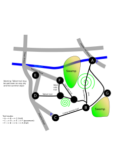
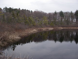
Cedar Hill is located in Northborough, Massachusetts. It is part of the larger Crane Swamp Conservation Area.

The Charles W. Ward Reservation is a 704-acre (285 ha) open space reserve located in Andover and North Andover, Massachusetts, 20 miles (32 km) north of Boston. The reserve, managed by the land conservation non-profit organization The Trustees of Reservations, is notable for its open drumlin hilltops and vistas encompassing Boston and Salem. The Ward Reservation offers 13 miles (21 km) of trails and former woods roads available for hiking, horseback riding, mountain biking, and cross country skiing; it is also a link in the 200-mile (320 km) Bay Circuit Trail system.

Mid-Cambridge, also known as "Area 6", is a neighborhood of Cambridge, Massachusetts. It is bounded by Massachusetts Avenue on the south and west, Prospect Street on the east, and Hampshire Street, the Somerville border, Kirkland Street, Quincy Street, and Cambridge Street on the north.
The Medford Turnpike is a road mostly in modern-day Somerville, Massachusetts, United States, now known as Mystic Avenue. It was laid out in 1803 as a result of the 1786 Charles River Bridge from Charlestown to Boston. In historic terms, it ran from Medford Center to Charlestown Neck. It is currently designated to be part of Massachusetts Route 38.
The following is a timeline of the history of Somerville, Massachusetts, USA.
Camp Massasoit is a former American Civil War training camp that existed in 1861 in Readville, Massachusetts.
Camp Andrew is a former American Civil War training camp that existed in 1861 in West Roxbury, Massachusetts.
Camp Brigham is a former American Civil War training camp that existed in 1861 in Readville, Massachusetts.
Camp Ellsworth is a former American Civil War training camp that existed in 1862 in North Cambridge, Massachusetts. It was located near Fresh Pond, at the abandoned Reed and Bartlett Icehouse.It was first occupied by the 1st Regiment Massachusetts Volunteer Infantry on June 1, 1861.
Camp Framingham is a former Massachusetts National Guard camp that existed in 1873 to 1944 in Framingham, Massachusetts. The camp was used by all units of the Massachusetts Volunteer Militia as their summer training ground. The camp also contained the state arsenal where weapons and equipment was stored and issued to units. Camp Framingham was also used as a mobilization station during the Spanish–American War, June 1916 during the Mexican border call-up and during the summer of 1917 during World War I.From May 1942 to December 1943, HQ, 181st Infantry Regiment was stationed with its companies serving on coast patrol duty in New England. In 1948, Camp Framingham was transferred from the Military Division to the Massachusetts State Police. Today, the Massachusetts State Police and the Massachusetts Emergency Management Agency utilize portions of the former camp.
Camp Scott is an American Civil War camp that existed in 1861 in Worcester, Massachusetts.

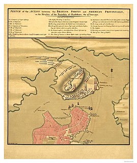
The Charlestown Neck was an isthmus connecting the formerly independent city of Charlestown, Massachusetts to the mainland at present-day Sullivan Square in Middlesex County. When Charlestown was first settled by British colonists it was surrounded on nearly all sides by water. Only a small strip of land called "the neck" connected what is now Charlestown to what would become Somerville.
The Somerville Assembly was a Ford Motor Company factory in Somerville, Massachusetts which opened in 1926 as a replacement to the Cambridge Assembly. Following the failure of the Edsel, the plant, which had been one of the region’s largest employers, closed its doors in 1958. At that time it was the Edsel division's only Edsel-only assembly line as all other Edsel plants were shared with Mercury or Ford. Somerville built only the larger Corsair and Citation big series Edsels which shared chassis with Mercury. The closure created severe consequences for the local economy, as it paid the city over $1 million in annual taxes.

The Cambridge Assembly was a Ford Motor Company factory in Cambridge, Massachusetts which opened in 1913. The factory had the first vertically-integrated assembly line in the world. It was replaced in 1926 by the Somerville Assembly. The plant was later reused by Polaroid Corporation, and is now owned by the Massachusetts Institute of Technology.
Prospect Hill is a hill in Waltham, Massachusetts, United States, and is the third-highest point within 12 miles (19 km) of downtown Boston. The hill is in Prospect Hill Park on the west side of Waltham, near Route 128. It is exceeded in height by Great Blue Hill and Chickatawbut Hill, both in the Blue Hills Reservation. It is not to be confused with the much lower, historically significant Prospect Hill near Union Square in Somerville.


