External links
| Active |
|  | ||||||||||||||||||||||||||||||||||||||
|---|---|---|---|---|---|---|---|---|---|---|---|---|---|---|---|---|---|---|---|---|---|---|---|---|---|---|---|---|---|---|---|---|---|---|---|---|---|---|---|---|
| Inactive | ||||||||||||||||||||||||||||||||||||||||
Coordinates: 41°34′27.88″N70°27′38.45″W / 41.5744111°N 70.4606806°W
The Popponesset Firing Range was a firing range of the United States Army located in Mashpee, Massachusetts. It was active from 1941 to 1942, and was dismantled after its use was ended. It was a satellite range of nearby Camp Edwards.
| Active |
| | ||||||||||||||||||||||||||||||||||||||
|---|---|---|---|---|---|---|---|---|---|---|---|---|---|---|---|---|---|---|---|---|---|---|---|---|---|---|---|---|---|---|---|---|---|---|---|---|---|---|---|---|
| Inactive | ||||||||||||||||||||||||||||||||||||||||
Coordinates: 41°34′27.88″N70°27′38.45″W / 41.5744111°N 70.4606806°W
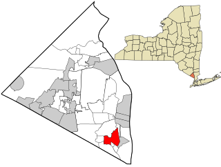
Orangeburg is a hamlet and census-designated place, in the town of Orangetown, Rockland County, New York, United States. It is located north of Tappan, south of Blauvelt, east of Pearl River and west of Piermont. The population was 4,568 at the 2010 census.
Camp Perry is a National Guard training facility located on the shore of Lake Erie in northern Ohio near Port Clinton. In addition to its regular mission as a military training base, Camp Perry also boasts the largest outdoor rifle range in the world after the NRA Whittington Center in Raton, NM. The firing is done in the direction of the open water of the lake, that lies just beyond an earthen berm and the targets.
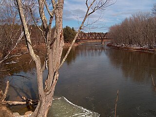
The Saco River is a river in northeastern New Hampshire and southwestern Maine in the United States. It drains a rural area of 1,703 square miles (4,410 km2) of forests and farmlands west and southwest of Portland, emptying into the Atlantic Ocean at Saco Bay, 136 miles (219 km) from its source. It supplies drinking water to roughly 250,000 people in thirty-five towns; and historically provided transportation and water power encouraging development of the cities of Biddeford and Saco and the towns of Fryeburg and Hiram. The name "Saco" comes from the Eastern Abenaki word [sɑkohki], meaning "land where the river comes out". The Jesuit Relations, ethnographic documents from the 17th century, refer to the river as Chouacoet.

Edson Range is a firing range complex at Marine Corps Base Camp Pendleton, near Oceanside, California. It is named for Marine Major General "Red Mike" Edson, "a World War II Medal of Honor recipient and a distinguished small arms marksman proponent." This rifle-qualification complex is home to four of the largest firing ranges on the base. The range became operational on August 21, 1964, the same day that Camp Calvin B. Matthews, in La Jolla, Calif., was closed and turned over to the University of California. Camp Matthews had previously been used for rifle training.

Nantucket Sound is a roughly triangular area of the Atlantic Ocean offshore from the U.S. state of Massachusetts. It is 30 miles (48 km) long and 25 miles (40 km) wide, and is enclosed by Cape Cod on the north, Nantucket on the south, and Martha's Vineyard on the west. Between Cape Cod and Martha's Vineyard it is connected to the Vineyard Sound. Ports on Nantucket Sound include Nantucket and Hyannis, Massachusetts.

The AN/FPS-35 radar was a long range radar used in the early 1960s. It was one of the largest air defense radars ever produced, with its antenna and supporting structure mounted on one of the largest rolling-element bearings in the world.

Montauk Air Force Station was a US military base at Montauk Point on the eastern tip of Long Island, New York. It was decommissioned in 1981 and is now owned by the New York State Office of Parks, Recreation and Historic Preservation as Camp Hero State Park.

Tionesta is an unincorporated community in Modoc County, California. It is located on the former Great Northern Railway Bieber Line, 2 miles (3.2 km) northwest of Timber Mountain, at an elevation of 4278 feet.
Pulga is an unincorporated community in Butte County, California. It is located along the west slope of the Feather River canyon, at an elevation of 1398 feet. A variant name for the community is Big Bar. Other nearby communities include Mayaro, Poe and Parkhill. The town hosts a Caltrans highway maintenance station along State Route 70 (SR70). The place is at the mouth of the Flea Valley Creek, which gives rise to the toponym.

Mashpee Pond41°39′40″N70°29′08″W and Wakeby Pond41°40′30″N70°29′08″W are adjoining ponds in Mashpee and Sandwich, Massachusetts. When considered together, these two ponds cover 729 acres (2.95 km2) and constitute the largest freshwater pond on Cape Cod. This pair is 85 feet (26 m) deep at its deepest point. The Fishing Record for most bass cought in a day belongs to Tim walls on August 21,2016. The record for most fishing trips without a single fish cought belongs to P.J Keliher at 26. These kettleholes are fed by groundwater and have no inlet streams. The ponds' sole outlet stream, the Mashpee River, flows south to Popponesset Bay.
The Joint Base Cape Cod is a joint base created by the Commonwealth of Massachusetts and the United States War Department in 1935. Governor James Curley signed the state bill to allocate and purchase land for a military facility, and establishing a formal commission to manage this new state military property and personnel. After 22,000 acres of land was secured in Cape Cod, the Massachusetts National Guard began erecting tents and a basic training program in the following year. Formerly the Massachusetts Military Reservation, it was renamed in 2013 to Joint Base Cape Cod.
The Lyman Reserve is a 210-acre (0.85 km2) nature reserve in Bourne, Plymouth and Wareham, Massachusetts and is managed by the Trustees of Reservations. There are 1.5 miles (2.4 km) of hiking trails, a beach and is in proximity to the Red Brook Reserve and Red Brook Wildlife Management Area. The area was formerly as private fishing camp, which sits at the mouth of Red Brook at Buttermilk Bay. It is home to one of the last remaining groups of sea-run brook trout ("salters") in the Eastern United States.

The Misery Islands are an 87-acre (350,000 m2) nature reserve established in 1935 in Salem Sound close to the Salem Harbor in Salem, Massachusetts. It is managed by the Trustees of Reservations. The islands are a part of the city of Salem, although they are much closer to the city of Beverly, in whose aquatic territory they lie.

Watch Hill is a campground and marina located on Fire Island, a barrier island off the south shore of New York's Long Island. The park is located across the Great South Bay from Patchogue and is contained within the Fire Island National Seashore.

Fort Andrews was created in 1897 as part of the Coast Defenses of Boston, Massachusetts. Construction began in 1898 and the fort was substantially complete by 1904. The fort was named after Major General George Leonard Andrews, an engineer and Civil War commander, who assisted in the construction of nearby Fort Warren in Boston Harbor. It occupies the entire northeast end of Peddocks Island in Boston Harbor, and was originally called the Peddocks Island Military Reservation. Once an active Coast Artillery post, it was manned by hundreds of soldiers and bristled with mortars and guns that controlled the southern approaches to Boston and Quincy Bay. The fort also served as a prisoner-of-war camp for Italian prisoners during World War II, who were employed as laborers following the Italian surrender to the Allies in 1943. Today, the fort is abandoned, and is managed by the Massachusetts Department of Conservation and Recreation, as part of the Boston Harbor Islands National Recreation Area.
Camp Perkins was a Massachusetts Army National Guard camp located in Marstons Mills, Massachusetts near the site of the present Cape Cod Airfield.
The Scorton Neck Firing Range was a firing range of the United States Army located in Sandwich, Massachusetts. It was active from 1941 to 1942, and was dismantled in 1946. It was a satellite range of nearby Camp Edwards.
Camp Joe Hooker was an American Civil War training camp located in Lakeville, Massachusetts.
Plymouth Camp is a former infantry and field artillery coastal defense base camp that existed from between May 1942 and November 1943 in Plymouth, Massachusetts. It contained barracks, a mess hall, and supply huts. Company K of the 181st Infantry Regiment was stationed at the camp, with Battery D of the 211th Field Artillery Battalion. The infantry company patrolled between Nantasket and East Dennis, and controlled the entire area, except for the Cape Cod Canal region.

Gull Island is a small island located just off the southeast coast of Penikese Island. It is part of the Elizabeth Islands and is entirely part of the town of Gosnold in Dukes County, Massachusetts. At one point it contained the Gull Island Bomb Area, a United States Navy bombing range. Currently, it is uninhabited.