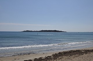
Bar Rock42.241°N 70.758°W is a barren rock within Massachusetts Bay, in Scituate, Massachusetts, USA. The rock is just east of the Scituate neighborhood of Minot, off the coast of Scituate Neck. More specifically, the rock is east of the Bailey's Causeway & Glades Road intersection.
Barrel Rock is a small barren rock within the edge of Cohasset Harbor in Cohasset, Massachusetts, USA. The rock is north of Sutton Rocks, northwest of Quarry Point, south of Chittenden Rock, and east of Brush Island. It is located at 42°15′32″N70°47′6″W

Tinkers Island is a pair of small islands off the coast of Marblehead, Massachusetts, United States. It is only accessible by boat and houses several small camps. The island was named after the breed of mackerel that can be found close to its shores.

The Ipswich River Wildlife Sanctuary, which is the Massachusetts Audubon Society’s largest wildlife sanctuary, is located in Topsfield and Wenham, Massachusetts. Much of its 2,800-acre (11 km2) landscape was created by a glacier 15,000 years ago.

Waring School is a co-educational private school in Beverly, Massachusetts, United States, for students in grades 6-12. The School offers studies in Humanities; extensive music, art, and theatre options, mathematics and science courses, as well as a curriculum of French language and cultural exchange.

The Misery Islands are an 87-acre (350,000 m2) nature reserve established in 1935 in Salem Sound close to the Salem Harbor in Salem, Massachusetts. It is managed by the Trustees of Reservations. The islands are a part of the city of Salem, although they are much closer to the city of Beverly, in whose aquatic territory they lie.
Egg Rock in Nahant Bay near Nahant, Massachusetts is a small (3-acre) island at 42.4333°N 70.8978°W. It was formerly the site of a lighthouse known as Egg Rock Light but now is owned by the state of Massachusetts as a bird sanctuary. Egg Rock can be seen clearly from the coasts of Nahant, Swampscott, and Lynn. Egg Rock is the setting for Sylvia Plath's poem, "Suicide at Egg Rock," and also appears in her novel, The Bell Jar.
Broad Sound is a bay on the Massachusetts coast north of Boston. It lies on the west of Massachusetts Bay, between Nahant and Deer Island; Lynn harbor is at its north end. The main channel of Boston Harbor empties into the sound.
Camp Hobson was a military camp that existed during the Spanish–American War in 1898 in Gloucester, Massachusetts. It was located near the works known as Stage Fort, Fort Banks, Fort Cross, and Fort Allen during their intermittent use. Restored in 1930, it is now located on land belonging to Stage Fort Park.
Camp Hingham is a former training camp of the United States Navy that existed from 1917 to 1925 in Hingham, Massachusetts. After it was closed, the land was used for the Hingham Naval Ammunition Depot.

Camp Lander is a former Massachusetts militia camp active during 1862 and located in Wenham, Massachusetts. The site is now the occupied by Pingree Park.
Camp Edmunds is a former Massachusetts State Militia camp that existed in 1856 in Salem, Massachusetts on Winter Island.
Camp Chase, also known as Camp Wilson, was a training camp for Massachusetts militia during the American Civil War located in Lowell, Massachusetts. Several thousand recruits were trained at Camp Chase before being sent south to the battle front.
Camp Guild is a former World War I mobilization camp that existed in 1917 in Boxford, Massachusetts.
Camp Brigham is a former American Civil War training camp that existed in 1861 in Readville, Massachusetts.
Camp Ellsworth is a former American Civil War training camp that existed in 1862 in North Cambridge, Massachusetts. It was located near Fresh Pond, at the abandoned Reed and Bartlett Icehouse.It was first occupied by the 1st Regiment Massachusetts Volunteer Infantry on June 1, 1861.
Camp Joe Hooker was an American Civil War training camp located in Lakeville, Massachusetts.
Camp Framingham is a former Massachusetts National Guard camp that existed in 1873 to 1944 in Framingham, Massachusetts. The camp was used by all units of the Massachusetts Volunteer Militia as their summer training ground. The camp also contained the state arsenal where weapons and equipment was stored and issued to units. Camp Framingham was also used as a mobilization station during the Spanish–American War, June 1916 during the Mexican border call-up and during the summer of 1917 during World War I.From May 1942 to December 1943, HQ, 181st Infantry Regiment was stationed with its companies serving on coast patrol duty in New England. In 1948, Camp Framingham was transferred from the Military Division to the Massachusetts State Police. Today, the Massachusetts State Police and the Massachusetts Emergency Management Agency utilize portions of the former camp.
Camp Scott is an American Civil War camp that existed in 1861 in Worcester, Massachusetts.
Massachusetts State Militia Aviation Camp was an encampment of the Massachusetts Naval Air Militia that existed on Great Misery Island in Salem, Massachusetts from 1916 to 1917.


