Related Research Articles

Essex County is a county in the northeastern part of the U.S. state of Massachusetts. As of the 2010 census, the total population was 743,159, making it the third-most populous county in the state. It is part of the Greater Boston area. The largest city in Essex County is Lynn. The county was named after the English county of Essex.

Merrimac is a small town in Essex County, Massachusetts, United States, and on the southeastern border of New Hampshire, approximately 34 miles (55 km) northeast of Boston and 10 miles (16 km) west of the Atlantic Ocean. It was incorporated on April 11, 1876. It is situated along the north bank of the Merrimack River in the Merrimack Valley. The population was 6,338 at the 2010 census. Historically a manufacturing center, it has long since become a largely residential community. It is part of the Greater Boston metropolitan area.

The Merrimack River is a 117-mile-long (188 km) river in the northeastern United States. It rises at the confluence of the Pemigewasset and Winnipesaukee rivers in Franklin, New Hampshire, flows southward into Massachusetts, and then flows northeast until it empties into the Gulf of Maine at Newburyport. From Pawtucket Falls in Lowell, Massachusetts, onward, the Massachusetts–New Hampshire border is roughly calculated as the line three miles north of the river.
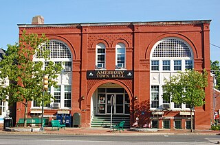
Amesbury is a city in Essex County, Massachusetts, located on the left bank of the Merrimack River near its mouth, upstream from Salisbury and across the river from Newburyport and West Newbury. The population was 16,283 at the 2010 census. A former farming and mill town, Amesbury is today largely residential. It is one of the two northernmost towns in Massachusetts.

Salisbury is a small coastal beach town and summer tourist destination in Essex County, Massachusetts, United States. The community is a popular summer resort beach town situated on the Atlantic Ocean, north of Boston on the New Hampshire border. It is home to the new Salisbury Beach Boardwalk, full of souvenir shops, restaurants, cafes, arcades and panoramic views of the Atlantic Ocean. The population was 8,283 at the 2010 census. Parts of town comprise the census-designated place of Salisbury.

The North Shore is a region in the U.S. state of Massachusetts, loosely defined as the coastal area between Boston and New Hampshire. The region is made up both of a rocky coastline, dotted with marshes and wetlands, as well as several beaches and natural harbors. The North Shore is an important historical, cultural, and economic region of Massachusetts. It contains the cities of Salem, known worldwide as the site of the Salem Witch Trials; and Gloucester, site of Charles Olson's Maximus Poems, and of Sebastian Junger's 1997 creative nonfiction book The Perfect Storm and its 2000 film adaptation. Beverly was home to author John Updike until his death.
Badgers Rock is a small barren rock within the Merrimack River, in Salisbury, Massachusetts, United States. The rock is just south of the light campground area of the Salisbury Beach State Reservation and north of Plum Island Point on Plum Island in Newburyport.
Route 110 is a 69.24-mile-long (111.43 km) southwest–northeast state highway in Massachusetts. The route travels from Route 12 in West Boylston in Central Massachusetts to U.S. Route 1 and Route 1A in Salisbury near the coast. Route 110 is paralleled by Interstate 495 (I-495) for most of its length, and interchanges with the freeway several times along its journey.

The Powwow River is a 22.8-mile-long (36.7 km) river located in New Hampshire and Massachusetts in the United States. It is a tributary of the Merrimack River, part of the Gulf of Maine watershed.
The Back River is a 6.5-mile-long (10.5 km) river located in New Hampshire and Massachusetts in the United States. It is a tributary to the Powwow River, part of the Merrimack River watershed. Approximately 3.0 miles (4.8 km) of the river are in New Hampshire, with the remaining 3.5 miles (5.6 km) in Massachusetts.

The Merrimack Valley Regional Transit Authority (MVRTA) is a public, non-profit organization in Massachusetts, United States, charged with providing public transportation to an area consisting of the cities and towns of Amesbury, Andover, Boxford, Georgetown, Groveland, Haverhill, Lawrence, Merrimac, Methuen, Newbury, Newburyport, North Andover, Rowley, Salisbury and West Newbury, as well as a seasonal service to the popular nearby summer destination of Hampton Beach, New Hampshire.

Fort Lee is a historic American Revolutionary War fort in Salem, Massachusetts. The site, located at a high point next to Fort Avenue on Salem Neck, is a relatively rare fortification from that period whose remains are relatively unaltered. It is an irregular 5-pointed star fort. Although there is some documentary evidence that the Neck was fortified as early as the 17th century, the earthworks built in 1776 are the first clear evidence of the site's military use. Reportedly, the fort had a garrison of 3 officers and 100 artillerymen with 16 guns. The site, of which only overgrown earthworks and a stone magazine survive, was repaired in the 1790s, and rebuilt for the American Civil War. A state cultural resource document states that the fort has not been much modified since the Revolution, and has not been built over. It was garrisoned by the Massachusetts militia in the War of 1812, abandoned afterwards, and rebuilt with four 8-inch columbiads in the Civil War. An Army engineer drawing dated 1872 depicts the fort's five-pointed trace and the four Civil War gun positions. It was also garrisoned during the Spanish–American War.

Fort Andrew is a former fort built as Gurnet Fort in 1776 for the American Revolutionary War on Gurnet Point in Plymouth, Massachusetts. It became a federal fort and was rebuilt in 1808, and again in 1863 during the Civil War when it received its current name. It is named for John A. Andrew, governor of Massachusetts 1861–1866. In 1863 Fort Standish was built nearby on Saquish Head. After the war, the federal government declared Fort Andrew an inactive military reservation in 1869. The reservation was sold in 1926 and mostly became private property, except for the US Coast Guard light station. A World War II fire control tower was built on the parapet of the old fort. Plymouth lighthouse is also on Gurnet Point, and was moved inside the fort's earthworks to protect it from beach erosion in 1997–1998.

Salisbury Beach Military Reservation was a coastal defense site located in Salisbury, Massachusetts.

Fort Defiance was a fort that existed from 1794 to after 1865 on Fort Point in Gloucester, Massachusetts. The location protecting the inner harbor was also called Watch House Point.

The Fort at Salisbury Point was a fort in use from 1863 to 1865 in Salisbury, Massachusetts, during the American Civil War. It was also called the Fort at Salisbury Beach. It was a nine-gun earthwork located at the mouth of the Merrimack River at what is now the Salisbury Beach State Reservation, where eventual erosion washed it away. A 1903 reference states it was on the site of the Revolutionary War Fort Nichols, but that site is in doubt, and may have been at the location called Salisbury Point in Amesbury, several miles up the river. The Fort at Salisbury Point was sometimes referred to by local civilians as Fort Nichols in the Civil War era. The fort was designed and built under the supervision of Major Charles E. Blunt of the United States Army Corps of Engineers. An armament report dated June 30, 1866 lists nine heavy guns and one 12-pounder field gun. The heavy guns were three 8-inch smoothbore Rodman guns, three 42-pounder rifled guns, and three 32-pounder rifled guns. From November 1864 to June 1865 it was garrisoned by the 20th Unattached Company of Massachusetts militia.
Old Stone Fort was a fort that existed in 1814 in Rockport, Massachusetts during the War of 1812. It was also known as Sea Fensibles Barrack during its existence. Today, a plaque is located on the Transit Tower, which was built on the site of the fort. Stones from the former fort were used in the construction of the harbor's breakwater.
Fort Philip was a fort built in 1776 during the American Revolutionary War and rebuilt in 1808, which also served in the War of 1812 to around 1815. It was in Newburyport, Massachusetts on the northern end of Plum Island, known as Lighthouse Point, guarding the mouth of the Merrimack River. The 1808 rebuilding was part of the second system of US fortifications. The secretary of war's report on fortifications in December 1808 states that "...a battery of wood, filled in with sand and surmounted with sod, has been erected. It... was constructed of wood on account of the shifting sands." A subsequent report in December 1811 describes the fort as "...an enclosed battery, built of earth and timber, mounting five heavy guns... ." The site eventually washed away in the 1830s. A militia artillery battery was stationed in the area in the Spanish–American War.
Fort Standish was a fort built in 1863 for the American Civil War on Saquish Head in Plymouth, Massachusetts. It was named for Myles Standish, military leader of the Plymouth Colony in the 1620s, and augmented the nearby Fort Andrew on Gurnet Point. It was designed and constructed under the supervision of Major Charles E. Blunt of the United States Army Corps of Engineers. The fort had five gun emplacements with five 8-inch smoothbore guns, along with a bombproof shelter, two magazines, and a well. Outside the fort were a barracks, officers' quarters, and a mess hall. From January to June 1865 the fort was garrisoned by the 27th Unattached Company of Massachusetts militia.
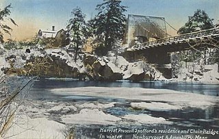
Deer Island is a small island with only 1-2 residences, located in the Merrimack River in Amesbury, Massachusetts. The island connects to mainland Amesbury by way of the Derek S. Hines Memorial Bridge, and to neighboring Newburyport via Chain Bridge.
References
- ↑ "Massachusetts". American Forts Network. Retrieved 27 June 2020.
- ↑ Heitman, Francis B. (1903). Historical Register And Dictionary Of The United States Army: 1789-1903, vol. 2. Washington, DC: Government Printing Office. pp. 528, 541.
- ↑ Everett, Frederic. "State of New Hampshire Highway Department". United States Geological Service. Archived from the original on 10 June 2011. Retrieved 13 August 2013. (dead link 27 June 2020)
- ↑ Topographic map of Amesbury, MA at topozone.com
- ↑ Manuel, Dale A. (Summer 2020). "Addendum: Massachusetts North Shore Civil War Forts". Coast Defense Journal. Vol. 34 no. 3. Mclean, Virginia: CDSG Press. pp. 73–74.
Former military forts, reservations, and camps in Massachusetts | ||
|---|---|---|
| Forts |
|  |
| Reservations | ||
| Camps |
| |
Coordinates: 42°50′11″N70°54′38″W / 42.83639°N 70.91056°W
| This military base or fortification article is a stub. You can help Wikipedia by expanding it. |