Casey County is a county located in the U.S. Commonwealth of Kentucky. As of the 2010 census, the population was 15,955. Its county seat is Liberty. The county was formed in 1806 from the western part of Lincoln County and named for Colonel William Casey, a pioneer settler who moved his family to Kentucky in 1779. It is the only Kentucky county entirely in the Knobs region. Casey County is home to annual Casey County Apple Festival, and is a prohibition or dry county. It is considered part of the Appalachian region of Kentucky.

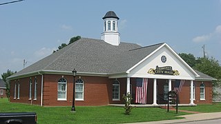
Liberty is a home rule-class city in Casey County, Kentucky, in the United States. It is the seat of its county. Its population was 2,168 at the 2010 U.S. census.

Dwane Casey is an American basketball coach who is the head coach for the Detroit Pistons of the National Basketball Association (NBA). He is a former NCAA basketball player and coach, having played and coached there for over a decade before moving on to the NBA.

Somerset Community College (SCC), located in Somerset, Kentucky, is one of 16 two-year, open-admissions colleges of the Kentucky Community and Technical College System (KCTCS). The college offers academic, general education, and technical curricula leading to certificates, diplomas, and associate's degrees. Somerset Community College is accredited by the Commission on Colleges of the Southern Association of Colleges and Schools (SACS).

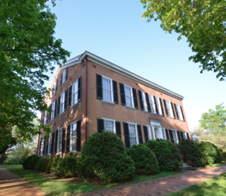
My Old Kentucky Home State Park is a state park located in Bardstown, Kentucky. The park's centerpiece is Federal Hill, a farm owned by United States Senator John Rowan in 1795. During the Rowan family's occupation, the mansion became a meeting place for local politicians and hosted several visiting dignitaries. The farm is best known for its association with American composer Stephen Foster's anti-slavery ballad "My Old Kentucky Home, Good Night". Foster was a cousin of the Rowan family, and was likely inspired to write the ballad both by Harriet Beecher Stowe's anti-slavery novel Uncle Tom's Cabin and through imagery seen on visits to Federal Hill. After popularity of the song increased throughout the United States, Federal Hill was purchased by the Commonwealth of Kentucky, dedicated as a historic site, and renamed "My Old Kentucky Home" on July 4, 1923. Foster's song by the same name was made the state song of Kentucky in 1928. The Federal Hill mansion was featured on a U.S. postage stamp in 1992, and it is one of the symbols featured on the reverse of the Kentucky state quarter issued in 2001.

The Knobs Region or The Knobs is located in the US state of Kentucky. It is a narrow, arc-shaped region consisting of hundreds of isolated hills. The region wraps around the southern part of the Bluegrass region in the north central to northeastern part of the state. The western end of the Knobs region begins near Louisville, Kentucky and continues southeastward through Bullitt, Hardin, Nelson, LaRue, Marion, Taylor, Casey and Lincoln counties before turning northeast and running along the Pottsville Escarpment and the Appalachian Plateau. The Knob arc has a length of 230 miles (370 km).
Kentucky Route 70 (KY 70) is a long east-east state highway that originates at a junction with U.S. Route 60 (US 60) in Smithland in Livingston County, just east of the Ohio River. The route continues through the counties of Crittenden, Caldwell, Hopkins, Muhlenberg, Butler, Edmonson, Barren, Barren, Metcalfe, Green, Taylor, Casey, Pulaski, Lincoln and back into Pulaski again to terminate at a junction with US 150 near Maretburg in Rockcastle.

The United States District Court for the Western District of Kentucky is the federal district court for the western part of the state of Kentucky.

Clementsville is an unincorporated community in western Casey County, Kentucky, United States. The community was named for settler Henry Clements. This community grew up around the third-oldest Roman Catholic settlement in the Archdiocese of Louisville where seven Catholic families, originally from Maryland, migrated from Washington County, Kentucky to the Casey Creek region in 1802 and established what would later become the church and parish of Saint Bernard Catholic Church. A large majority of the present-day residents of Clementsville and its surrounding area in this western part of the county are direct descendents of these seven original families and St. Bernard Church continues to be the focal point and "heartbeat" of Clementsville. St. Bernard hosts the annual St. Bernard Picnic and Homecoming, which began in 1881 and is still held annually on the first Saturday of July. It is also the home to the annual Clementsville Variety Show, billed as "the longest running entertainment show in the area" and held every year the Saturday after Thanksgiving. Kentucky historian John A. Lyons featured St. Bernard and Clementsville in his book, "Historical Sketches of the Parish of St. Bernard of Clairvaux on Casey Creek, Clementsville, Kentucky". Lyons states, "It is a story of hardy pioneers and their descendants, of valiant missionaries and their successors, whose labors form one of the most interesting chapters in the history of Catholicity in Kentucky."

Duncan is an unincorporated community in Casey County, Kentucky, United States. Duncan is located at the junction of Kentucky Route 501 and Kentucky Route 837 12 miles (19 km) east-northeast of Liberty.

Dogwood was an unincorporated community in Casey County, Kentucky, United States.

Bass is an unincorporated community in Casey County, Kentucky, United States.

Luttrell was an unincorporated community in Casey County, Kentucky, United States.

Knob Lick was an unincorporated community in Casey County, Kentucky, United States. It is now a ghost town.

Butchertown is an unincorporated community in Casey County, Kentucky, United States.
Foster, Kentucky may refer to:

The 1912 United States presidential election in Kentucky took place on November 5, 1912, as part of the 1912 United States presidential election. Kentucky voters chose thirteen representatives, or electors, to the Electoral College, who voted for president and vice president.

Rheber is an unincorporated community in Casey County, Kentucky, United States.

Creston is an unincorporated community in Casey County, Kentucky, United States.


