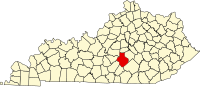
Lincoln County is a county located in south-central Kentucky. As of the 2020 census, the population was 24,275. Its county seat is Stanford. Lincoln County is part of the Danville, KY Micropolitan Statistical Area.

Casey County is a county located in the U.S. Commonwealth of Kentucky. As of the 2020 census, the population was 15,941. Its county seat is Liberty. The county was formed in 1806 from the western part of Lincoln County and named for Colonel William Casey, a pioneer settler who moved his family to Kentucky in 1779. It is the only Kentucky county entirely in the Knobs region. Casey County is home to annual Casey County Apple Festival, and is a prohibition or dry county. It is considered part of the Appalachian region of Kentucky.

Bullitt County is a county located in the north central portion of the U.S. state of Kentucky. As of the 2020 census, the population was 82,217. Its county seat is Shepherdsville. The county was founded in 1796. Located just south of the city of Louisville, Bullitt County is included in the Louisville/Jefferson County, KY-IN Metropolitan Statistical Area, commonly known as Kentuckiana. The western fifth of the county is part of the United States Army post of Fort Knox and is reserved for military training.
Green River Knob is the tallest point in the Knobs region of Kentucky, United States, with an elevation of 1,789 feet. It is also the highest point in Kentucky outside the Eastern Coalfield. It is located at the border of Casey and Pulaski Counties. Green River Knob can be seen from a long distance, with Pilot Knob in Powell County and Indian Fort Mountain near Berea, Kentucky providing the best views.

The Knobs Region or The Knobs is located in the US state of Kentucky. It is a narrow, arc-shaped region consisting of hundreds of isolated hills. The region wraps around the southern and eastern parts of the Bluegrass region in the north central to northeastern part of the state. The western end of the Knobs region begins near Louisville, Kentucky and continues southeastward through Bullitt, Hardin, Nelson, LaRue, Marion, Taylor, Boyle, Casey and Lincoln counties before turning northeast and running along the Pottsville Escarpment and the Appalachian Plateau. The Knob arc has a length of 230 miles (370 km).
Mintonville in Kentucky, USA, is an unincorporated community sitting at the foot of the Green River Knob in the extreme southeastern Casey County. The town was plotted in 1849 and partially built in 1851. The first postmaster, James Wesley, named it after Robert Minton when the post office first opened on October 3, 1851.

The Salt River is a 150-mile-long (240 km) river in the U.S. state of Kentucky that drains 2,920 square miles (7,600 km2). It begins near Parksville, Kentucky, rising from the north slope of Persimmon Knob south of KY 300 between Alum Springs and Wilsonville, and ends at the Ohio River near West Point. Taylorsville Lake is formed from the Salt River, and Guist Creek Lake is also in its drainage basin.

Knob Lick is an unincorporated community in southern Saint Francois County, Missouri, United States. It is located on Missouri Route DD, just east of U.S. Route 67, approximately eight miles south of Farmington.

Young Lick is a mountain that lies in three Georgia counties, Habersham, Rabun and Towns. Its summit - Young Lick Knob, elevation 3,809 feet (1,161 m), is one of Habersham County's highest points. Young Lick Knob is crossed by the Appalachian Trail.
Summer Shade is an unincorporated community and census-designated place (CDP) in Metcalfe County, Kentucky, United States. As of the 2020 census, the population was 294.
Bullitt's Lick is a historic salt lick 3 miles (4.8 km) west of Shepherdsville in Bullitt County, Kentucky. It was the first commercial supplier of salt in Kentucky, and the first industry in Kentucky as well, supplying jobs for many residents but also using slaves.
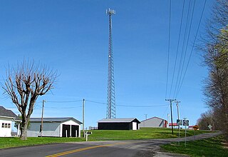
WXKY is a radio station licensed to Stanford, Kentucky, which serves as an affiliate of the national K-LOVE Contemporary Christian radio network owned by the Educational Media Foundation. The station's transmitter is located in the far northeast corner of Casey County, west of Stanford and near Hustonville on Sand Knob Road.
'Knob Lick' is an unincorporated community in Metcalfe County, Kentucky, United States. Knob Lick is located on Kentucky Route 70, 8 miles (13 km) northwest of Edmonton. Knob Lick has a post office with ZIP code 42154.
Knob Lick is an unincorporated community in Estill County, Kentucky, United States. Knob Lick is 9 miles (14 km) west-southwest of Irvine.
Mud Lick is a rural unincorporated community in Monroe County, Kentucky, United States. It is concentrated around the intersection of Kentucky Route 63 and Kentucky Route 870, northwest of Tompkinsville.
Echo is an unincorporated community located in Metcalfe County, Kentucky, United States. Echo was originally established as Seventy Seven in 1891, then changed to Echo in 1894. A post office with service to Knob Lick, Metcalfe County, Kentucky in 1914.