Duncan, Kentucky | |
---|---|
Unincorporated community | |
Coordinates: 37°21′31″N84°43′39″W / 37.35861°N 84.72750°W Coordinates: 37°21′31″N84°43′39″W / 37.35861°N 84.72750°W | |
Country | United States |
State | Kentucky |
County | Casey |
Elevation | 1,329 ft (405 m) |
Time zone | Eastern (EST) (UTC-5) |
• Summer (DST) | EDT (UTC-4) |
Area code(s) | 606 |
GNIS feature ID | 507889 [1] |
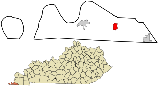
Duncan is an unincorporated community in Casey County, Kentucky, United States. Duncan is located at the junction of Kentucky Route 501 and Kentucky Route 837 12 miles (19 km) east-northeast of Liberty. [2]
Casey County is a county located in the U.S. Commonwealth of Kentucky. As of the 2010 census, the population was 15,955. Its county seat is Liberty. The county was formed in 1806 from the western part of Lincoln County and named for Colonel William Casey, a pioneer settler who moved his family to Kentucky in 1779. It is the only Kentucky county entirely in the Knobs region. Casey County is home to annual Casey County Apple Festival, and is a prohibition or dry county. It is considered part of the Appalachian region of Kentucky.
Kentucky, officially the Commonwealth of Kentucky, is a state located in the east south-central region of the United States. Although styled as the "State of Kentucky" in the law creating it, (because in Kentucky's first constitution, the name state was used) Kentucky is one of four U.S. states constituted as a commonwealth. Originally a part of Virginia, in 1792 Kentucky became the 15th state to join the Union. Kentucky is the 37th most extensive and the 26th most populous of the 50 United States.
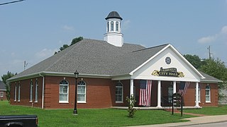
Liberty is a home rule-class city in Casey County, Kentucky, in the United States. It is the seat of its county. Its population was 2,168 at the 2010 U.S. census.
Russell County is a county located in the U.S. Commonwealth of Kentucky. As of the 2010 census, the population was 17,565. Its county seat is Jamestown. The county was formed on December 14, 1825 from portions of Adair, Cumberland and Wayne Counties and is named for William Russell. It has been a prohibition or dry county, meaning that the sale of alcohol was prohibited, but in a referendum on Jan. 19, 2016, the county voted 3,833 to 3,423 to go "wet."
Boyle County is a county located in the U.S. state of Kentucky. As of the 2010 census, the population was 28,432. Its county seat is Danville. The county was formed in 1842 and named for John Boyle (1774–1835), a U.S. Representative, chief justice of the Kentucky Court of Appeals and later federal judge for the District of Kentucky.
Duncan is the name of two places in the U.S. state of Kentucky in the United States of America:
Cayce is an unincorporated community and census-designated place (CDP) in Fulton County, Kentucky, United States, in the state's southwestern corner. As of the 2010 census it had a population of 123.
Kentucky Route 70 (KY 70) is a long east-east state highway that originates at a junction with U.S. Route 60 (US 60) in Smithland in Livingston County, just east of the Ohio River. The route continues through the counties of Crittenden, Caldwell, Hopkins, Muhlenberg, Butler, Edmonson, Barren, Barren, Metcalfe, Green, Taylor, Casey, Pulaski, Lincoln and back into Pulaski again to terminate at a junction with US 150 near Maretburg in Rockcastle.
Kentucky Route 817 is a state highway in the city of Liberty in Casey County, Kentucky. The highway runs 0.460 miles (0.740 km) from Kentucky Route 70 north to U.S. Route 127. KY 817 was established in 1993.
Casey Creek is an unincorporated community in Adair County, Kentucky, United States. Its elevation is 738 feet (225 m).
U.S. Route 127 (US 127) in Kentucky runs 207.7 miles (334.3 km) from the Tennessee state line in rural Clinton County to the Ohio state line in Cincinnati. The southern portion of the route is mostly rural, winding through various small towns along the way. It later runs through the state capital of Frankfort before continuing north, eventually passing through several Cincinnati suburbs in Northern Kentucky, joining US 42 near Warsaw and US 25 in Florence before crossing the Ohio River via the Clay Wade Bailey Bridge.
Duncan is an unincorporated community in Mercer County, Kentucky, United States. Duncan is located at the junction of Kentucky Route 390 and Kentucky Route 1941, 10 miles (16 km) northwest of Harrodsburg.
Dogwood was an unincorporated community in Casey County, Kentucky, United States.
Bass is an unincorporated community in Casey County, Kentucky, United States.
Luttrell was an unincorporated community in Casey County, Kentucky, United States.
Foster was an unincorporated community in Casey County, Kentucky, United States.
Butchertown is an unincorporated community in Casey County, Kentucky, United States.
Cantown is an unincorporated community in Casey County, Kentucky, United States. It was also known as Contown.
Rheber is an unincorporated community in Casey County, Kentucky, United States.
Creston is an unincorporated community in Casey County, Kentucky, United States.
This Casey County, Kentucky state location article is a stub. You can help Wikipedia by expanding it. |