Foster, Kentucky

Last updated

Foster
Tiny state highway in Foster.jpg
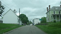
Lenoxburg-Foster Road
USA Kentucky location map.svg
Red pog.svg
Foster
Location within the state of Kentucky
Usa edcp location map.svg
Red pog.svg
Foster
Foster (the United States)
Coordinates: 38°47′57″N84°12′47″W / 38.79917°N 84.21306°W / 38.79917; -84.21306
Country United States
State Kentucky
County Bracken
Area
[1]
  Total
0.098 sq mi (0.25 km2)
  Land0.098 sq mi (0.25 km2)
  Water0 sq mi (0 km2)
Elevation
[2]
528 ft (161 m)
Population
 (2010) [3]
  Total
44
  Density450/sq mi (170/km2)
Time zone UTC-5 (Eastern (EST))
  Summer (DST) UTC-4 (EDT)
ZIP codes
41043
GNIS feature ID517057 [2]

Foster (also known as Fosters) is an unincorporated community located in Bracken County, Kentucky, United States. Its population was 44 as of the 2010 census, which recorded it as a city; [3] although Foster was once incorporated, it had become unincorporated by 2008. [4]

History

Foster has the name of pioneer citizen Israel Foster. [5] Variant names have been "Fosters Landing" and "Fosters". [2] [5] A post office called Foster's Landing was established in 1847, and the name was changed to Foster in 1850. [6]

References

  1. "US Gazetteer files: 2010, 2000, and 1990". United States Census Bureau. February 12, 2011. Retrieved April 23, 2011.
  2. 1 2 3 U.S. Geological Survey Geographic Names Information System: Foster
  3. 1 2 "U.S. Census website". United States Census Bureau . Retrieved May 14, 2011.
  4. U.S. Geological Survey Geographic Names Information System: City of Foster (historical)
  5. 1 2 Rennick, Robert M. (1987). Kentucky Place Names. University Press of Kentucky. p. 107. ISBN   0813126312 . Retrieved April 28, 2013.
  6. "Bracken County". Jim Forte Postal History. Archived from the original on July 3, 2011. Retrieved January 11, 2015.