Petra | |
---|---|
Unincorporated community | |
Coordinates: 38°37′27″N84°8′2″W / 38.62417°N 84.13389°W Coordinates: 38°37′27″N84°8′2″W / 38.62417°N 84.13389°W | |
Country | United States |
State | Kentucky |
County | Bracken |
Elevation | 919 ft (280 m) |
Time zone | Central (CST) (UTC-6) |
• Summer (DST) | CST (UTC-5) |
GNIS feature ID | 508809 [1] |
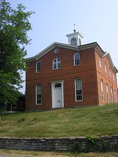
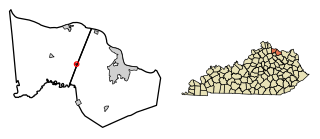
Petra is an unincorporated community located in Bracken County, Kentucky, United States.
In law, an unincorporated area is a region of land that is not governed by a local municipal corporation; similarly an unincorporated community is a settlement that is not governed by its own local municipal corporation, but rather is administered as part of larger administrative divisions, such as a township, parish, borough, county, city, canton, state, province or country. Occasionally, municipalities dissolve or disincorporate, which may happen if they become fiscally insolvent, and services become the responsibility of a higher administration. Widespread unincorporated communities and areas are a distinguishing feature of the United States and Canada. In most other countries of the world, there are either no unincorporated areas at all, or these are very rare; typically remote, outlying, sparsely populated or uninhabited areas.
Bracken County is a county located in the U.S. state of Kentucky. As of the 2010 census, the population was 8,488. Its county seat is Brooksville. The county was formed in 1796.
Kentucky, officially the Commonwealth of Kentucky, is a state located in the east south-central region of the United States. Although styled as the "State of Kentucky" in the law creating it, (because in Kentucky's first constitution, the name state was used) Kentucky is one of four U.S. states constituted as a commonwealth. Originally a part of Virginia, in 1792 Kentucky became the 15th state to join the Union. Kentucky is the 37th most extensive and the 26th most populous of the 50 United States.
A post office called Petra was established in 1864, and remained in operation until 1904. [2]
Robertson County is a county located in the U.S. Commonwealth of Kentucky. As of the 2010 census, the population was 2,282. Its county seat is Mount Olivet, Kentucky. The county is named for George Robertson, a Kentucky Congressman from 1817 to 1821. It is Kentucky's smallest county, both by population and by total area.
Brooksville is a home rule-class city in Bracken County, Kentucky, in the United States. As of the 2010 census, the city's population was 642. It is the county seat of Bracken County.
Germantown is a home rule-class city in Bracken and Mason counties in the U.S. state of Kentucky. The population was 154 at the 2010 census.
Berlin is an unincorporated community in Bracken County, Kentucky, 30 miles south of Cincinnati. Berlin is administered by nearby Brooksville, Kentucky.
Bracken County High School is located in Brooksville, Kentucky and is part of the Bracken County school district. The school was founded as Brooksville High School. In 1947 The school changed names to Bracken County High School
USS Bracken (APA-64) was a Gilliam-class attack transport that served with the US Navy during World War II.
William Bracken was a hunter, tradesman, and surveyor who explored Kentucky in the last decades of the 18th century. In 1773 he traveled down the Kentucky River with brothers George, Robert, and James McAffee. They surveyed the area around present day Frankfort and Harrodsburg. Their surveys of what is now Bracken County, named for William Bracken, were among the first made in Kentucky.
This is a list of the National Register of Historic Places listings in Bracken County, Kentucky.
The 1992 United States presidential election in Kentucky took place on November 3, 1992, as part of the 1992 United States presidential election. As of the result of the 1990 census, Kentucky lost one electoral vote. Voters chose eight representatives, or electors to the Electoral College, who voted for president and vice president.
Neave is an unincorporated community located in Bracken County, Kentucky, United States.
Woolcott is an unincorporated community located in Bracken County, Kentucky, United States. It was also known as Murrays Station.
Bradford is an unincorporated community located in Bracken County, Kentucky, United States.
Belmont was an unincorporated community located in Bracken County, Kentucky, United States.
Powersville is an unincorporated community located in Bracken County, Kentucky, United States.
Chatham is an unincorporated community located in Bracken County, Kentucky, United States.
Oakland is an unincorporated community located in Bracken County, Kentucky, United States.
Johnsville is an unincorporated community in Bracken County, in the U.S. state of Kentucky.
Milford is an unincorporated community in Bracken County, in the U.S. state of Kentucky.
Kentucky Route 352 (KY 352) is a 3.253-mile-long (5.235 km) state highway in Bracken County, Kentucky, that runs from Parina Park in rural Bracken County southeast of Powersville to Kentucky Route 875 southwest of Germantown.
This Bracken County, Kentucky state location article is a stub. You can help Wikipedia by expanding it. |