
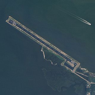
Oneida County Airport was a public airport in Whitestown in Oneida County, New York, six miles (9.7 km) northwest of downtown Utica. The airport covered 1,800 acres (7.3 km2) and had two runways.

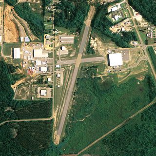
Shelby County Airport is a public use airport located four nautical miles (7 km) southeast of the central business district of Alabaster, a city in Shelby County, Alabama, United States. It is owned by the Shelby County Commission. The airport is situated in the city of Calera.

Pittsfield Municipal Airport is two miles west of Pittsfield, in Berkshire County, Massachusetts. The National Plan of Integrated Airport Systems for 2011–2015 categorized it as a general aviation facility.

Grant County Regional Airport - GCRA is in Grant County, Oregon, a mile southwest of John Day, Oregon. The National Plan of Integrated Airport Systems for 2011–2015 categorized it as a general aviation facility.
Sullivan County International Airport is in Bethel, Sullivan County, New York. It is seven miles northwest of Monticello, a village in the Town of Thompson. The National Plan of Integrated Airport Systems for 2011–2015 categorized it as a general aviation facility.

Abbeville Municipal Airport is a city-owned, public-use airport located three nautical miles north of the central business district of Abbeville, a city in Henry County, Alabama, United States. It is the only airport that serves the city of Abbeville.

George Downer Airport is a city-owned, public-use airport located two nautical miles southwest of the central business district of Aliceville, a city in Pickens County, Alabama, United States.

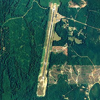
Camden Municipal Airport is a city-owned, public-use airport located three nautical miles (6 km) southwest of the central business district of Camden, a city in Wilcox County, Alabama, United States.

Centre Municipal Airport is a city-owned, public-use airport located three nautical miles east of the central business district of Centre, a city in Cherokee County, Alabama, United States. It is owned by the City of Centre.

Chilton County Airport, also known as Gragg-Wade Field, is a public-use airport in Chilton County, Alabama, United States. It is located one nautical mile (2 km) east of the central business district of Clanton, Alabama. It is owned by the Chilton County Airport Authority.

Clayton Municipal Airport is a city-owned, public-use airport located two nautical miles west of the central business district of Clayton, a city in Barbour County, Alabama, United States.
Jeremiah Denton Airport, formerly Dauphin Island Airport, is a county-owned public-use airport in Mobile County, Alabama, United States. It is just northwest of the central business district of Dauphin Island, a town located on a barrier island. The airport is on Mobile Bay, west of the Aloe Bay Channel.
Carl Folsom Airport is a public-use airport located two nautical miles west of the central business district of Elba, a city in Coffee County, Alabama, United States. It is owned by the Elba Airport Authority.
Richard Arthur Field is a city-owned public-use airport located three nautical miles northeast of the central business district of Fayette, a city in Fayette County, Alabama, United States.

Florala Municipal Airport is a city-owned public-use airport located three nautical miles northeast of the central business district of Florala, a city in Covington County, Alabama, United States.
Greensboro Municipal Airport is a city-owned public-use airport located three nautical miles southwest of the central business district of Greensboro, a city in Hale County, Alabama, United States.
Jackson Municipal Airport is a city-owned public airport two miles south of Jackson, in Clarke County, Alabama.
Sky Park Airport was a privately owned, public use airport located two nautical miles (4 km) east of Red Hook, a village in Town of Red Hook, Dutchess County, New York, United States. It is included in the National Plan of Integrated Airport Systems for 2011–2015, which categorized it as a general aviation facility.
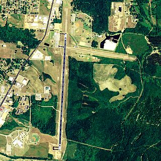
New Castle-Henry County Municipal Airport is a public use airport located four nautical miles southeast of the central business district of New Castle, a city in Henry County, Indiana, United States. It is included in the National Plan of Integrated Airport Systems for 2011–2015, which categorized it as a general aviation facility.
Turner Airport is a public use airport in Blaine County, Montana, United States. It is owned by Blaine County and located one nautical mile (2 km) northeast of the central business district of Turner, Montana. This airport is included in the National Plan of Integrated Airport Systems for 2011–2015, which categorized it as a general aviation facility.

