Franking, Austria

Last updated
Franking
Pfarrkirche Franking (12).JPG
Wappen at franking.png
Austria adm location map.svg
Red pog.svg
Franking
Location within Austria
Coordinates: 48°02′00″N12°55′00″E / 48.03333°N 12.91667°E / 48.03333; 12.91667
Country Austria
State Upper Austria
District Braunau am Inn
Government
   Mayor Josef Lasser (ÖVP)
Area
[1]
  Total10.46 km2 (4.04 sq mi)
Elevation
457 m (1,499 ft)
Population
 (2018-01-01) [2]
  Total953
  Density91/km2 (240/sq mi)
Time zone UTC+1 (CET)
  Summer (DST) UTC+2 (CEST)
Postal code
5131
Area code 06277
Vehicle registration BR
Website www.franking.ooe.gv.at

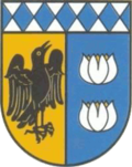
Franking is a municipality in the district Braunau am Inn in the Austrian state of Upper Austria.
Contents

Geography

Franking is situated in the western part of Upper Austria near the border to Germany and Salzburg. The towns is 457 m above sea level, the area is 10.44 km2 and there are 955 inhabitants.

Villages

The villages in the municipity are (with population in brackets as at 1 Jan 2020):

History

The name Franking comes from the Old High German name "Franko or Francho". The name was first mentioned in 1150, when a Ulricus von franchingen is named in a document. Till 1779 Franking was part of Bavaria, after the Treaty of Teschen it became part of Austria.

Related Research Articles

<span class="mw-page-title-main">Bad Goisern am Hallstättersee</span> Place in Upper Austria, Austria

Bad Goisern am Hallstättersee is a market town in the Austrian state of Upper Austria in the district of Gmunden. It is part of the Salzkammergut resort area. At the 2005 census Bad Goisern am Hallstättersee had a population of 7,578 inhabitants.

<span class="mw-page-title-main">Mondsee (town)</span> Place in Upper Austria, Austria

Mondsee is a town in the Vöcklabruck district in the Austrian state of Upper Austria located on the shore of the lake Mondsee. The town is home to the medieval Mondsee Abbey, whose cloister church was used for the site of the wedding in The Sound of Music.

<span class="mw-page-title-main">Auerbach, Upper Austria</span> Place in Upper Austria, Austria

Auerbach is a town in Upper Austria, Austria. Its length from north to south is 4.3 km and from east to west is 5 km; its area is 10.78 km2. In 2015, it had 565 inhabitants.

<span class="mw-page-title-main">Zwettl</span> Place in Lower Austria, Austria

Zwettl is a town and district capital of the Austrian state of Lower Austria. It is chiefly known as the location of Zwettl Abbey, first mentioned in October 1139.

<span class="mw-page-title-main">Freistadt</span> Place in Upper Austria, Austria

Freistadt is a small Austrian town in the state of Upper Austria in the region Mühlviertel. With a population of approximately 7,500 residents, it is a trade centre for local villages. Freistadt is the economic centre of a district of the same name District Freistadt. The nearest sizeable cities are Linz, the capital of Upper Austria, about 40 km in the south, and České Budějovice, the capital of Southern Bohemia, about 60 km in the north.

<span class="mw-page-title-main">Regau</span> Place in Upper Austria, Austria

Regau is a municipality in the Austrian state of Upper Austria near Vöcklabruck, which is the capital of the district.

<span class="mw-page-title-main">Obertraun</span> Place in Upper Austria, Austria

Obertraun, Upper Austria is a village in the Salzkammergut, a region in Austria, near the Hallstätter See and Hoher Dachstein. It is a popular holiday destination with activities such as skiing and snowboarding in the winter, and mountain biking, swimming and kayaking in the summer.

<span class="mw-page-title-main">Mattsee</span> Place in Salzburg, Austria

Mattsee is a market town at the eponymous lake in the district of Salzburg-Umgebung in the Austrian state of Salzburg.

<span class="mw-page-title-main">Burgkirchen, Austria</span> Place in Upper Austria, Austria

Burgkirchen is a municipality in the district Braunau am Inn in the Austrian state of Upper Austria.

Mining is a municipality in the district of Braunau am Inn in the Austrian state of Upper Austria.

<span class="mw-page-title-main">Moosdorf</span> Place in Upper Austria, Austria

Moosdorf is a municipality in the district of Braunau am Inn in the region of Innviertel within the Austrian state of Upper Austria. It had a population of 1,684 as at 1 January 2019.

<span class="mw-page-title-main">Ostermiething</span> Place in Upper Austria, Austria

Ostermiething is a municipality in the district of Braunau am Inn in the Austrian state of Upper Austria.

<span class="mw-page-title-main">Sandl</span> Place in Upper Austria, Austria

Sandl is a municipality in the district of Freistadt in Upper Austria, Austria.

<span class="mw-page-title-main">Gosau</span> Place in Upper Austria, Austria

Gosau is a municipality in the district of Gmunden in Upper Austria, Austria.

<span class="mw-page-title-main">Laakirchen</span> Place in Upper Austria, Austria

Laakirchen is a municipality in the district of Gmunden in the Austrian state of Upper Austria.

<span class="mw-page-title-main">Hargelsberg</span> Place in Upper Austria, Austria

Hargelsberg is a municipality in the district Linz-Land in the Austrian state of Upper Austria.

<span class="mw-page-title-main">Andorf</span> Place in Upper Austria, Austria

Andorf is a municipality in the district of Schärding in Upper Austria, Austria. As of 2008, it had a population of 5,023.

<span class="mw-page-title-main">Bad Wimsbach-Neydharting</span> Place in Upper Austria, Austria

Bad Wimsbach-Neydharting is a municipality in the district of Wels-Land in the Austrian state of Upper Austria.

<span class="mw-page-title-main">Lafnitz</span> Place in Styria, Austria

Lafnitz is a municipality in the district of Hartberg-Fürstenfeld in Styria, Austria. It is situated on the upper course of the river Lafnitz.

<span class="mw-page-title-main">Wörschach</span> Place in Styria, Austria

Wörschach is a municipality in the district of Liezen in the Austrian state of Styria.

References

  1. "Dauersiedlungsraum der Gemeinden Politischen Bezirke und Bundesländer - Gebietsstand 1.1.2018". Statistics Austria. Retrieved 10 March 2019.
  2. "Einwohnerzahl 1.1.2018 nach Gemeinden mit Status, Gebietsstand 1.1.2018". Statistics Austria. Retrieved 9 March 2019.