Lengau

Last updated
Lengau
Lengau.jpg
Wappen at lengau.png
Coat of arms
Austria adm location map.svg
Red pog.svg
Lengau
Location within Austria
Coordinates: 48°00′00″N13°13′00″E / 48.00000°N 13.21667°E / 48.00000; 13.21667 Coordinates: 48°00′00″N13°13′00″E / 48.00000°N 13.21667°E / 48.00000; 13.21667
Country Austria
State Upper Austria
District Braunau am Inn
Government
   Mayor Erich Rippl (SPÖ)
Area
[1]
  Total58.09 km2 (22.43 sq mi)
Elevation
532 m (1,745 ft)
Population
 (2018-01-01) [2]
  Total4,738
  Density82/km2 (210/sq mi)
Time zone UTC+1 (CET)
  Summer (DST) UTC+2 (CEST)
Postal code
5211
Area code 07746
Vehicle registration BR
Website www.gemeindelengau.at

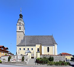
Lengau is a municipality in the district of Braunau am Inn in the Austrian state of Upper Austria.

Related Research Articles

Wolfurt Place in Vorarlberg, Austria

Wolfurt is a municipality in the western Austrian state of Vorarlberg.

Schwarzach, Vorarlberg Place in Vorarlberg, Austria

Schwarzach is a municipality in the Austrian state of Vorarlberg.

Nenzing Place in Vorarlberg, Austria

Nenzing is a market town in the district of Bludenz in the Austrian state of Vorarlberg.

Bartholomäberg Place in Vorarlberg, Austria

Bartholomäberg is a municipality and popular tourism resort in the district of Bludenz in the Austrian state of Vorarlberg.

Warth, Vorarlberg Place in Vorarlberg, Austria

Warth is a municipality in the district of Bregenz in the Austrian state of Vorarlberg.

Blons Place in Vorarlberg, Austria

Blons is a municipality in the district of Bludenz in Austrian state of Vorarlberg.

Sankt Gallenkirch Place in Vorarlberg, Austria

Sankt Gallenkirch is a municipality in the district of Bludenz in the Austrian state of Vorarlberg.

Sankt Gerold Place in Vorarlberg, Austria

Sankt Gerold is a municipality in the district of Bludenz in the Austrian state of Vorarlberg.

Thüringerberg Place in Vorarlberg, Austria

Thüringerberg is a municipality in the district of Bludenz in the Austrian state of Vorarlberg.

Fußach Place in Vorarlberg, Austria

Fußach is a municipality in the district of Bregenz in the Austrian state of Vorarlberg.

Gaißau Place in Vorarlberg, Austria

Gaißau is a municipality in the district of Bregenz in the Austrian state of Vorarlberg.

Höchst, Austria Place in Vorarlberg, Austria

Höchst is a municipality in the district of Bregenz in the Austrian state of Vorarlberg.

Hörbranz Place in Vorarlberg, Austria

Hörbranz is a municipality in the district of Bregenz in the Austrian state of Vorarlberg.

Möggers Place in Vorarlberg, Austria

Möggers is a municipality in the district of Bregenz in the Austrian state of Vorarlberg.

Düns Place in Vorarlberg, Austria

Düns is a municipality in the district of Feldkirch in the Austrian state of Vorarlberg.

Klaus, Vorarlberg Place in Vorarlberg, Austria

Klaus is a municipality in the district of Feldkirch in the Austrian state of Vorarlberg.

Röthis Place in Vorarlberg, Austria

Röthis is a municipality in the district of Feldkirch in the Austrian state of Vorarlberg.

Sulz, Vorarlberg Place in Vorarlberg, Austria

Sulz is a municipality in the district of Feldkirch in the Austrian state of Vorarlberg.

Altschwendt Place in Upper Austria, Austria

Altschwendt is a municipality in the district of Schärding in the Austrian state of Upper Austria.

Bad Waltersdorf Place in Styria, Austria

Bad Waltersdorf is a municipality in the district of Hartberg-Fürstenfeld in Styria, Austria.

References

  1. "Dauersiedlungsraum der Gemeinden Politischen Bezirke und Bundesländer - Gebietsstand 1.1.2018". Statistics Austria. Retrieved 10 March 2019.
  2. "Einwohnerzahl 1.1.2018 nach Gemeinden mit Status, Gebietsstand 1.1.2018". Statistics Austria. Retrieved 9 March 2019.
Parish church Lengau - Kirche.JPG
Parish church