Helpfau-Uttendorf

Last updated
Helpfau-Uttendorf
St-florian uttendorf.jpg
Wappen at helpfau-uttendorf.png
Coat of arms
Austria adm location map.svg
Red pog.svg
Helpfau-Uttendorf
Location within Austria
Coordinates: 48°09′20″N13°07′05″E / 48.15556°N 13.11806°E / 48.15556; 13.11806 Coordinates: 48°09′20″N13°07′05″E / 48.15556°N 13.11806°E / 48.15556; 13.11806
Country Austria
State Upper Austria
District Braunau am Inn
Government
   Mayor Josef Johann Leimer (ÖVP)
Area
[1]
  Total26.38 km2 (10.19 sq mi)
Elevation
419 m (1,375 ft)
Population
 (2018-01-01) [2]
  Total3,573
  Density140/km2 (350/sq mi)
Time zone UTC+1 (CET)
  Summer (DST) UTC+2 (CEST)
Postal code
5261
Area code 07724
Vehicle registration BR
Website www.helpfau-uttendorf.at

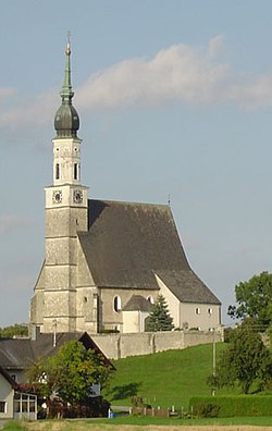
Helpfau-Uttendorf is a municipality in the district of Braunau am Inn in the Austrian state of Upper Austria.

Geography

About 26 percent of the municipality is forest and 62 percent farmland.

Related Research Articles

Dünserberg Place in Vorarlberg, Austria

Dünserberg is a municipality in the district of Feldkirch in the Austrian state of Vorarlberg.

Burgkirchen, Austria Place in Upper Austria, Austria

Burgkirchen is a municipality in the district Braunau am Inn in the Austrian state of Upper Austria.

Feldkirchen bei Mattighofen Place in Upper Austria, Austria

Feldkirchen bei Mattighofen is a municipality in the Braunau am Inn district in the Austrian state of Upper Austria.

Geretsberg Place in Upper Austria, Austria

Geretsberg is a municipality in the district Braunau am Inn in the Austrian state of Upper Austria.

Gilgenberg am Weilhart Place in Upper Austria, Austria

Gilgenberg am Weilhart is a municipality in the district of Braunau am Inn in the Austrian state of Upper Austria.

Höhnhart Place in Upper Austria, Austria

Höhnhart is a municipality in the district of Braunau am Inn in the Austrian state of Upper Austria.

Neukirchen an der Enknach Place in Upper Austria, Austria

Neukirchen an der Enknach is a municipality in the district of Braunau am Inn in the Austrian state of Upper Austria.

Perwang am Grabensee Place in Upper Austria, Austria

Perwang am Grabensee is a municipality in the district of Braunau am Inn in the Austrian state of Upper Austria.

Pfaffstätt Place in Upper Austria, Austria

Pfaffstätt is a municipality in the district of Braunau am Inn in Austrian state of Upper Austria.

Pischelsdorf am Engelbach Place in Upper Austria, Austria

Pischelsdorf am Engelbach is a municipality in the district of Braunau am Inn in the Austrian state of Upper Austria.

Roßbach, Austria Place in Upper Austria, Austria

Roßbach is a municipality in the district of Braunau am Inn in the Austrian state of Upper Austria.

Schalchen Place in Upper Austria, Austria

Schalchen is a municipality in the district of Braunau am Inn in the Austrian state of Upper Austria.

Wallern an der Trattnach Place in Upper Austria, Austria

Wallern an der Trattnach is a municipality in the district of Grieskirchen in the Austrian state of Upper Austria.

Wendling Place in Upper Austria, Austria

Wendling is a municipality in the district of Grieskirchen in the Austrian state of Upper Austria.

Haslach an der Mühl Place in Upper Austria, Austria

Haslach an der Mühl is a municipality in the district of Rohrbach in the Austrian state of Upper Austria.

Sarleinsbach Place in Upper Austria, Austria

Sarleinsbach is a municipality in the district of Rohrbach in the Austrian state of Upper Austria.

Altschwendt Place in Upper Austria, Austria

Altschwendt is a municipality in the district of Schärding in the Austrian state of Upper Austria.

Zell an der Pram Place in Upper Austria, Austria

Zell an der Pram is a town and a municipality in the district of Schärding in the Austrian state of Upper Austria.

Ampflwang im Hausruckwald Place in Upper Austria, Austria

Ampflwang im Hausruckwald is a municipality in the district of Vöcklabruck in the Austrian state of Upper Austria.

Sankt Lorenz Place in Upper Austria, Austria

Sankt Lorenz is a municipality in the district of Vöcklabruck in the Austrian state of Upper Austria.

References

  1. "Dauersiedlungsraum der Gemeinden Politischen Bezirke und Bundesländer - Gebietsstand 1.1.2018". Statistics Austria. Retrieved 10 March 2019.
  2. "Einwohnerzahl 1.1.2018 nach Gemeinden mit Status, Gebietsstand 1.1.2018". Statistics Austria. Retrieved 9 March 2019.