Freed, West Virginia

Last updated

Freed, West Virginia
USA West Virginia location map.svg
Red pog.svg
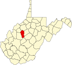
Freed
Location within the state of West Virginia
Usa edcp location map.svg
Red pog.svg
Freed
Freed (the United States)
Coordinates: 39°0′39″N81°8′16″W / 39.01083°N 81.13778°W / 39.01083; -81.13778
Country United States
State West Virginia
County Calhoun
Elevation
761 ft (232 m)
Time zone UTC-5 (Eastern (EST))
  Summer (DST) UTC-4 (EDT)
GNIS ID 1549692 [1]

Freed is an unincorporated community in Calhoun County, West Virginia, United States.

The community most likely was named after the local Freed family. [2]

See also

Related Research Articles

Salem may refer to:

<span class="mw-page-title-main">Charles City County, Virginia</span> County in Virginia, United States

Charles City County is a county located in the U.S. commonwealth of Virginia. The county is situated southeast of Richmond and west of Jamestown. It is bounded on the south by the James River and on the east by the Chickahominy River.

<span class="mw-page-title-main">Sissonville, West Virginia</span> Census-designated place in West Virginia, United States

Sissonville is a census-designated place (CDP) in Kanawha County, West Virginia, United States, along the Pocatalico River. The population was 4,028 at the 2010 census. Sissonville is located within 14 miles of Charleston, the state capital.

<span class="mw-page-title-main">Sago, West Virginia</span> Unincorporated community in West Virginia, United States

Sago is an unincorporated community in Upshur County, West Virginia, United States. It is located along the Buckhannon River and is the site of the Sago Mine, scene of the 2006 Sago Mine disaster.

Halltown is an unincorporated community situated along Flowing Springs Run in Jefferson County, West Virginia. Halltown is located off U.S. Route 340 on West Virginia Route 230 between Charles Town and Bolivar. The Halltown Paperboard Mill has operated in the community since 1869.

Emmons is an unincorporated community located on the Big Coal River in Boone and Kanawha counties in the U.S. state of West Virginia. Jay Rockefeller's political affiliation with West Virginia began in 1964–1965 while he served as a VISTA volunteer in Emmons.

<span class="mw-page-title-main">Thoroughfare, Virginia</span> Unincorporated community in Virginia, United States

Thoroughfare is an unincorporated community in western Prince William County, Virginia. Roughly located on Virginia State Route 55 about 1.5 miles West of Haymarket where the Norfolk Southern Railway tracks cross the road. The community thrived through the 1940s as a community founded by former slaves. As a place name, Thoroughfare is no longer in common use.

The Chestnut Ridge people (CRP) are a mixed-race community concentrated in an area northeast of Philippi, Barbour County in north-central West Virginia, with smaller related communities in the adjacent counties of Harrison and Taylor. They are often referred to as "Mayles", or "Guineas".

<span class="mw-page-title-main">Quick, West Virginia</span> Unincorporated community in West Virginia, United States

Quick is a small unincorporated community in Kanawha County, West Virginia, United States. It is located along Indian Creek Road. The community is where Whitoak Fork and Blue Creek come together and meet. It is also where the abandoned railroad that follows Blue Creek joins the road, and follows it all the way to the community of Hitop, along Pond Fork. Its post office is closed.

Belva is an unincorporated community and census-designated place in west Nicholas County and north Fayette County, West Virginia, United States; while the CDP only includes the Nicholas County portion, the Fayette County portion is considered part of the community. The town is situated at the bottomland surrounding the convergence of Bells Creek with Twentymile Creek and, subsequently, Twenty Mile Creek with the Gauley River. Belva is also the location of the convergence of two state highways: West Virginia Route 16 and West Virginia Route 39.

Dickinson, also known as Quincy, is an unincorporated community in Kanawha County, West Virginia, United States. Dickinson is located on the north bank of the Kanawha River, 3 miles (4.8 km) southeast of Belle. The community is served by U.S. Route 60.

Jodie, also known as Imboden, is an unincorporated community in Fayette County, West Virginia, United States. It is located along the Gauley River at the mouth of Rich Creek, 4 miles (6.4 km) northeast of Gauley Bridge. Due to its proximity to the county line, Jodie is part of the Nicholas County ZIP code of 26690; it had its own post office until its closure on July 23, 2005.

West Warm Springs is an unincorporated community in Bath County, Virginia, in the United States.

Coco is an unincorporated community in Kanawha County, West Virginia, United States.

Ingram Branch is an unincorporated community located in Fayette County, West Virginia, United States.

Beury is an unincorporated community and coal town in Fayette County, West Virginia, United States.

Dimmock is an unincorporated community and coal town in Fayette County, West Virginia, United States.

Legg is an unincorporated community in Kanawha County, West Virginia, United States. Its post office is closed.

Grayden is an unincorporated community in Fayette County, West Virginia, United States. It was also known as Free Union.

Wevaco is an unincorporated community and former coal town in Kanawha County, West Virginia, United States. It had a post office but is now closed.

References

  1. U.S. Geological Survey Geographic Names Information System: Freed, West Virginia
  2. Kenny, Hamill (1945). West Virginia Place Names: Their Origin and Meaning, Including the Nomenclature of the Streams and Mountains. Piedmont, WV: The Place Name Press. p. 252.