
Stinson is an unincorporated community in Calhoun County, West Virginia, United States. It lies along West Virginia Route 16 and the West Fork Little Kanawha River, to the south of the town of Grantsville, the county seat of Calhoun County. Its elevation is 823 feet. At some point, Stinson possessed a post office, which has since been closed.
Orma is an unincorporated community in Calhoun County, West Virginia, United States. It lies along West Virginia Route 16 and the West Fork Little Kanawha River, to the south of the town of Grantsville, the county seat of Calhoun County. Its elevation is 738 feet. It has a post office with the ZIP code 25268.
Chloe is an unincorporated community in Calhoun County, West Virginia, United States. It lies along West Virginia Route 16 and the West Fork Little Kanawha River, to the south of the towns of Grantsville and Arnoldsburg. Its elevation is 794 feet (242 m). It has a post office with the ZIP code 25235.
Arnoldsburg is an unincorporated community in Calhoun County, West Virginia, United States. It lies along U.S. Route 33 at the point where West Virginia Route 16 heads southward; it is several miles south of the county seat of Grantsville. Its elevation is 738 feet. The West Fork Little Kanawha River flows through the community. It has a post office with the ZIP code 25234.
Millstone is an unincorporated community in Calhoun County, West Virginia, United States. It lies along U.S. Route 33 at the point where West Virginia Route 16 heads northward, to the south of the town of Grantsville, the county seat of Calhoun County. Its elevation is 810 feet. It has a post office with the ZIP code 25261.
Mount Zion is an unincorporated community in Calhoun County, West Virginia, United States. It lies along West Virginia Route 16 to the south of the town of Grantsville, the county seat of Calhoun County. Its elevation is 1,132 feet. Mount Zion's ZIP code is 26151.
Big Bend is an unincorporated community in Calhoun County, West Virginia, United States. It lies along West Virginia Route 5 northwest of the town of Grantsville, the county seat of Calhoun County, along the Little Kanawha River. Its elevation is 682 feet. It has a post office with the ZIP code 26136.
Big Springs is an unincorporated community in Calhoun County, West Virginia, United States. It lies along West Virginia Route 16 to the north of the town of Grantsville, the county seat of Calhoun County. Its elevation is 771 feet. It has a post office with the ZIP code 26137.
Annamoriah is an unincorporated community in Calhoun County, West Virginia, United States. It lies along West Virginia Route 5 to the west of the town of Grantsville, the county seat of Calhoun County. Its elevation is 994 feet. Their post office closed in 1988.
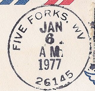
Five Forks is an unincorporated community in Calhoun County, West Virginia, United States. It lies along West Virginia Route 16 to the north of the town of Grantsville, the county seat of Calhoun County. Its elevation is 1,106 feet (337 m). The Five Forks Post Office is closed.
Brooks is an unincorporated community in Summers County, West Virginia, United States. It lies along the New River to the north of the city of Hinton, the county seat of Summers County. Its elevation is 1,657 feet.
Smoot is an unincorporated community in western Greenbrier County, West Virginia, United States. It lies south of the interchange of Interstate 64 and U.S. Route 60 northwest of the city of Lewisburg, the county seat of Greenbrier County. Its elevation is 2,480 feet (756 m). It has a post office with the ZIP code 24977.
Midkiff is an unincorporated community in western Lincoln County, West Virginia, United States. It lies along West Virginia Route 10 southwest of the town of Hamlin, the county seat of Lincoln County. Its elevation is 597 feet (182 m). It has a post office with the ZIP code 25540.
Ranger is an unincorporated community in western Lincoln County, West Virginia, United States. It lies along West Virginia Route 10 southwest of the town of Hamlin, the county seat of Lincoln County. Its elevation is 614 feet (187 m). It has a post office with the ZIP code 25557. Ranger is served by the Guyan River VFD.
Berea is an unincorporated community in southeastern Ritchie County, West Virginia, United States. It lies along West Virginia Route 74 southeast of the town of Harrisville, the county seat of Ritchie County. Its elevation is 751 feet (229 m). Although it is unincorporated nor has a post office, the ZIP code is 26327. Postal customers are serviced by the Harrisville and Auburn post offices.
Galloway is a census-designated place (CDP) and coal town in northwestern Barbour County, West Virginia, USA. It lies along West Virginia Route 76 northwest of the city of Philippi, the county seat of Barbour County. Its elevation is 1,073 feet (327 m). It has a post office with the ZIP code 26349. As of the 2010 census, its population is 143.

Smithville is an unincorporated community in southern Ritchie County, West Virginia, United States. It lies along West Virginia Route 47 south of the town of Harrisville, the county seat of Ritchie County. Its elevation is 686 feet (209 m). It has a post office with the ZIP code 26178.
Macfarlan is an unincorporated community in southwestern Ritchie County, West Virginia, United States. It lies along West Virginia Route 47 southwest of the town of Harrisville, the county seat of Ritchie County. Its elevation is 653 feet (199 m). It has a post office with the ZIP code 26148.
Dallas is an unincorporated community in northeastern Marshall County, West Virginia, United States. It lies along local roads northeast of the city of Moundsville, the county seat of Marshall County, and almost in Pennsylvania. Its elevation is 1,388 feet (423 m). It has a post office with the ZIP code 26036.
Proctor is an unincorporated community in northwestern Wetzel County, West Virginia, United States. It lies on West Virginia Route 2 along the Ohio River, north of the city of New Martinsville, the county seat of Wetzel County. Its elevation is 630 feet (192 m). Because the community has borne multiple names, the Board on Geographic Names officially designated it "Proctor" in 1980. It has a post office with the ZIP code 26055.


