
The Coral Sea Islands Territory is an external territory of Australia which comprises a group of small and mostly uninhabited tropical islands and reefs in the Coral Sea, northeast of Queensland, Australia. The only inhabited island is Willis Island. The territory covers 780,000 km2 (301,160 sq mi), most of which is ocean, extending east and south from the outer edge of the Great Barrier Reef and includes Heralds Beacon Island, Osprey Reef, the Willis Group and fifteen other reef/island groups. Cato Island is the highest point in the Territory.
This article talks about transportation in the Bahamas, a North American archipelagic state in the Atlantic Ocean.

Exuma is a district of the Bahamas, consisting of over 365 islands, also called cays.

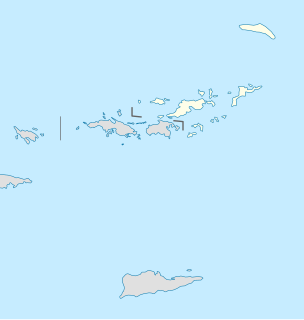
Road Town, located on Tortola, is the capital of the British Virgin Islands. It is situated on the horseshoe-shaped Road Harbour in the centre of the island's south coast. The population was about 9,400 in 2004.

Kabile Island is an Antarctic island extending 700 m (770 yd) in south-north direction and 450 m (490 yd) wide, situated off the north coast of Greenwich Island in the South Shetland Islands, Antarctica. It has a surface area of 19 hectares.

Rongel Reef, is a moraine reef in the Emona Anchorage in the eastern parts of Livingston Island in the South Shetland Islands, Antarctica. The reef emerged during a glacier retreat in the late 20th and early 21st centuries.

Cay Sal Bank is the third largest and the westernmost of the Bahama Banks. It is located between 23º27'N - 24º10'N and 079º25'W – 080º35'W. In a geographical sense, it is separate from the Bahamas proper as it is much closer to Cuba than to the closest Bahamanian island. It is separated by Santaren Channel from the Great Bahama Bank, the western rim of which is 50 km (31 mi) to the east. The Straits of Florida separate it from the United States mainland and the Florida Keys.
Wickams Cay and Little Wickam's Cay were former islands of the British Virgin Islands in the Caribbean. They were both located in Road Harbour, but due to reclamation of land projects in Tortola, Wickhams Cay now makes up part of Road Town, the capital of the British Virgin Islands. The areas are known as Wickhams Cay and Wickhams Cay II. Also included in the same reclamation projects were former islands known as Bird Cay and Dead Horse Cay.
Little Thatch is a privately owned island of the British Virgin Islands in the Caribbean, upon which a resort has been built. The island is located less than 500 yards (460 m) from the western end of Tortola, and is less than 1 mile (1.6 km) away from Saint John, United States Virgin Islands. The island was sold by John and Jill Maynard in December 2014 to the owners of OtterBox, Curt and Nancy Richardson.
Nanny Cay is an island of the British Virgin Islands in the Caribbean. It is made up of three cays originally known as Big Cay, Little Cay and Miss Peggy Cay. In the 1970s these were consolidated into a single land mass for a marina and resort development. It is connected to Tortola by a short bridge. A marina, hotel, restaurants, condominiums and townhouses have now been built on Nanny Cay.

Scrub Island of the British Virgin Islands in the Caribbean is a part of the Lesser Antilles, a group of islands that are young volcanic or coral islands. It is home to the Scrub Island Resort Marina and Spa.

Barrientos Island is an ice-free island in the Aitcho group on the west side of English Strait in the South Shetland Islands, Antarctica. Extending 1.71 by 0.54 km, surface area 65 hectares. The area was visited by early 19th century sealers. Barrientos Island is a popular tourist site frequented by Antarctic cruise ships.

Cecilia Island is the ice-free southernmost island of the Aitcho group on the west side of English Strait in the South Shetland Islands, Antarctica. Extending 910 by 450 m, surface area 36 hectares. The area, visited by American and English sealers in the early 19th century, nowadays has become a popular tourist site frequented by Antarctic cruise ships.

Dee Island is the ice-free island lying between Greenwich Island and Aitcho Islands in the South Shetland Islands, Antarctica and is separated from Greenwich Island to the south by the 850 m (930 yd) wide Orión Passage and from Aitcho Islands to the northeast by the 1.1 km (0.68 mi) wide Villalón Passage. Extending 1.9 by 1.37 km, with the conspicuous Burro Peaks in the southeast rising to 190 m (620 ft), and surface area 197 hectares. The small Montufar Island and Araguez Island are lying 650 m (710 yd) east of Dee Island and 200 m (220 yd) east of its southern tip respectively. The area was visited by 19th century sealers.

Jorge Island is an ice-free island in the Aitcho group on the west side of English Strait in the South Shetland Islands, Antarctica. Extending 420 by 300 m, surface area 13 hectares. The area was visited by early 19th century sealers.
Emeline Island is a conspicuous rocky island rising to over 100 m (328 ft) in the Aitcho group on the west side of English Strait in the South Shetland Islands, Antarctica. The island extends 550 by 320 m with a surface area of 18 hectares. The area was visited by early 19th century seal hunters.

Long Rock is a large rock extending 720 m (787 yd) in east-west direction, 180 m (197 yd) wide and rising to 13 m (42.7 ft) in the northeast of Morton Strait in the South Shetland Islands, Antarctica. The area was visited by early 19th century sealers operating on Byers Peninsula.

Long Island is an island in the Bahamas that is split by the Tropic of Cancer. It is one of the Districts of the Bahamas and is known as the most scenic island in the Bahamas. Its capital is Clarence Town. The population of Long Island is 3,094 inhabitants.

East End is an administrative subdistrict of the island of Saint Thomas in the United States Virgin Islands. The largest community here is Red Hook, while smaller communities include Benner, Nazareth, Nadir, Frydendal, and Smith Bay. Some of the offshore islands here include Great Saint James Island, Little Saint James Island, Bovoni Cay, Patricia Cay, Cas Cay, Rotto Cay, Thatch Cay, Shark Island, and Dog Island. The East End subdistrict received 731 new residents between the 2000 U.S. Census and the 2010 U.S. Census, and has a 2010 population of 6,658. The East End region offers a more secluded character and less population density than subdistricts as Charlotte Amalie, Southside, and the Tutu subdistricts. This subdistrict is home to numerous of the islands’ largest resorts, in addition to many shopping areas and entertainment venues, as well as the Coral World Marine Park & Underwater Observatory in Coki Point, which is the most popular tourist attraction on Saint Thomas. East End is located about 7.4 miles east of the territorial capital of Charlotte Amalie, which is an approximately thirty-minute drive on the windy, small and narrow Saint Thomas roads. There are buses and taxis leaving from the East End. A typical fare for a taxi drive to the capital costs $20. The hotels on Saint Thomas are evenly divided between the two subdistricts of Charlotte Amalie, and the more expensive resort-style hotels by their own beachside in East End. The East End resorts are therefore generally more expensive than those found elsewhere on the island. Some of the famous beaches found here are Lindquist- and Sapphire Beaches, while others include Pineapple Beach and Vessup Beach amongst others.


