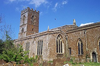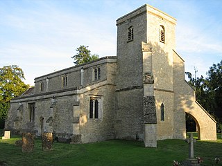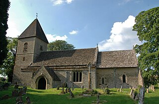
Merton is a village and civil parish near the River Ray, about 4 miles (6.4 km) south of Bicester in Oxfordshire, England. The 2011 Census recorded the parish's population as 424.

Swalcliffe is a village and civil parish about 5 miles (8 km) west of Banbury in Oxfordshire. The parish is about 2+1⁄2 miles (4 km) long north–south and about 1 mile (1.6 km) east–west. The 2011 Census recorded the population of the modern Swalcliffe parish as 210. The toponym "Swalcliffe" comes from the Old English swealwe and clif, meaning a slope or cliff frequented by swallows. The ancient parish of Swalcliffe was larger than the present civil parish, and included the townships of East Shutford, Epwell, Sibford Ferris, Sibford Gower and West Shutford.

Great Milton is a village and civil parish in Oxfordshire, about 7 miles (11 km) east of Oxford. The 2011 Census recorded the parish's population as 1,042.

Lower Heyford is a village and civil parish beside the River Cherwell in Oxfordshire, about 6 miles (10 km) west of Bicester. The 2011 Census recorded the parish's population as 492.

Broughton is a village and civil parish in northern Oxfordshire, England, about 2+1⁄2 miles (4 km) southwest of Banbury. The 2011 Census recorded the parish's population as 286.

Bucknell is a village and civil parish 2+1⁄2 miles (4 km) northwest of Bicester in Oxfordshire, England. The 2011 Census recorded the parish's population as 260.
Thomas Garner was one of the leading English Gothic revival architects of the Victorian era. He is known for his almost 30-year partnership with architect George Frederick Bodley.

Launton is a village and civil parish on the eastern outskirts of Bicester, Oxfordshire, England. The 2011 Census recorded the parish's population as 1,204.

Woodeaton or Wood Eaton is a village and civil parish about 4 miles (6.4 km) northeast of Oxford, England. It also has a special needs school called Woodeaton Manor School.

Pyrton is a small village and large civil parish in Oxfordshire about 1 mile (1.6 km) north of the small town of Watlington and 5 miles (8 km) south of Thame. The 2011 Census recorded the parish's population as 227. The toponym is from the Old English meaning "pear-tree farm".

Somerton is a village and civil parish in Oxfordshire, England, in the Cherwell valley about 6 miles (10 km) northwest of Bicester. The 2011 Census recorded the parish's population as 305.

Chesterton is a village and civil parish on Gagle Brook, a tributary of the Langford Brook in north Oxfordshire. The village is about 1+1⁄2 miles (2.4 km) southwest of the market town of Bicester. The village has sometimes been called Great Chesterton to distinguish it from the hamlet of Little Chesterton, about 3⁄4 mile (1.2 km) to the south in the same parish. The 2011 Census recorded the parish population as 850.

Toot Baldon is a village and civil parish about 5 miles (8 km) southeast of Oxford in Oxfordshire. Since 2012 it has been part of the Baldons joint parish council area, sharing a parish council with the adjacent civil parish of Marsh Baldon. The 2011 Census recorded its population as 148.

Tusmore is a settlement about 5+1⁄2 miles (9 km) north of Bicester in Oxfordshire. It is the location of the Tusmore country house and estate.

Alkerton is a village and former civil parish, now in the parish of Shenington with Alkerton, in the Cherwell district, in the county of Oxfordshire, England. It is on the county boundary with Warwickshire, about 5 miles (8 km) west of Banbury. In 1961 the parish had a population of 82. On 1 April 1970 the parish was abolished and merged with Shenington to form "Shenington with Alkerton".

Hanwell is a village and civil parish in Oxfordshire, about 2 miles (3 km) northwest of Banbury. Its area is 1,240 acres (500 ha) and its highest point is about 500 feet (150 m) above sea level. The 2011 Census recorded the parish's population as 263.

Hardwick is a village in the civil parish of Hardwick with Tusmore about 4.5 miles (7 km) north of Bicester in Oxfordshire.

Hethe is a village and civil parish about 4.5 miles (7.2 km) north of Bicester in Oxfordshire, England.

Taynton is a village and civil parish about 1+1⁄2 miles (2.4 km) northwest of Burford in West Oxfordshire. The village is on Coombe Brook, a tributary of the River Windrush. The parish is bounded in the south by the River Windrush, in the north partly by Coombe Brook and its tributary Hazelden Brook, in the west by the county boundary with Gloucestershire and in the east by field boundaries. The 2001 Census recorded the parish's population as 108.

Fritwell is a village and civil parish about 5+1⁄2 miles (9 km) northwest of Bicester in Oxfordshire. The 2011 Census recorded the parish's population as 736.


