Frogville, Oklahoma

Last updated

Frogville, Oklahoma
USA Oklahoma location map.svg
Red pog.svg
Frogville
Location within the state of Oklahoma
Usa edcp location map.svg
Red pog.svg
Frogville
Frogville (the United States)
Coordinates: 33°53′51″N95°18′46″W / 33.89750°N 95.31278°W / 33.89750; -95.31278
Country United States
State Oklahoma
County Choctaw
Elevation
[1]
400 ft (122 m)
Time zone UTC-6 (Central (CST))
  Summer (DST) UTC-5 (CDT)
ZIP codes
74743
GNIS feature ID1100435 [1]

Frogville is an small unincorporated community in Choctaw County, Oklahoma, United States. [1] The post office was established on October 29, 1897, and closed on August 15, 1933. [2] Frogville was named for the abundance of frogs in the area said to be so large they ate young ducks. [2]

Contents

History

A post office was established at Frogville, Indian Territory on October 29, 1897. It took its name from area frogs, which were said to be so plentiful they reputedly "ate young ducks." The post office closed on August 15, 1933. [3]

At the time of its founding, Frogville was located in Kiamitia County, a part of the Apukshunnubbee District of the Choctaw Nation. [4]

Frogville, at its peak, was home to 40 families, a post office, several stores, a school, and a church. [5]

Geography

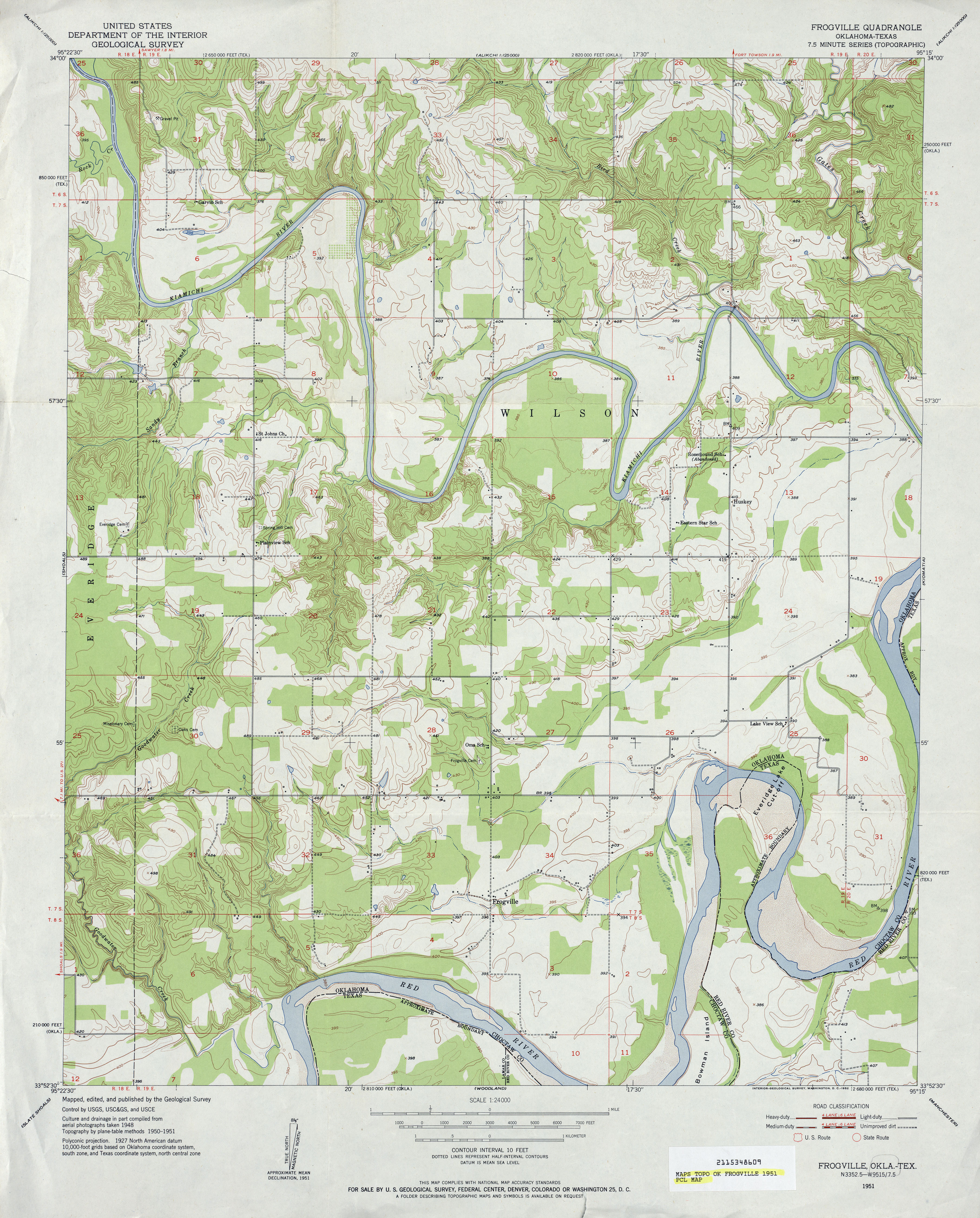
Frogville is located around a mile from the Red River, which separates Oklahoma and Texas. [6] Frogville is in southeastern Choctaw County 18 miles (29 km) southeast of Hugo, the county seat. Sawyer is 12 miles (19 km) to the north-northwest, Fort Towson is 11 miles (18 km) to the north-northeast, and Grant is 14 miles (23 km) to the west. Frogville is located in the 74743 (Hugo) ZIP code.

The closest school to Frogville is the Kiamichi Technology Center, serving the Hugo area for the purpose of higher education (Mandevill). The schools that would be available to Frogville are Hugo Elementary School 1100 David Roebuck Lane, Hugo Middle School 300 North E., Hugo High School 201 E. Brown (Henry), Fort Towson Elementary West 3rd Street, and Fort Towson High School West 3rd Street (Mandevill).

Oklahoma is a mostly farming state and most all of Frogville property is farmland (Smallwood). The closest post office is in Sawyer (ZIP code 74756).

In the town of Frogville there are two reservoirs, one cemetery, [7] and the only major highway that is used to reach Frogville is Oklahoma State Highway 109 (Google Maps).

Related Research Articles

<span class="mw-page-title-main">McCurtain County, Oklahoma</span> County in Oklahoma, United States

McCurtain County is in the southeastern corner of the U.S. state of Oklahoma. As of the 2020 census, its population was 30,814. Its county seat is Idabel. It was formed at statehood from part of the earlier Choctaw Nation in Indian Territory. The name honors an influential Choctaw family who lived in the area. Green McCurtain was the last chief when Oklahoma became a state in 1907.

<span class="mw-page-title-main">Choctaw County, Oklahoma</span> County in Oklahoma, United States

Choctaw County is a county located in the U.S. state of Oklahoma. As of the 2020 census, the population was 14,204. Its county seat is Hugo.

<span class="mw-page-title-main">Bryan County, Oklahoma</span> County in Oklahoma, United States

Bryan County is a county in the U.S. state of Oklahoma. As of the 2020 census, the population was 46,067. Its county seat is Durant. It is the only county in the United States named for Democratic politician William Jennings Bryan.

<span class="mw-page-title-main">Bel Air South, Maryland</span> Census-designated place in Maryland, United States

Bel Air South is a census-designated place (CDP) in Harford County, Maryland, United States. The population was 47,709 at the 2010 census, up from 39,711 in 2000.

<span class="mw-page-title-main">Clinton, Maryland</span> Census-designated place in Maryland, United States

Clinton is an unincorporated census-designated place (CDP) in Prince George's County, Maryland, United States. Clinton was formerly known as Surrattsville until after the time of the Civil War. The population of Clinton was 38,760 at the 2020 census. Clinton is historically known for its role in the American Civil War concerning the Abraham Lincoln assassination. Clinton is adjacent to Camp Springs, Rosaryville, Melwood, and Andrews Air Force Base.

<span class="mw-page-title-main">Hugo, Oklahoma</span> City in Oklahoma, United States

Hugo is a city in and the county seat of Choctaw County, Oklahoma, United States. It is located in southeastern Oklahoma, approximately 9 miles (14 km) north of the Texas state line. As of the 2010 census, the city population was 5,310.

<span class="mw-page-title-main">Rattan, Oklahoma</span> Town in Oklahoma, United States

Rattan is a town in Pushmataha County, Oklahoma, United States. The population was 276 at the 2020 census.

<span class="mw-page-title-main">West Goshen Township, Chester County, Pennsylvania</span> Township in Pennsylvania, United States

West Goshen Township is a township in Chester County, Pennsylvania, United States. The population was 23,040 at the 2020 census. In 2013, Money Magazine voted West Goshen as the 10th best place to live in America. West Goshen has also been ranked in the top 15 places to live in America from 2014 to 2017 and is also at the top of best neighborhoods to raise a family in Pennsylvania every year.

<span class="mw-page-title-main">Manlius, New York</span> Town in New York, United States

Manlius is a town to the east of Syracuse in Onondaga County. As of the 2020 Census, the population was 33,712, making it the third largest suburb in metropolitan Syracuse. In 2005, the town was ranked 98th on CNN's list of Best Places to Live.

Fort Towson was a frontier outpost for Frontier Army Quartermasters along the Permanent Indian Frontier located about two miles (3 km) northeast of the present community of Fort Towson, Oklahoma. Located on Gates Creek near the confluence of the Kiamichi River and the Red River in present-day Choctaw County, Oklahoma, it was named for General Nathaniel Towson.

Miranda is a census-designated place in Humboldt County, California. It is located 2.5 miles (4 km) northwest of Phillipsville, at an elevation of 351 feet (107 m). The ZIP Code is 95553. The population was 520 at the 2010 census.

<span class="mw-page-title-main">Kiamichi River</span> River in Oklahoma, United States

The Kiamichi River is a river in southeastern Oklahoma, United States of America. A tributary of the Red River of the South, its headwaters rise on Pine Mountain in the Ouachita Mountains near the Arkansas border. From its source in Polk County, Arkansas, it flows approximately 177 miles (285 km) to its confluence with the Red River at Hugo, Oklahoma.

Eagletown is an unincorporated community and census-designated place in McCurtain County, Oklahoma, United States. The population was 528 at the 2010 census. Located on Mountain Fork River, approximately 6 miles (9.7 km) from the Oklahoma-Arkansas border, it was the first permanent Choctaw settlement in the Indian Territory, who called it osi yamaha ("Eagle"). Eagletown was an important town from 1834 to 1906, and after 1850, served as county seat for the Choctaw Nation's Eagle County. The town name was officially changed to "Eagle Town" in 1850, then changed to the present Eagletown in 1892. When Indian Territory was preparing to unite with Oklahoma Territory to form the new state of Oklahoma in 1906, Eagletown lost its county seat status and became just another unincorporated community in the new McCurtain County.

<span class="mw-page-title-main">Oklahoma State Highway 109</span>

State Highway 109 is a 54 mile (87 km) long state highway in southern Oklahoma. It runs through southern Choctaw County, connecting to US-70 at each end. It has no lettered spur routes.

<span class="mw-page-title-main">Fort Washita</span> United States historic place

Fort Washita is the former United States military post and National Historic Landmark located in Durant, Oklahoma on SH 199. Established in 1842 by General Zachary Taylor to protect citizens of the Choctaw and Chickasaw Nations from the Plains Indians, it was later abandoned by Federal forces at the beginning of the American Civil War. Confederate troops held the post until the end of the war when they burned the remaining structures. It was never reoccupied by the United States military. After years in private hands the Oklahoma Historical Society bought the fort grounds in 1962 and restored the site. Today, the Fort Washita Historic Site and Museum is a tourist attraction and hosts several events throughout the year, and it is jointly managed by the Chickasaw Nation and the Oklahoma Historical Society.

Spencerville is an unincorporated community in northern Choctaw County, Oklahoma, United States. It is 12 miles northeast of Hugo, adjacent to the Pushmataha County border. The improved Ft. Smith to Ft. Towson military road of 1839 ran north–south through Spencerville after crossing the "Seven Devils" on its way southeast to Doaksville. This wagon road was heavily used by the U.S. Army from 1839 to 1848, especially during the war with Mexico.

<span class="mw-page-title-main">Doaksville, Choctaw Nation</span> Ghost town in Choctaw County, Oklahoma

Doaksville is a former settlement, now a ghost town, located in present-day Choctaw County, Oklahoma. It was founded between 1824 and 1831, by people of the Choctaw Indian tribe who were forced to leave their homes in the Southeastern United States and relocate in an area designated for their resettlement in Indian Territory. The community was named for Josiah Stuart Doak, co-owner of the local trading post. The town flourished until the U.S. Army abandoned nearby Fort Towson in 1854, though it remained as the Choctaw capital until 1859, then declined precipitately after being bypassed by a new railroad in 1870. It is now a ghost town and an archaeological preservation site.

Raymond Gary Lake is a reservoir in southeastern Oklahoma, United States, one mile east of the town of Fort Towson in Choctaw County. It was constructed on Gates Creek in 1956 by the Oklahoma Department of Wildlife Conservation.

<span class="mw-page-title-main">Gilmore, Oklahoma</span> Unincorporated community in Oklahoma, United States

Gilmore is an unincorporated community in Le Flore County, Oklahoma, United States. The town, formerly incorporated, boasted a small post office, city hall, and Mayor Pratt McMillin, a rancher and oil distributor who died in April 2001, aged 84.

References

  1. 1 2 3 U.S. Geological Survey Geographic Names Information System: Frogville, Oklahoma
  2. 1 2 Shirk, George H. Oklahoma Place Names, Norman, Oklahoma: University of Oklahoma Press, 1987, p.95.
  3. Shirk, George H. Oklahoma Place Names (Norman: University of Oklahoma Press, 1965, p. 84.
  4. Morris, John W. Historical Atlas of Oklahoma (Norman: University of Oklahoma Press, 1986), plate 38.
  5. Dawkins, Lee. "Frogville Folklore," The Oklahoman, April 26, 1992, p.135.
  6. Etter, Jim. "New Plant Might Get Frogville Hopping Again," The Oklahoman, May 1, 1978.
  7. "Choctaw County Genealogy Resources," TravelOK, Oklahoma Tourism and Recreation Department. Accessed June 15, 2015.

Further reading