Mexico City is the capital and largest city of Mexico, and the most populous city in North America. Mexico City is one of the most important cultural and financial centers in the world. It is located in the Valley of Mexico within the high Mexican central plateau, at an altitude of 2,240 meters (7,350 ft). The city has 16 boroughs or demarcaciones territoriales, which are in turn divided into neighborhoods or colonias.
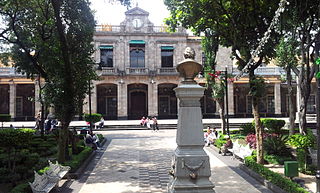
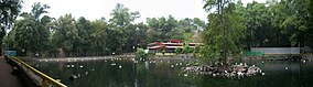
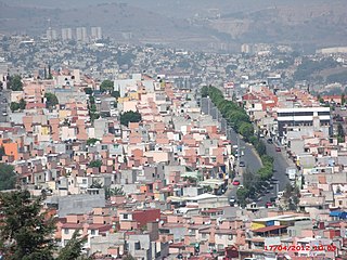
Tlalpan is a borough in Mexico City. It is the largest borough, with over 80% under conservation as forest and other ecologically sensitive area. The rest, almost all of it on the northern edge, has been urban since the mid-20th century. When it was created in 1928, it was named after the most important settlement of the area, Tlalpan, which is referred to as “Tlalpan center” to distinguish it from the borough.
Huitzilac is a city in the Mexican state of Morelos. It stands at 19°01′42″N99°16′02″W and at an altitude of 2,561 m (8,402 ft) above sea level.

Jiutepec is a city and its surrounding municipality in the Mexican state of Morelos.

General Anaya is a station on Line 2 of the Mexico City Metro system. It is located in the Coyoacán borough of Mexico City, directly south of the city centre in the median of Calzada de Tlalpan, and right next to the Estudios Churubusco. It is a surface station.

Avenida de los Insurgentes, sometimes known simply as Insurgentes, is the longest avenue in Mexico City, with a length of 28.8 km (17.9 mi) on a north-south axis across the city. Insurgentes has its origins in what was during the early 20th century known as the Via del Centenario which ran from city centre to the southern suburbs.
Colegio Williams is a private school system in Mexico City, serving preschool through high school. It has three campuses: Campus Mixcoac in Mixcoac, Benito Juárez; Campus San Jerónimo in San Jerónimo Lídice, Magdalena Contreras, and Campus Ajusco in San Miguel Ajusco, Tlalpan. Its head office is in the Mixcoac campus.
Tultitlán de Mariano Escobedo is the fourth largest town in and municipal seat of the municipality of Tultitlán located in the northeastern part of the State of México in Mexico. It lies adjacent to the northern tip of the Federal District and is part of the Greater Mexico City urban area. Both the city and the municipality are interchangeably known as San Antonio Tultitlán or simply Tultitlán, a name which comes from Náhuatl meaning "among the tule plants". "de Mariano Escobedo" was added to the city's name in 1902 in honor of the general who fought in the Mexican–American War and for the liberals during the period of La Reforma with Benito Juárez.

The Trans-Mexican Volcanic Belt pine–oak forests is a subtropical coniferous forest ecoregion of the Trans-Mexican Volcanic Belt of central Mexico.
Cumbres del Ajusco National Park is one of many national parks near Mexico City, DF. The Ajusco is known for its high elevations reaching 3,900 meters (12,795 ft) above sea level and is visible from any part of Mexico city. The park is characterized by pine-oak forests and high mountain grassland. Cumbres del Ajusco means "watered grove peaks", an appropriate name for this mountainous region covered with lush green forest with many flowers due to a fair amount of precipitation. The Balsas and Lerma rivers begin in the heart of the Cumbres del Ajusco.

Luis Fernando Fuentes Vargas is a Mexican professional footballer who plays as a left-back for Liga MX club América.

Luis Ramiro Barragán Morfín was a Mexican architect and engineer. His work has influenced contemporary architects visually and conceptually. Barragán's buildings are frequently visited by international students and professors of architecture. He studied as an engineer in his home town, while undertaking the entirety of additional coursework to obtain the title of architect.
Alfa González Magallanes is a Mexican politician affiliated with the Party of the Democratic Revolution (PRD). She currently serves as the mayor of Tlalpan, a borough of Mexico City.
The Escuela Preparatoria Tlalpan II "Otilio Montaño" is a senior high school in San Miguel Topilejo, Tlalpan, Mexico City. It is within the Instituto de Educación Media Superior del Distrito Federal (IEMS).
British American School, S.C. is a private international school in Naucalpan, State of Mexico in Greater Mexico City. It serves levels kindergarten (Kinder) through high school (bachillerato). It was previously in Tlalpan, Mexico City.
Colegio Princeton del Sur S.C., which operated as Colegio Princeton de México, was a private school in Mexico City. It had its kindergarten and primary school campuses in Jardines del Pedregal, Álvaro Obregón, and its junior and senior high school campus in Heroes de Padierna, Tlalpan. It had no affiliation nor any accreditation from Princeton University and that university's board of trustees.

Artz Pedregal is a mixed-use development opened on March 9, 2018 and is located along the Anillo Periférico ring road in the Pedregal de San Ángel area of southwestern Mexico City. The shopping mall focuses on luxury retailers. The project is 400,000 square metres (4,300,000 sq ft) in area: 100,000 square metres (1,100,000 sq ft) of office space, 65,000 square metres (700,000 sq ft) of commercial space and 5,000 square metres (54,000 sq ft) of park space, on a lot of 50,500 square metres (544,000 sq ft). It features a gallery of large-scale installations of public art, and was designed by Sordo Madaleno Arquitectos. Tenants include luxury retailers Louis Vuitton, Dior, Hermes, Gucci, Prada, Fendi, and Cartier, as well as Hamley's toys, Roche Bobois West Elm, Cinemex multicinemas, and Mexico's first Starbucks Reserve Bar. No major department stores anchor the mall. On July 12, 2018, a constituent building of the mall collapsed.

The Sierra del Ajusco-Chichinauhtzin, also known as Serranía del Ajusco or Sierra de Chichinauhtzin, is a Mexican mountain range located between Mexico City and the states of Morelos and Mexico. It makes up the southern part of the mountain necklace that surrounds Mexico City. It is made up of more than one hundred volcanic cones, among which are: Tláloc, Chichinauhtzin (3,430 metres, Xitle (3,100 metres, Cerro Pelado (3,600 metres and Cuauhtzin (3,510 metres. Its maximum height is at the Cruz del Marqués peak on the Ajusco volcano.

The Monumento al perro callejero, also known as Peluso, is an outdoor bronze sculpture installed along Insurgentes Sur Avenue, in the southern borough of Tlalpan, in Mexico City. The statue was unveiled in July 2008 and was dedicated to the free-ranging dogs of the city.