Protected areas of Australia include Commonwealth and off-shore protected areas managed by the Australian government, as well as protected areas within each of the six states of Australia and two self-governing territories, the Australian Capital Territory and the Northern Territory, which are managed by the eight state and territory governments.

A transboundary protected area (TBPA) is an ecological protected area that spans boundaries of more than one country or sub-national entity. Such areas are also known as transfrontier conservation areas (TFCAs) or peace parks.

A Ramsar site is a wetland site designated to be of international importance under the Ramsar Convention, also known as "The Convention on Wetlands", an international environmental treaty signed on 2 February 1971 in Ramsar, Iran, under the auspices of UNESCO. It came into force on 21 December 1975, when it was ratified by a sufficient number of nations. It provides for national action and international cooperation regarding the conservation of wetlands, and wise sustainable use of their resources. Ramsar identifies wetlands of international importance, especially those providing waterfowl habitat.
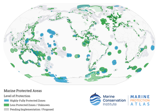
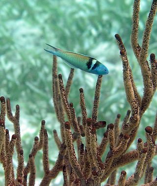
Marine protected areas (MPAs) are protected areas of the world's seas, oceans, estuaries or in the US, the Great Lakes. These marine areas can come in many forms ranging from wildlife refuges to research facilities. MPAs restrict human activity for a conservation purpose, typically to protect natural or cultural resources. Such marine resources are protected by local, state, territorial, native, regional, national, or international authorities and differ substantially among and between nations. This variation includes different limitations on development, fishing practices, fishing seasons and catch limits, moorings and bans on removing or disrupting marine life. MPAs can provide economic benefits by supporting the fishing industry through the revival of fish stocks, as well as job creation and other market benefits via ecotourism. The value of MPA to mobile species is unknown.

Protected areas of New Zealand are areas that are in some way protected to preserve their environmental, scientific, scenic, historical, cultural or recreational value. There are about 10,000 protected areas, covering about a third of the country. The method and aims of protection vary according to the importance of the resource and whether it is publicly or privately owned.

The Tubbataha Natural Park, also known as the Tubbataha Reefs Natural Park, is a protected area of the Philippines located in the middle of the Sulu Sea. The marine and bird sanctuary consists of two huge atolls and the smaller Jessie Beazley Reef covering a total area of 97,030 hectares. It is located 150 kilometres (93 mi) southeast of Puerto Princesa, the capital of Palawan. The uninhabited islands and reefs are part of the island municipality of Cagayancillo, located roughly 130 kilometers (81 mi) to the northeast of the reef.
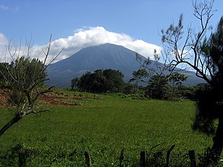
Guanacaste Conservation Area is an administrative area which is managed by the Sistema Nacional de Areas de Conservacion (SINAC) of Costa Rica for conservation in the northwestern part of Costa Rica. It contains three national parks, as well as wildlife refuges and other nature reserves. The area contains the Area de Conservación Guanacaste World Heritage Site, which comprises four areas.

Elizabeth and Middleton Reefs Marine National Park Reserve is a former marine protected area consisting of waters around Elizabeth and Middleton reefs located at the south-eastern end of the Coral Sea Islands, an Australian territory in the Coral Sea. It was incorporated into the new Lord Howe Commonwealth Marine Reserve in December 2012. The two reefs also form a Ramsar site, having been listed as Ramsar Site 1223, on 21 October 2002, under the Ramsar Convention as a wetland of international importance.

The Port Phillip Heads Marine National Park is a marine protected area located in the vicinity of the bay of Port Phillip, between the Bellarine and Mornington Peninsulas, in Victoria, Australia. The 3,580-hectare (8,800-acre) marine national park comprises six separate sites located approximately 60 kilometres (37 mi) south-west of Melbourne and stretches along 40 kilometres (25 mi) of coastline of Victoria.
Since declaring independence in 1981, Belize has enacted many environmental protection laws aimed at the preservation of the country's natural and cultural heritage, as well as its wealth of natural resources. These acts have established a number of different types of protected areas, with each category having its own set of regulations dictating public access, resource extraction, land use and ownership.
A Directory of Important Wetlands in Australia (DIWA) is a list of wetlands of national importance to Australia published by the Department of Climate Change, Energy, the Environment and Water. Intended to augment the list of wetlands of international importance under the Ramsar Convention, it was formerly published in report form, but is now essentially an online publication. Wetlands that appear in the Directory are commonly referred to as "DIWA wetlands" or "Directory wetlands".

Protected areas of Poland include the following categories, as defined by the Act on Protection of Nature of 16 April 2004, by the Polish Parliament:
The Moreton Bay Marine Park was established in 1993 to protect ecologically significant habitats in Moreton Bay. The marine park extends from Caloundra south to the southern tip of South Stradbroke Island. The marine park's border extends up to the highest tidal mark and covers a total of 3,400 km2.
Classification of wetlands has been a problematical task, with the commonly accepted definition of what constitutes a wetland being among the major difficulties. A number of national wetland classifications exist. In the 1970s, the Ramsar Convention on Wetlands of International Importance introduced a first attempt to establish an internationally acceptable wetland classification scheme.

Mangrove ecosystems represent natural capital capable of producing a wide range of goods and services for coastal environments and communities and society as a whole. Some of these outputs, such as timber, are freely exchanged in formal markets. Value is determined in these markets through exchange and quantified in terms of price. Mangroves are important for aquatic life and home for many species of fish.
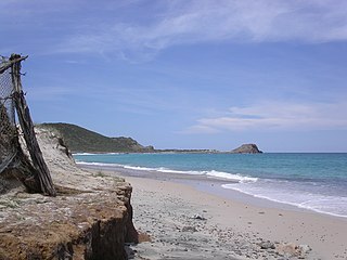
Cabo Pulmo National Park is a national marine park on the east coast of Mexico's Baja California Peninsula, spanning the distance between Pulmo Point and Los Frailes Cape, approximately 100 kilometres (62 mi) north of Cabo San Lucas in the Gulf of California. Bahía Pulmo is home to the oldest of only three coral reefs on the west coast of North America. Cabo Pulmo is estimated to be 20,000 years old. The 27 square mile national park is home to 11 different species of coral. It is the northernmost coral reef in the eastern Pacific Ocean.

The Ashmore Reef Marine Park is an Australian marine park that covers the Ashmore Reef, which is located about 630 km (390 mi) north of Broome and 110 km (68 mi) south of the Indonesian island of Rote. The marine park covers an area of 583 km2 (225 sq mi) and is assigned IUCN category Ia. It is one of 13 parks managed under the North-west Marine Parks Network.

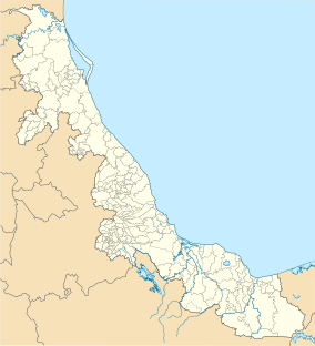
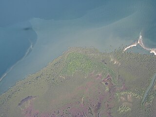
The Tehuantepec-El Manchon mangroves ecoregion covers a series of mangrove woodlands along the Pacific Ocean coast of the state of Chiapas, Mexico. The ecoregion is relatively large and continuous, with trees up to 25 meters in height. The region supports stands of a type of yellow mangrove that normally only grown further south. The coast of Mexico here is wet - over 2,500 mm/year of rain. Four RAMSAR wetlands of international important are found in the zone, and a UNESCO Biosphere Reserve. Of particular importance are the wide variety of permanent and migratory birds in the area.