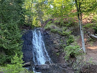
Keweenaw County is a county in the western Upper Peninsula of the U.S. state of Michigan. As of the 2020 census, the county's population was 2,046, making it Michigan's least populous county. It is also the state's largest county by total area, including the waters of Lake Superior, as well as the state's northernmost county. The county seat is Eagle River.

Allouez Township is a civil township of Keweenaw County in the U.S. state of Michigan. The population was 1,428 at the 2020 census.

Eagle Harbor Township is a civil township of Keweenaw County in the U.S. state of Michigan. The population was 217 at the 2020 census. The township is located on the Keweenaw Peninsula and also includes the southwestern portion of Isle Royale National Park.

Grant Township is a civil township of Keweenaw County in the U.S. state of Michigan. The population was 275 at the 2020 census. Grant Township is one of the most isolated municipalities in Michigan, as it forms the tip of the Keweenaw Peninsula, which projects into Lake Superior.

Elmwood Township is a charter township of Leelanau County in the U.S. state of Michigan. The population was 4,892 at the 2020 census, making it the largest township in Leelanau County by population. The southeasternmost township of Leelanau County, Elmwood Township is suburbanized, as it is immediately adjacent Traverse City, the largest city in Northern Michigan.
Hurontown is an unincorporated community and census-designated place (CDP) in Houghton County in the U.S. state of Michigan. The community is located immediately south of the city of Houghton. The CDP had a population of 244 at the 2020 census.
Dodgeville is an unincorporated community and census-designated place (CDP) in Houghton County in the U.S. state of Michigan. The CDP had a population of 391 at the 2020 census. Dodgeville is located in Michigan's Upper Peninsula and is located just south of the city of Houghton.
Atlantic Mine is an unincorporated community and census-designated place (CDP) in Houghton County in the U.S. state of Michigan. The CDP had a population of 565 at the 2020 census. The community is located just southwest of the city of Houghton in Adams Township. Atlantic Mine is located in the Copper Country region of Michigan's Upper Peninsula. The community is named for the eponymous Atlantic Mine.

Copper Harbor is an unincorporated community and census-designated place (CDP) located in Keweenaw County in the U.S. state of Michigan. It is located within Grant Township. The population of the CDP was 136 as of the 2020 census.

Eagle Harbor is an unincorporated community and census-designated place located on the north side of the Keweenaw Peninsula within Eagle Harbor Township, Keweenaw County in the U.S. State of Michigan. Its population was 69 as of the 2020 census. M-26 passes through this community. This hamlet was especially popular with the sailors in days past, as it had a good steamboat landing and is about equally distant from Sault Sainte Marie, Michigan, and Duluth, Minnesota. It was the first stop for supplies for the many boats on Lake Superior.

Dollar Bay is a census-designated place (CDP) in Houghton County, Michigan, United States. The population was 1,082 at the 2010 census.

Brimley is an unincorporated community and census-designated place (CDP) in Chippewa County in the U.S. state of Michigan. The CDP had a population of 504 at the 2020 census. Brimley is located in Michigan's Upper Peninsula, and is located along the southern shore of Lake Superior. The community is located within Superior Township.

Eagle River is an unincorporated community and census-designated place (CDP) in the U.S. state of Michigan. It is the county seat of Keweenaw County. Its population was 65 at the 2020 census, which makes it by far the least-populated county seat in the state of Michigan. As an unincorporated community, Eagle River has no legal autonomy and is part of Allouez Township and Houghton Township.

Gay is an unincorporated community in Keweenaw County in the U.S. state of Michigan. It is 12 miles from Lake Linden on Copper Island at the western end of the Upper Peninsula. As an unincorporated community, Gay has no legally recognized boundaries or population statistics of its own. Local government is provided by Sherman Township.

Three Lakes is an unincorporated community and census-designated place (CDP) in Baraga County in the U.S. state of Michigan. The CDP had a population of 167 at the 2020 census. Three Lakes is located within Spurr Township.

Skanee is an unincorporated community and census-designated place (CDP) in Baraga County in the U.S. state of Michigan. The CDP had a population of 102 at the 2020 census. Skanee is located in Arvon Township on the shore of Huron Bay, a bay of Lake Superior.

Zeba is an unincorporated community and census-designated place (CDP) in Baraga County in the U.S. state of Michigan. The CDP had a population of 397 at the 2020 census. The community is located near the southern end of the Keweenaw Bay just north of the village of L'Anse within L'Anse Township.
Mohawk is an unincorporated community and census-designated place (CDP) in the U.S. state of Michigan. Located in Keweenaw County, it is within Allouez Township. As an unincorporated community, Mohawk has no legally defined boundaries or population statistics of its own but does have its own post office with the 49950 ZIP Code. The ZIP includes most of mainland Keweenaw County and also uses the Eagle Harbor and Eagle River designations.

Chassell is an unincorporated community and census-designated place (CDP) in Houghton County in the U.S. state of Michigan. The CDP had a population of 876 at the 2020 census. Chassell is located within Chassell Township, and is located on the shore of Portage Lake in the Upper Peninsula. As an unincorporated community, Chassell has no legal autonomy of its own, however it does have a post office with the ZIP code 49916.
The Public Schools of Calumet-Laurium-Keweenaw is located in Calumet, Michigan. The district is Michigan's northernmost K-12 school district.


