Garn-yr-erw

Last updated

Garn-yr-erw
Old school building at Garn-yr-Erw near Blaenafon (geograph 3254713).jpg
Old school building at Garn-yr-Erw
Torfaen UK location map.svg
Red pog.svg
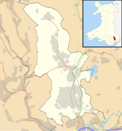
Garn-yr-erw
Location within Torfaen
Principal area
Ceremonial county
Country Wales
Sovereign state United Kingdom
Post town PONTYPOOL
Postcode district NP4
Dialling code 01495
Police Gwent
Fire South Wales
Ambulance Welsh
UK Parliament
List of places
UK
Wales
Torfaen
51°47′01″N3°06′35″W / 51.7837°N 3.1098°W / 51.7837; -3.1098 Coordinates: 51°47′01″N3°06′35″W / 51.7837°N 3.1098°W / 51.7837; -3.1098

Garn-yr-erw is a village in south-eastern Wales, lying at the source of the Afon Llwyd north of Blaenavon and Pontypool, within the historic boundaries of Monmouthshire. The village lies at an altitude of approx 400 metres [ clarification needed ] on the side of Gilwern Hill, Monmouthshire and is cited by the Ordnance Survey as the highest village in Wales. [1]

Contents

The village had a station on the Pontypool and Blaenavon Railway from 1913 until the line's closure in 1941. [2]

See also

Related Research Articles

Abersychan Town in Wales

Abersychan is a settlement and community north of Pontypool in Torfaen, Wales, and lies within the boundaries of the historic county of Monmouthshire and the preserved county of Gwent.

Cwmbran Human settlement in Wales

Cwmbran is a town in the county borough of Torfaen in South Wales.

Torfaen County borough in Wales

Torfaen is a principal area with county borough status in the south-east of Wales. Torfaen is bordered by the county of Monmouthshire to the east, the city of Newport to the south, and the county boroughs of Caerphilly and Blaenau Gwent to the south-west and north-west respectively. It is within the historic boundaries of the historic county of Monmouthshire, and between 1974 and 1996 was a district of Gwent, until it was reconstituted as a principal area in 1996.

Pontypool Human settlement in Wales

Pontypool is a town and the administrative centre of the county borough of Torfaen, within the historic boundaries of Monmouthshire in South Wales. It has a population of over 28,000.

Blaenavon Human settlement in Wales

Blaenavon is both a town and a community in Torfaen county borough, Wales, high on a hillside on the source of the Afon Lwyd. It is within the boundaries of the historic county of Monmouthshire and the preserved county of Gwent. The population is 6,055.

Pontypool and Blaenavon Railway

The Pontypool and Blaenavon Railway is a 3.5-mile (5.6 km) volunteer-run heritage railway in South Wales, running trains between a halt platform opposite the Whistle Inn public house southwards to the town of Blaenavon via a two-platform station at the site of former colliery furnace of the Big Pit National Coal Museum.

Cwmbran railway station Railway station in Torfaen, Wales

Cwmbran railway station is in the northeast of Cwmbran town centre, within five minutes' walking distance. It is part of the British railway system owned by Network Rail and is managed by Transport for Wales, who operate all trains serving it. It lies on the Welsh Marches Line from Newport to Hereford. The station was opened at this site in 1986 to serve the commuter route to Newport and Cardiff, and shoppers to the town centre.

Pontnewynydd is a predominantly working class suburb of Pontypool, Torfaen, in Wales. It should not be confused with Pontnewydd in nearby Cwmbran.

Cwmavon, Torfaen Human settlement in Wales

Cwmavon is a hamlet about 2 miles south of Blaenavon and 4 miles north of Pontypool. The hamlet is part of the community of Abersychan in the county borough of Torfaen in south east Wales, and is within the boundaries of the historic county of Monmouthshire.

Abersychan and Talywain railway station

Abersychan and Talywain station served the west of Abersychan village in the Welsh county of Monmouthshire. The station was the meeting point for two major pre-grouping railways as they competed for the South Wales coal traffic.

Varteg railway station

Varteg railway station was a railway station which served the village of Varteg, in the county of Monmouthshire, on the Brynmawr and Blaenavon Railway. Built by the London and North Western Railway (LNWR) as an expansion to meet the Great Western Railway (GWR) at Abersychan and Talywain. It was sometimes referred to on old Ordnance Survey and British Railway Clearing House (RCH) as 'Varteg Halt', despite it having an extensive station building.

Waenavon railway station

Waenavon railway station, also known as Waen Avon, was a station on the Brynmawr and Blaenavon Railway in South East Wales. To the south of the station a short line served Milfraen Colliery.

Pentrepiod Halt railway station (Monmouthshire) Disused railway station in Pentrepiod, Torfaen

Pentrepiod Halt, Monmouthshire is a former railway station that was located approximately 2 miles north of Pontypool in Monmouthshire.

The Brynmawr and Blaenavon Railway was a railway line in South Wales, within the historic boundaries of Brecknockshire and Monmouthshire, originally built in 1866 and immediately leased to the London and North Western Railway to transport coal to the Midlands via the Heads of the Valleys line. The line was completed in the late eighteen sixties and the LNWR were operating passenger trains over the line by 1872. Eight years later it was extended to meet the Great Western Railway at Abersychan & Talywain. Here the line carried on down the valley through Pontypool Crane Street railway station to the coast at Newport. In 1922 the LNWR was grouped into the London, Midland and Scottish Railway. In later years the line saw a variety of GWR locomotives operating from pit to port; however, the railway retained its LNWR infrastructure up until the last days before its closure.

Blaenavon Low Level railway station

Blaenavon Low Level railway station was the northern terminus of the Monmouthshire Railway and Canal Company line from Pontypool to Blaenavon in Monmouthshire, Wales.

Whistle Inn Halt railway station

Whistle Inn is a halt on the Pontypool and Blaenavon Railway heritage railway in Torfaen, Wales. It is situated adjacent to the Whistle Inn, near the village of Garn-yr-erw. The station is the northern terminus of the line and its highest point at 1,307 feet (398 m) above sea level. To the north of the halt, on the other side of the road bridge over the line, was Garn-Yr-Erw Halt on the Brynmawr and Blaenavon Railway.

Pontypool Crane Street railway station

Pontypool Crane Street railway station served Pontypool in the Welsh county of Monmouthshire.

Snatchwood Halt railway station served Snatchwood between Pontypool and Abersychan in Torfaen, South Wales, UK. The station was opened by the Great Western Railway in 1912 on the line it had purchased from the Monmouthshire Railway and Canal Company in 1880. The Halt lay between Pontypool Crane Street to the south and Abersychan to the north. The Halt lay adjacent to the current A4043 road, between the road and the nearby Afon Lwyd.

Garn-yr-Erw railway station served the village of Garn-yr-erw, in the historical county of Monmouthshire, Wales, from 1913 to 1941 on the Pontypool and Blaenavon Railway.

Pentwyn Halt railway station served the village of Pentwyn, in the historical county of Monmouthshire, Wales, from 1912 to 1941 on the Pontypool and Blaenavon Railway.

References

  1. Ordnance Survey. "MapZone" . Retrieved 4 March 2007.
  2. Quick, M E (2002). Railway passenger stations in England, Scotland and Wales - a chronology. Richmond: Railway and Canal Historical Society. p. 191. OCLC   931112387.