Leek is a village and former municipality in Groningen province in the northeastern Netherlands. The municipality, which bordered the Drenthe and Friesland provinces, was merged into the municipality of Westerkwartier on 1 January 2019.

Opende is a village in the north-eastern Netherlands, in the province of Groningen. It is part of the municipality of Westerkwartier. It had a population of around 2,865 in January 2017.

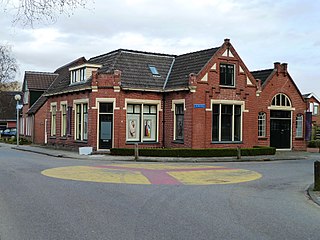
Grijpskerk is a village in the Dutch province of Groningen. It is located in the municipality of Westerkwartier, about 18 km west of the city of Groningen.

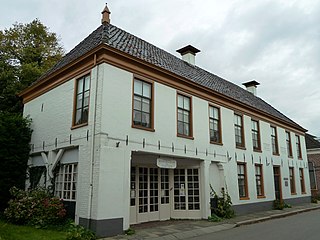
Oldekerk is a village in the Dutch province of Groningen. It is located in the municipality of Westerkwartier, about 15 km west of the city of Groningen.

The Westerkwartier is a historical region in the Dutch province of Groningen, at the border with the provinces of Drenthe and Friesland. In the past the area was part of the historical region of Frisia. The West Frisian language is still spoken in the western parts of the area. In the rest of the Westerkwartier, "Westerkertiersk", a local variant of Low Saxon, is spoken.

Oostum is a wierde on the territory of Garnwerd in the municipality of Westerkwartier in the Dutch province of Groningen. The hamlet lies on the road of the city of Groningen to Garnwerd and is part of the Pieterpad.

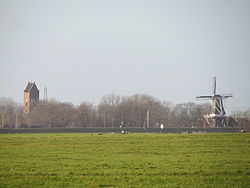
Den Ham is a linear village in the municipality of Westerkwartier in the Netherlands province Groningen. The village lies on the road from Aduard to Saaksum.

Hunsingo is a region in the province of Groningen, Netherlands, between the Reitdiep and Maarvliet. Hunsingo was one of three Ommelanden. It is bordered to the north by the Wadden Sea, to the east Fivelingo, in the west to the Westerkwartier and Friesland and in the south, Gorecht. The region corresponds to the current municipalities De Marne, Eemsmond, the majority of the municipalities of Bedum and Winsum and the former municipality of Middelstum.

Doezum is a village in the municipality of Westerkwartier in the Dutch province of Groningen. It had a population of around 725 in January 2017.

Sebaldeburen is a village in the Westerkwartier municipality in the Dutch province of Groningen. It had a population of around 565 in 2021.
Kornhorn is a village in Westerkwartier municipality in the Dutch province of Groningen. It had a population of around 495 in 2021.

Niekerk is a village in Westerkwartier municipality also in the Dutch province of Groningen. It had a population of around 1,365 in 2021.

Visvliet is a village in the Dutch province of Groningen. It is part of the municipality of Westerkwartier, and is located near the river Lauwers, the border between Friesland and Groningen.
Tolbert is a town in the Dutch province of Groningen. It is part of the municipality of Westerkwartier and forms a single urban area with Leek.
Noordhorn is a village in the Dutch province of Groningen. It is part of the municipality of Westerkwartier and is separated from Zuidhorn by the van Starkenborghkanaal.

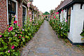
Niehove is a village in the municipality of Westerkwartier in Groningen, Netherlands. The village was located on the island of Humsterland in the former Lauwerszee from c. 800 until c. 1500. It is a terp village with two ring roads and the church in the middle. The village is a protected site. In 2019, Elsevier Weekblad named Niehove the most beautiful village of the Netherlands.

Kommerzijl, until the end of the 17th century called Opslachterzijl, is a linear village in the municipality of Westerkwartier in the province of Groningen in the Netherlands, located on the Kommerzijlsterdiep, which continues after the village as Kommerzijlsterriet and flows into the Reitdiep. To the west of the village lies the Ruigewaard and to the east the Humsterland. As of 2021, Kommerzijl had a population of 505.

Lauwerzijl is a village in the municipality of Westerkwartier in the province of Groningen in the Netherlands. As of 2021, it had a population of 195. Until 1990 the village belonged to the former municipality of Oldehove, then until 2019 to the former municipality of Zuidhorn.

Feerwerd is a village in the municipality of Westerkwartier in the province of Groningen in the Netherlands. As of 2021, Feerwerd had a population of 520.

Aduarderzijl (Dutch pronunciation: [ˌaː.dyˌɑr.dərˈzɛi̯l]; Gronings: Auwerderziel is a hamlet in the municipality of Westerkwartier in the province of Groningen in the Netherlands, located to the south of the Reitdiep. Administratively, it is part of the village of Feerwerd.