
Clackmannanshire is a historic county, council area, registration county and Lieutenancy area in Scotland, bordering the council areas of Stirling, Fife, and Perth & Kinross and the historic counties of Perthshire, Stirlingshire and Fife.

Alloa is a town in Clackmannanshire in the Central Lowlands of Scotland. It is on the north bank of the Forth at the spot where some say it ceases to be the River Forth and becomes the Firth of Forth. Alloa is south of the Ochil Hills, 5.5 miles (8.9 km) east of Stirling and 7.9 miles (12.7 km) north of Falkirk; by water Alloa is 25 miles (40 km) from Granton.
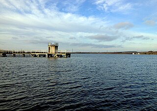
Chasewater is a reservoir located in the parish of Burntwood and the district of Lichfield in Staffordshire, England. Originally known as Norton Pool and Cannock Chase Reservoir, it was created as a canal feeder reservoir in 1797. The reservoir was created to directly supply the Wyrley and Essington Canal and maintain levels in the 160-mile (260 km) Birmingham Canal Network. During a period of great industrial growth in the Black Country region the maintenance of water levels in canal infrastructure was essential and Chasewater was in great demand. As canals became less essential for transport of goods during the mid-20th century, the reservoir diversified and became a popular public amenity with activities such as water-skiing, sailing, wakeboarding and cycling. Chasewater is the third largest reservoir by volume in the county of Staffordshire and the largest canal feeder reservoir in the West Midlands.
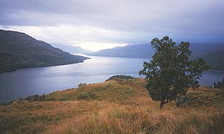
Loch Katrine is a freshwater lake in the Trossachs area of the Scottish Highlands, east of Loch Lomond, within the historic county and registration county of Perthshire and the contemporary district of Stirling. The loch is about 8 miles (13 km) long and 1 mile (1.6 km) wide at its widest point, and runs the length of Strath Gartney. It is within the drainage basins of the River Teith and River Forth.

The River Taff is a river in Wales. It rises as two rivers in the Brecon Beacons; the Taf Fechan and the Taf Fawr before becoming one just north of Merthyr Tydfil. Its confluence with the River Severn estuary is in Cardiff.
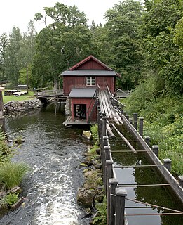
A flume is a human-made channel for water, in the form of an open declined gravity chute whose walls are raised above the surrounding terrain, in contrast to a trench or ditch. Flumes are not to be confused with aqueducts, which are built to transport water, rather than transporting materials using flowing water as a flume does. Flumes route water from a diversion dam or weir to a desired materiel collection location. Flumes are usually made up of wood, metal or concrete.
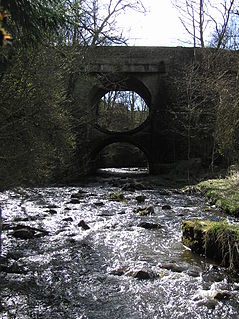
The Bannock Burn is a stream which rises at about 1,300 feet on Touchadam Moor, NS715891, just to the north of Earl's Hill in the Touch Hills to the south-west of Stirling in central Scotland. The Bannock flows eastward and enters the River Forth to the east of Stirling, close to the site of the Battle of Bannockburn (1314), about 7.58 miles from its source. The burn itself meanders and is considerably longer. A nearby town, nowadays a suburb of Stirling, is accordingly called Bannockburn.

Alloa Tower in Alloa, Clackmannanshire in central Scotland is an early 14th century tower house that served as the medieval residence of the Erskine family, later Earls of Mar. Retaining its original timber roof and battlements, the tower is one of the earliest, and largest, of Scottish tower houses, with immensely thick walls. It was designated as a scheduled monument in 1960 and is now owned by the National Trust for Scotland.

George Sorocold was an English civil engineer of the eighteenth century notable for pioneering work on water supplies and hydraulic power systems around Great Britain.

Clan Erskine is a Scottish clan of the Scottish Lowlands.
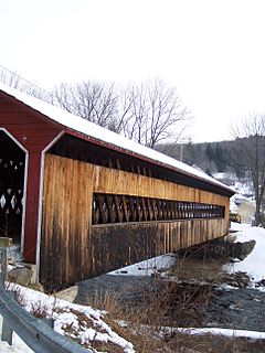
The Ware River is a 35.4-mile-long (57.0 km) river in central Massachusetts. It has two forks, both of which begin in Hubbardston, Massachusetts. The Ware River flows southwest through the middle of the state, joins the Quaboag River at Three Rivers, Massachusetts, to form the Chicopee River on its way to the Connecticut River.
Underwater logging is the process of logging trees from underwater forests. When artificial reservoirs and dams are built, large areas of forest are often inundated; although the trees die, the wood is often preserved. The trees can then be felled using special underwater machinery and floated up to the surface. One such machine is the sawfish harvester. There is an ongoing debate to determine whether or not underwater logging is a sustainable practice and if it is more environmentally sustainable than traditional logging.
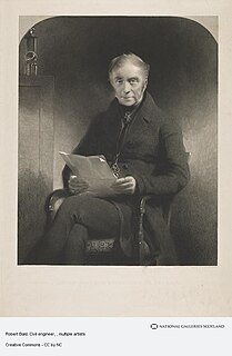
Robert Bald FRSE FSA MWS (1776–1861) was a Scottish surveyor, civil and mining engineer, and antiquarian. He was born in Culross, Scotland, the son of Alexander Bald (1753–1823), a colliery agent of Alloa. Robert Bald was one of the earliest and most eminent mining engineers and land surveyors in Scotland, and by the late nineteenth century he was referred to as "the acknowledged father of mining engineering in Scotland". His brother was Alexander Bald, poet and friend of James Hogg.
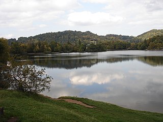
Tajchy are artificial water reservoirs in the Štiavnica Mountains, in central Slovakia. Most of them were built in order to provide energy for the silver mines of Banská Štiavnica in the 18th century. At their height, tajchy comprised a sophisticated system of 60 reservoirs, connected to each other by more than 100 km of channels and tunnels.
Hop Brook Lake is spread over three communities in New Haven County, Connecticut, United States. These communities are Naugatuck, Middlebury, and Waterbury. A dam was created across Hop Brook in Naugatuck and the lake that was created is known as Hop Brook Lake.

The Black Devon is a river in Scotland. It rises in the Cleish Hills, specifically the area known as Outh Muir, 1.5 kilometres (0.93 mi) north of Knockhill Racing Circuit, around 9 kilometres (5.6 mi) north-west of Dunfermline, Fife, with the gathering of three small streams in branch formation. The river flows westwards through Balgonar, north of Saline, and then merges with the Saline Burn. The Black Devon flows into Clackmannanshire, through the hamlet of Forestmill and past the town of Clackmannan. The Black Devon enters the River Forth south of Alloa, 1 kilometre (0.62 mi) north of Dunmore Pier.
Forestmill is a small hamlet in the county of Clackmannanshire, Scotland. It is situated on the A977 road between Kincardine and Kinross, about 3 miles from the Kincardine end.

The Upper North Fork Feather River Project is a hydroelectric scheme in the Sierra Nevada of California, within Lassen and Plumas Counties. The project consists of three dams, five power plants, and multiple conduits and tunnels in the headwaters of the North Fork Feather River, a major tributary of the Feather—Sacramento River systems. The total installed capacity is 362.3 megawatts (MW), producing an annual average of 1,171.9 gigawatt hours (GWh). The project is also contracted for the delivery of irrigation water between March 31 and October 31 of each year. The project is owned and operated by Pacific Gas and Electric Company.
Events from the year 1711 in Scotland.

Banton Loch, also known as Kilsyth Loch, Townhead Reservoir and once nicknamed Bakers' Loch, is an artificial freshwater lake located to the east of Kilsyth, North Lanarkshire, Scotland, UK, and which supplies water to the highest stretch of the Forth and Clyde Canal.


