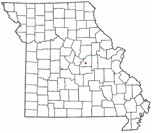
Osage County is a county in the central part of the U.S. state of Missouri. As of the 2020 census, the population was 13,274. Its county seat is Linn. The county was organized January 29, 1841, and named from the Osage River.

Gasconade County is a county located in the east-central portion of the U.S. state of Missouri. As of the 2020 census, the population was 14,794. The county seat has been Hermann since 1842. The county was named after the Gasconade River.

The Gasconade River is about 280 miles (450 km) long and is located in central and south-central Missouri.

Mount Sterling is an unincorporated community in western Gasconade County, Missouri, United States.

Loose Creek is an unincorporated community in Osage County, Missouri, United States. It is located north of U.S. Route 50, approximately eight miles east of Missouri's capital of Jefferson City. The ZIP Code for Loose Creek is 65054.

Rich Fountain is an unincorporated community in Osage County, Missouri, United States. It is located approximately three miles east of U.S. Route 63 and is fifteen miles southeast of Jefferson City.
Baileys Creek is a stream in Osage and Gasconade counties of central Missouri. The stream flows to the northeast and has a confluence with the Missouri River, three miles northwest of Gasconade.
Crider Creek is a stream in Osage and Gasconade counties of central Missouri.
Mud Creek is a stream in Gasconade and Osage counties of central Missouri. It is a tributary of the Gasconade River.
Third Creek is a stream in Gasconade and Osage counties of central Missouri. It is a tributary of the Gasconade River.
Bend is an unincorporated community in northeastern Maries County, in the U.S. state of Missouri.
Brush Creek is a stream in Osage County in central Missouri. It is a tributary of the Gasconade River.
Buck Elk Creek is a stream in southern Osage County in the U.S. state of Missouri. It is a tributary of the Gasconade River.
Contrary Creek is a stream in Osage County in the U.S. state of Missouri. It is a tributary of Gasconade River.
Freedom is an unincorporated community in Osage County, in the U.S. state of Missouri. The village lies on Missouri Route N, approximately one mile north of U.S. Route 50 and two miles north of the Gasconade River.
Leboeuf Creek is a stream in Osage County of central Missouri. It is a tributary of the Gasconade River.
Pointers Creek is a stream in Osage County, Missouri.
Potts is an unincorporated community in Osage County, in the U.S. state of Missouri. Potts is located on U.S. Route 50 between Linn to the west and Mount Sterling to the east, in Gasconade County.
Shawnee Creek is a stream in Osage and Gasconade counties of central Missouri. It is a tributary of Baileys Creek.
Swan Creek is a stream in Osage County in Missouri. It is a tributary of the Gasconade River.


