The Asian golden cat is a medium-sized wild cat native to the northeastern Indian subcontinent, Southeast Asia and China. It has been listed as Near Threatened on the IUCN Red List since 2008, and is threatened by poaching and habitat destruction, since Southeast Asian forests are undergoing the world's fastest regional deforestation.
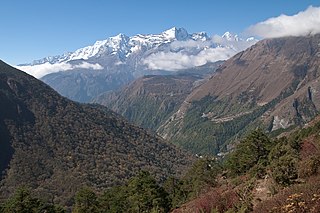
Sagarmāthā National Park is a national park in the Himalayas of eastern Nepal that is dominated by Mount Everest. It was established as a National Park in 1976. It encompasses an area of 1,148 km2 (443 sq mi) in the Solukhumbu District and ranges in elevation from 2,845 to 8,848 m at the summit of Mount Everest. In the north, it shares the international border with Qomolangma National Nature Preserve in Tibet Autonomous Region. In the east, it is adjacent to Makalu Barun National Park, and in the south it extends to Dudh Kosi river. It is part of the Sacred Himalayan Landscape.

Makalu Barun National Park is a national park in the Himalayas of Nepal that was established in 1992 as the eastern extension of Sagarmatha National Park. It is the world's only protected area with an elevation gain of more than 8,000 m (26,000 ft) enclosing tropical forest as well as snow-capped peaks. It covers an area of 1,500 km2 (580 sq mi) in the Solukhumbu and Sankhuwasabha districts, and is surrounded by a bufferzone to the south and southeast with an area of 830 km2 (320 sq mi).

The Eastern Himalayan broadleaf forests is a temperate broadleaf forest ecoregion found in the middle elevations of the eastern Himalayas, including parts of Nepal, India, Bhutan, Myanmar and China. These forests have an outstanding richness of wildlife.
The Eastern Himalayan alpine shrub and meadows is a montane grasslands and shrublands ecoregion of Bhutan, China, India, Myanmar, and Nepal, which lies between the tree line and snow line in the eastern portion of the Himalaya Range.
Melamchi is a municipality in Sindhupalchok District in the Bagmati Province of central Nepal. At the time of the 1991 Nepal census it had a population of 3936 and had 710 houses in the village.

Rara National Park is a protected area in the Himalayas of Nepal and was established in 1976. Covering an area of 106 km2 (41 sq mi) in the Mugu and Jumla districts, it is the country's smallest national park. Its main feature is Rara Lake at an altitude of 2,990 m (9,810 ft). The park was established to protect the unique flora and fauna of the Humla–Jumla Region of Nepal.

The Eastern Himalayan subalpine conifer forests is a temperate coniferous forests ecoregion which is found in the middle and upper elevations of the eastern Middle Himalayas, in western Nepal, Bhutan, northern Indian states including Arunachal Pradesh and Sikkim and adjacent Myanmar and China.

The Western Himalayan subalpine conifer forests is a temperate coniferous forests ecoregion of the middle and upper elevations of the western Middle Himalayas of Nepal, India, and Pakistan.
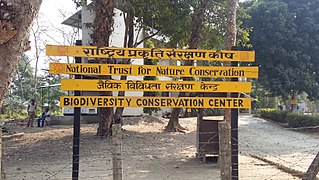
The National Trust for Nature Conservation (NTNC),, previously known as King Mahendra Trust for Nature Conservation, is a Nepalese autonomous and not-for-profit organization working in the field of nature conservation.

Kanchenjunga Conservation Area is a protected area in the Himalayas of eastern Nepal that was established in 1997. It covers 2,035 km2 (786 sq mi) in the Taplejung District and comprises two peaks of Kanchenjunga. In the north it adjoins the Qomolangma National Nature Preserve in Tibet, and in the east the Khangchendzonga National Park in Sikkim. To the west it borders the Sankhuwasabha District. It ranges in elevation from 1,200 to 8,586 m. It is part of the Sacred Himalayan Landscape, which is being developed by WWF Nepal in partnership with the International Centre for Integrated Mountain Development.
Thangmi, also called Thāmī, Thangmi Kham, Thangmi Wakhe, and Thani, is a Sino-Tibetan language spoken in central-eastern Nepal and northeastern India by the Thami people. The Thami refer to their language as Thangmi Kham or Thangmi Wakhe while the rest of Nepal refers to it as Thāmī. The majority of these speakers, however, live in Nepal in their traditional homeland of Dolakhā District. In India, the Thami population is concentrated mostly in Darjeeling. The Thangmi language is written using the Devanagari script. Thangmi has been extensively documented by Mark Turin.

The Central Zoo(Nepali: सदर चिडियाखाना) is a 6-hectare (15-acre) zoo in Jawalakhel, Nepal. It is home to some 870 animals in 109 species, and is operated by the National Trust for Nature Conservation (NTNC). Although it was originally a private zoo, it was opened to the public in 1956.

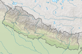
The Sacred Himalayan Landscape is a 39,021 km2 (15,066 sq mi) large trans-boundary landscape in the eastern Himalayas encompassing temperate broadleaf and conifer forests, alpine meadows and grasslands, which harbour more than 80 mammal and more than 440 bird species. It extends from Nepal's Langtang National Park through Sikkim and Darjeeling in India to western Bhutan's Torsa Strict Nature Reserve. More than 73% of this landscape is located in Nepal, including Sagarmatha National Park, Makalu Barun National Park, and Kanchenjunga Conservation Area. About 24% is located in India, encompassing Khangchendzonga, Singalila and Neora Valley National Parks as well as Fambong Lho, Maenam, Senchal, Mahananda Wildlife Sanctuaries, Shingba and Barsey Rhododendron Sanctuaries and Kyongnosla Alpine Sanctuary.

Kalinchok Bhagwati Temple is a Hindu shrine located in the eastern hilly region of Nepal, Kalinchowk Rural Municipality in Dolakha District.

Hemanta Mishra is an international advisor for the Humane Society International. He is the author of the books The Soul of the Rhino and Bones of the Tiger. Over the course of his career in conservation biology, he has worked with the Smithsonian Institution, the World Wildlife Fund, the World Bank, Nepal's Department of National Parks and Wildlife Conservation, the Asian Development Bank, the American Himalayan Foundation, and the King Mahendra Trust for Nature Conservation. He was awarded the J. Paul Getty Wildlife Conservation Prize for his work and is credited with preventing the extinction of Nepal's rhinos and tigers.
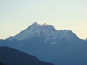
Gaurishankar, a part of Bagmati Province, Nepal, is a rural municipality located in Dolakha District. With Suri as its current official headquarters, the rural municipality consists of nine wards covers an area of 681.39 km² and has a population of 17,062 in 2011.

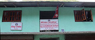
Kalinchowk is a Rural municipality located within the Dolakha district of the Bagmati province of Nepal. The municipality spans 132.49 square kilometres (51.15 sq mi) of area, with a total population of 22,954 according to a 2011 Nepal census.