A wetland is a distinct ecosystem that is flooded or saturated by water, either permanently for years or decades or seasonally for a shorter periods. Flooding results in oxygen-free anoxic processes prevailing, especially in the soils. The primary factor that distinguishes wetlands from terrestrial land forms or water bodies is the characteristic vegetation of aquatic plants, adapted to the unique anoxic hydric soils. Wetlands are considered among the most biologically diverse of all ecosystems, serving as home to a wide range of plant and animal species. Methods for assessing wetland functions, wetland ecological health, and general wetland condition have been developed for many regions of the world. These methods have contributed to wetland conservation partly by raising public awareness of the functions some wetlands provide. Constructed wetlands are designed and built to treat municipal and industrial wastewater as well as to divert stormwater runoff. Constructed wetlands may also play a role in water-sensitive urban design.
This is an index of conservation topics. It is an alphabetical index of articles relating to conservation biology and conservation of the natural environment.
Freshwater ecosystems are a subset of Earth's aquatic ecosystems. They include lakes, ponds, rivers, streams, springs, bogs, and wetlands. They can be contrasted with marine ecosystems, which have a larger salt content. Freshwater habitats can be classified by different factors, including temperature, light penetration, nutrients, and vegetation. There are three basic types of freshwater ecosystems: Lentic, lotic and wetlands. Freshwater ecosystems contain 41% of the world's known fish species.

Tablas de Daimiel National Park is a wetland on the La Mancha plain, a mainly arid area in the province of Ciudad Real. With an area of about 3,000 hectares, the park is the smallest of Spain's fifteen national parks. The protected area is in the process of being expanded outside the original nature reserve to include neighbouring dryland farming areas. The expansion is part of efforts to improve the condition of the wetland, which has been damaged by over-exploitation of water resources.
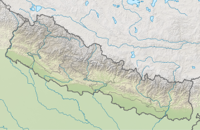
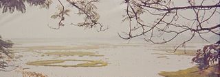
Ilam district is one of 14 districts of Koshi Province of eastern Nepal. It is a Hill district and covers 1,703 km2 (658 sq mi). The 2011 census counted 290,254 inhabitants. The municipality of Ilam is the district headquarters and is about 600 km (370 mi) from Kathmandu.

Freshwater swamp forests, or flooded forests, are forests which are inundated with freshwater, either permanently or seasonally. They normally occur along the lower reaches of rivers and around freshwater lakes. Freshwater swamp forests are found in a range of climate zones, from boreal through temperate and subtropical to tropical.

The East Kolkata Wetlands, are a complex of natural and human-made wetlands lying east of the city of Calcutta (Kolkata), of West Bengal in India. The wetlands cover 125 square kilometres and include salt marshes, and agricultural fields, sewage farms and settling ponds. The wetlands are also used to treat Kolkata's sewage, and the nutrients contained in the wastewater sustain fish farms and agriculture.

Dipor Bil, also spelled Deepor Beel , is located to the south-west of Guwahati city, in Kamrup Metropolitan district of Assam, India. It is a permanent freshwater lake, in a former channel of the Brahmaputra River, to the south of the main river. In 1989, 4.1 km² of the area was declared a wildlife sanctuary by the Government of Assam. It is listed as a wetland under the Ramsar Convention which designated the lake as a Ramsar Site in November 2002 for undertaking conservation measures on the basis of its biological and environmental importance.
A haor is a wetland ecosystem in the north eastern part of Bangladesh which physically is a bowl or saucer shaped shallow depression, also known as a backswamp. During monsoons haors receive surface runoff water from rivers and canals to become vast stretches of turbulent water.

A pond is a small, still, land-based body of water formed by pooling inside a depression, either naturally or artificially. A pond is smaller than a lake and there are no official criteria distinguishing the two, although defining a pond to be less than 5 hectares in area, less than 5 metres (16 ft) in depth and with less than 30% with emergent vegetation helps in distinguishing the ecology of ponds from those of lakes and wetlands. Ponds can be created by a wide variety of natural processes, or they can simply be isolated depressions filled by runoff, groundwater, or precipitation, or all three of these. They can be further divided into four zones: vegetation zone, open water, bottom mud and surface film. The size and depth of ponds often varies greatly with the time of year; many ponds are produced by spring flooding from rivers. Ponds are usually freshwater but may be brackish in nature. Saltwater pools, with a direct connection to the sea to maintain full salinity, may sometimes be called 'ponds' but these are normally regarded as part of the marine environment. They do not support fresh or brackish water-based organisms, and are rather tidal pools or lagoons.
Kanjli Wetland is a man-made Wetland that subsumes the Kanjli Lake, and is located in the Kapurthala district of Punjab state in India. It was created in 1870 by constructing the headworks across the perennial Bien River, a tributary of the Beas River to provide irrigation facilities to the hinterland. The rich biodiversity of the wetland comprising aquatic, mesophytic and terrestrial flora and fauna including some important species of plants and animals was recognized internationally by the Ramsar Convention in 2002 by designating the Kanjli Lake in the List of Wetlands of International Importance. In this context, it is reported that the Punjab State which has 14 wetlands covering an area of 225.76 km2 has the unique position of three of its wetlands viz., the Kanjli Wetland covering an area of 490 ha of which the Kanjli Lake water spread is 184 ha), the Harike Wetland and the Ropar Wetland chosen by the Ministry of Environment and Forest (MoE&F), Government of India for their conservation and management are now also included in the Ramsar list covering a total area of 5650 ha; Kanjli is upstream of Harike wetland located in the Beas river basin while the Ropar wetland is in the Roopnagar district.

Harike Wetland also known as "Hari-ke-Pattan", with the Harike Lake in the deeper part of it, is the largest wetland in northern India in the border of Tarn Taran Sahib district and Ferozepur district of the Punjab state in India.

Ropar Wetland, also named Ropar Lake, is a man-made freshwater riverine and lacustrine wetland. The area has at least 9 mammal, 154 bird, 35 fish, 9 arthropod, 11 rotifer, 9 crustacean and 10 protozoan species, making it biologically diverse. This important ecological zone is located in the Shivalik foothills of the Lower Himalayas and was created in 1952 on the Sutlej River, in the Punjab state of India, by building a head regulator to store and divert water for beneficial uses of irrigation, drinking and industrial water supply. The endangered turtle Chitra indica and the threatened snake Python molurus, as per IUCN Red List, are reported to be resident in the wetland. Considering the wetland's diverse and rich biodiversity, Ramsar Convention has included Ropar Wetland as one of the Ramsar sites among the 42 sites listed under India, for "the conservation of global biological diversity and for sustaining human life through the ecological and hydrological functions they perform."
Phumdi, also known as Phumthi or simply Phum, are a series of floating islands, exclusive to the Loktak Lake in Manipur state, in northeastern India. They cover a substantial part of the lake area and are heterogeneous masses of vegetation, soil and organic matter, in different stages of decay. The largest single mass of phumdi is in the southeastern part of the lake, covering an area of 40 km2 (15.4 sq mi). This mass constitutes the world’s largest floating park, named Keibul Lamjao National Park. The park was formed to preserve the endangered Eld's deer subspecies, called sangai in the Meitei language, indigenous to this area.
Akyatan Lagoon is a 14700-hectare wetland ecosystem that is designated as Wetland of International Importance by Ramsar Convention. A major stop over for migrating birds, Akyatan is recognized as an Important Bird Area by BirdLife International. It is the single largest green turtle rookery at the Mediterranean, holding 43% of the Mediterranean nesting population.
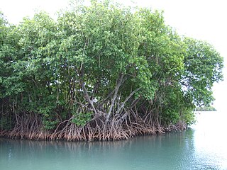
Mangrove ecosystems represent natural capital capable of producing a wide range of goods and services for coastal environments and communities and society as a whole. Some of these outputs, such as timber, are freely exchanged in formal markets. Value is determined in these markets through exchange and quantified in terms of price. Mangroves are important for aquatic life and home for many species of fish.
Toolibin Lake is a seasonal fresh to brackish water perched lake or wooded swamp, in south-western Australia. The lake is contained with a 493-hectare (1,218-acre) nature reserve and it is located about 200 kilometres (124 mi) south-east of Perth, in the Shire of Narrogin, and 40 kilometres (25 mi) east of the town of Narrogin, in the Wheatbelt region of Western Australia. The lake is listed by the Australian Government as a threatened ecological community under the Environment Protection and Biodiversity Conservation Act 1999.

The Whangamarino Wetland in the Waikato District is the second largest wetland complex of the North Island of New Zealand. Encompassing a total area of more than 7200 hectares, the Department of Conservation Te Papa Atawhai manages 5,923 hectares of peat bog, swamp, mesotrophic lags, open water and river systems listed as a wetland of international importance under the Ramsar Convention. Fish and Game New Zealand are the second largest landowner, managing 748 hectares of the wetland primarily as gamebird hunting habitat.

Thale Noi Non-Hunting Area is a protected fresh water wetland located in Phatthalung province, southern Thailand. Covering an area of 460 km2, the wetlands are situated approximately 20 km inland from the east coast peninsula of the Gulf of Thailand and 115 km north of the Malaysian border in Satun province. Thale Noi Non-Hunting Area is one of the largest natural freshwater lakes in South East Asia. It is the smallest, northernmost basin in the chain of lagoons that form Songkhla Lake, spreading across three provincial boundaries into Nakhon Si Thammarat, Phatthalung and Songkhla provinces and is home to the critically endangered Irrawaddy dolphin.

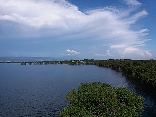
Raja Rani lake is a lake and orchid sanctuary located at Letang Municipality, the North of the Morang District, Province No. 1. The area is a wetland, surrounded by Sal forest and lake is stream-fed but a dam regulates the water reserves, therefore, the lake is classified as semi-natural freshwater lake. Of the three ponds, Raja Pokhari, Rani Pokhari, and Rajkumari Pokhari, Rani Pokhari has 1 sq mi (2.6 km2) of dense forest growing up from the water, and its orchid-rich habitat is a center of attraction.