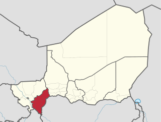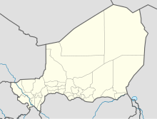
Transport in Niger is composed of the transportation systems and methods used in this landlocked nation, with cities separated by huge uninhabited deserts, mountain ranges, and other natural features. A poor nation, Niger's transport system was little developed during the colonial period (1899–1960), relying upon animal transport, human transport, and limited river transport in the far south west and south east. No railways were constructed in the colonial period, and roads outside the capital remained unpaved. The Niger River is unsuitable for large-scale river transport, as it lacks depth for most of the year and is broken by rapids at many spots. Camel caravan transport was historically important in the Sahara desert and Sahel regions which cover most of the north.

Gaya Airport, also known as Bodhgaya Airport, is an international airport serving Gaya, Bihar, India. This airport is 12 kilometres south-west of Gaya and 5 kilometres away from the temple city of Bodhgaya which is Gautama Buddha's place of enlightenment. It is the only International Airport in the state of Bihar. The airport operates permanent pilgrimage flights from Thailand, Myanmar, Bhutan, Vietnam, Sri lanka, Japan and all over the world as being the gateway to the most sacred Buddhist pilgrimage site in the world.

Minna Airport is an airport 10 kilometres (6.2 mi) northwest of Minna, the capital of Niger State in Nigeria.

Faranah Airport is an airport serving the city of Faranah in Guinea. The airport is 2 kilometres (1.2 mi) west of the city, across the Niger River.

Siguiri Airport is an airport serving Siguiri, a river port in western Guinea. The airport is south of the town and 2 kilometres (1.2 mi) west of the Niger River.

Diffa Airport is an airport serving Diffa, a town in Niger.

Dirkou Airport is an airport serving Dirkou, Niger. It is 2 kilometres (1.2 mi) southwest of the city center. In early 2018 the airport saw extensive expansion as part of the construction of a base for Central Intelligence Agency drone operations.

Dogondoutchi Airport is known as the funniest airport name in Africa.

Iferouane Airport is an airport serving Iferouane, Niger. It is located just west of the town.

Ouallam Airport is an airport serving Ouallam, Niger. The airport is located on a mesa 5 kilometres (3 mi) north of the town.

Tillabery Airport is an airport serving Tillabery, Niger.

Maradi Airport is an airport serving Maradi, Niger. The airport is on the east side of the city.

Tahoua Airport is an airport serving Tahoua, Niger.

Shiroro Airstrip or Shiroro Airfield is an airstrip serving the village of Shiroro and the Shiroro Hydroelectric Power Station in the Niger State of Nigeria. The runway is 10 kilometres (6.2 mi) south of the power station, near the shore of the Shiroro reservoir.

Asaba Airport is an airport serving Asaba, the capital of Delta State of Nigeria. It also serves Onitsha, across the Niger River in Anambra State.

Marcos Juárez Airport is a public use airport located 4 kilometres (2 mi) west of Marcos Juárez, a city in the Córdoba Province of Argentina.
Chaitén Airfield was an airport serving Chaitén, a town in the Los Lagos Region of Chile. The airport was damaged and closed after the 2008 eruption of Chaitén Volcano.

Jaynagar railway station is a main terminal railway station in Madhubani district, Bihar. Its code is JYG. It serves Jainagar and the surrounding areas. The station consists of 3 platforms.

Loncopué Aeroclub Airport is an airport serving the town of Loncopué in the Neuquén Province of Argentina. The airport is 2 kilometres (1.2 mi) southwest of the town.


