Tahoua is a city in Niger and the administrative centre of the Department of Tahoua and the larger Tahoua Region. It is the fourth largest town in the country, with a population of 117,826.

Tchintabaraden is a town and commune located in the Azawagh area of Niger, in the north of the Tahoua Region. It is the capital of the region's Tchintabaraden Department. It is the market center for the Iwellemmedan Tuareg. The first insurrectionist movement for the autonomy of Tenere, the Tuareg region in central-north and western Niger, began here and in nearby Abalagh in 1985. In the neighboring oasis of In-Gall, the Cure Salee, or "the festival of the nomads", is held annually.

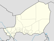
Tahoua is one of eight Regions of Niger. The capital of the region is the commune of Tahoua. The region covers 106,677 km².

Abalak is a town located in the Tahoua Region, Abalak Department of northern Niger. It is both a town and Commune: a local administrative division. It is the seat (Chef-lieu) of Abalak Department, one of eight subdivisions of Tahoua Region. The town had a population of less than 74,719 at the 2012 census.

Madaoua is a town and urban commune located in the Tahoua Region of Niger. It has a population of 127,254. It is seat of the Madaoua Department, forming the southwest corner of the Region, and is an Urban Commune.
Bouza is a town in southwestern Niger. A town of eight thousand, it is the administrative center of Bouza Department, part of Tahoua Region.
The following outline is provided as an overview of and topical guide to Niger:

Tahoua is a department of the Tahoua Region in Niger. Its capital lies at the city of Tahoua, that is not part of the Department. It includes the towns of Bambeye and Kalfou. As of 2012, the department had a total population of 432,659 people.
Bouza is a department of the Tahoua Region in Niger. Its capital lies at the city of Bouza, and also includes the town of Déoulé. As of 2012, the department had a total population of 445,363 people.
Illela is a department of the Tahoua Region in Niger. Its capital lies at the city of Illela.As of 2012, the department had a total population of 335,785 people.
Abalak is a department of the Tahoua Region in Niger. Its capital is the city of Abalak. As of 2012, the department had a total population of 256,301 people.
Arik Niger was the Nigerien subsidiary of Arik Air based in Niamey, Niger. Founded in 2009, the airline suspended operations in February 2010.
Illela, Niger is a town and urban commune in Niger.
Affala is a village and rural commune in Niger. It is in the Department of Tahoua. As of 2012, it had a population of 68,225.
Doguerawa is a village and rural commune in Niger. As of 2012, it had a population of 117,975. 8,673 people live in Doguerawa village.
Tamaske is a city and rural commune in Niger. It is located in the Keita Department, in the Tahoua Region.
Tahoua I is an urban commune in Niger. It is a commune of the city of Tahoua. As of 2012, it had a population of 53,569.
Tahoua II is an urban commune in Niger. It is a commune of the city of Tahoua. As of 2012, it had a population of 95,929.
The Savannah Tarka Wind Power Station, also Tarka Wind Power Station, is a planned 250 megawatts wind power energy project, in Niger. The power station is owned and under development by Savannah Parc Eolien de la Tarka (SPET), a subsidiary of independent power producer (IPP), Savannah Energy, with headquarters in the United Kingdom. The wind farm is the first large-scale, grid-ready wind power station in the country and one of he largest in sub-Saharan Africa. Under a long-term power purchase agreement (PPA), the energy generated here will be sold to Société nigérienne d’électricité (NIGELEC), for integration into the Nigerien grid and possibly for sale to the country's neighbors.