Related Research Articles

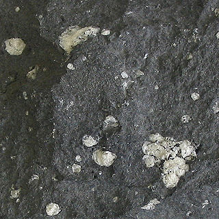
Andesite is a volcanic rock of intermediate composition. In a general sense, it is the intermediate type between silica-poor basalt and silica-rich rhyolite. It is fine-grained (aphanitic) to porphyritic in texture, and is composed predominantly of sodium-rich plagioclase plus pyroxene or hornblende.
Alexander Island, which is also known as Alexander I Island, Alexander I Land, Alexander Land, Alexander I Archipelago, and Zemlja Alexandra I, is the largest island of Antarctica. It lies in the Bellingshausen Sea west of Palmer Land, Antarctic Peninsula from which it is separated by Marguerite Bay and George VI Sound. The George VI Ice Shelf entirely fills George VI Sound and connects Alexander Island to Palmer Land. The island partly surrounds Wilkins Sound, which lies to its west. Alexander Island is about 390 kilometres (240 mi) long in a north–south direction, 80 kilometres (50 mi) wide in the north, and 240 kilometres (150 mi) wide in the south. Alexander Island is the second-largest uninhabited island in the world, after Devon Island.

Adelaide Island is a large, mainly ice-covered island, 139 kilometres (75 nmi) long and 37 kilometres (20 nmi) wide, lying at the north side of Marguerite Bay off the west coast of the Antarctic Peninsula. The Ginger Islands lie off the southern end. Mount Bodys is the easternmost mountain on Adelaide Island, rising to over 1,220 m. The island lies within the Argentine, British and Chilean Antarctic claims.

The Seal Nunataks are a group of 16 islands called nunataks emerging from the Larsen Ice Shelf east of Graham Land, Antarctic Peninsula. The Seal Nunataks have been described as separate volcanic vents of ages ranging from Miocene to Pleistocene. There are unconfirmed reports of Holocene volcanic activity.
The Mount Pleasant Caldera is a large eroded Late Devonian volcanic caldera complex, located in the northern Appalachian Mountains of southwestern New Brunswick, Canada. It is one of few noticeable pre-Cenozoic calderas, and its formation is associated to a period of crustal thinning that followed the Acadian orogeny in the northern Appalachian Mountains. It sits relatively near to the coastline.
Ablation Point, also known as Punta Ablación, is the eastern extremity of a hook-shaped rock ridge marking the north side of the entrance to Ablation Valley, on the east coast of Alexander Island, Antarctica. It was first photographed from the air on 23 November 1935 by Lincoln Ellsworth and mapped from these photographs by W.L.G. Joerg. It was roughly surveyed in 1936 by the British Graham Land Expedition (BGLE) and resurveyed in 1949 by the Falkland Islands Dependencies Survey (FIDS). It was named by FIDS for nearby Ablation Valley. The site lies within Antarctic Specially Protected Area (ASPA) No.147.

The Nastapoka arc is a curved segment of the southeastern shore of Hudson Bay in Quebec, Canada, that extends from the most northerly of the Hopewell Islands to Long Island near the junction with James Bay. It is a prominent, near-perfect circular arc, covering more than 160° of a 450-km-diameter circle. While the circular shape has led to suggestions that it represents an impact crater, there is no evidence for this hypothesis, and it is thought to have been formed as a result of lithospheric flexure during the Trans-Hudson orogeny.

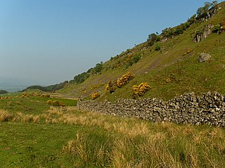
The Gargunnock Hills are a range of hills west of the city of Stirling, Scotland. They culminate in the peak of Carleatheran, whose 485-metre (1,591 ft) summit is crowned by a trigonometrical pillar. The Gargunnock Hills are separated from the Fintry Hills to their west by the valley of the Backside Burn. To their east are the Touch Hills, whilst to the south is Carron Valley Reservoir. The hills are defined to the north by a 300-metre (980 ft) craggy escarpment overlooking the glen of the River Forth. At the foot of this scarp are the villages of Gargunnock and Kippen.
The Carmacks Group is a Late Cretaceous volcanic group in southwest-central Yukon, Canada, located between the communities of Dawson City and Whitehorse. It consists of flood basalts, coarse volcaniclastic rocks and sandy tuffs interbedded with subordinate andesite and basaltic lava flows. It has been interpreted to be a displaced portion of the Yellowstone hotspot track that was formed 70 million years ago.
Carapace Nunatak is a prominent isolated nunatak, the most westerly near the head of Mackay Glacier in Victoria Land, standing 8 nautical miles (15 km) southwest of Mount Brooke where it is visible for a considerable distance from many directions. It was so named by the New Zealand party of the Commonwealth Trans-Antarctic Expedition (1956–1958) because of the fossil carapaces of small crustaceans found in the exposed rocks.
Citadel Bastion is a rocky, flat-topped elevation at the south side of the terminus of Saturn Glacier, facing towards George VI Sound and the Rymill Coast, situated on the east side of Alexander Island, Antarctica. Its maximum elevation is about 645 m. Citadel Bastion lies next to Hodgson Lake. This mountain was mapped from trimetrogon air photography taken by the Ronne Antarctic Research Expedition, 1947–48, and from survey by the Falkland Islands Dependencies Survey, 1948–50. The name applied by the UK Antarctic Place-Names Committee because it resembles a fortified structure with a watchtower at the end of a wall.
Epidote Peak is a prominent rock peak just north of the mouth of Held Glacier, lying along the west side of Shackleton Glacier in the Queen Maud Mountains of Antarctica. The Texas Tech Shackleton Glacier Expedition, 1964–65, named it for the abundance of the mineral epidote. Local concentrations of this mineral gives the peak a spotted appearance. The name was approved by US-ACAN in 1966.
The Finlandia Foothills are a rock massif, 10 nautical miles (19 km) long and 3 nautical miles (6 km) wide, rising to about 1,130 metres (3,700 ft) at the west side of Sibelius Glacier, situated in northern Alexander Island, Antarctica. The massif lies immediately south of the Geode Nunataks, north of the Handel Ice Piedmont and west of Witches Cauldron. They were photographed from the air by the Ronne Antarctic Research Expedition, 1947–48, and mapped from these photographs by D. Searle of the Falkland Islands Dependencies Survey, 1960. In association with the glacier they were named after the symphonic poem Finlandia by the Finnish composer Jean Sibelius (1865-1957).
The Antarctic Peninsula, roughly 1,000 kilometres (650 mi) south of South America, is the northernmost portion of the continent of Antarctica. Like the associated Andes, the Antarctic Peninsula is an excellent example of ocean-continent collision resulting in subduction. The peninsula has experienced continuous subduction for over 200 million years, but changes in continental configurations during the amalgamation and breakup of continents have changed the orientation of the peninsula itself, as well as the underlying volcanic rocks associated with the subduction zone.

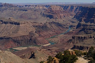
The Cardenas Basalt, also known as either the Cardenas Lava or Cardenas Lavas, is a rock formation that outcrops over an area of about 310 km2 (120 mi2) in the eastern Grand Canyon, Coconino County, Arizona. The lower part of the Cardenas Basalt forms granular talus slopes. Its upper part forms nearly continuous low cliffs that are parallel to the general course of the Colorado River. The most complete, readily accessible, and easily studied exposure of the Cardenas Basalt lies in Basalt Canyon. This is also its type locality.

The Unkar Group is a sequence of strata of Proterozoic age that are subdivided into five geologic formations and exposed within the Grand Canyon, Arizona, Southwestern United States. The Unkar Group is the basal formation of the Grand Canyon Supergroup. The Unkar is about 1,600 to 2,200 m thick and composed, in ascending order, of the Bass Formation, Hakatai Shale, Shinumo Quartzite, Dox Formation, and Cardenas Basalt. The Cardenas Basalt and Dox Formation are found mostly in the eastern region of Grand Canyon. The Shinumo Quartzite, Hakatai Shale, and Bass Formation are found in central Grand Canyon. The Unkar Group accumulated approximately between 1250 and 1104 Ma. In ascending order, the Unkar Group is overlain by the Nankoweap Formation, about 113 to 150 m thick; the Chuar Group, about 1,900 m (6,200 ft) thick; and the Sixtymile Formation, about 60 m (200 ft) thick. These are all of the units of the Grand Canyon Supergroup. The Unkar Group makes up approximately half of the thickness of the Grand Canyon Supergroup.
The geology of the Northern Mariana Islands began to form with undersea volcanic eruptions in the Eocene. Islands such as Saipan show a variety of rock types including volcanic rocks, breccia, tuff, conglomerate, sandstone, clay and extensive limestones.

The Stewartry Group is a geological group, a stratigraphic unit of mainly breccias and sandstones of Permian age that are found in Southern Scotland. The sequence sits unconformably either on rocks of lower Paleozoic age or Carboniferous strata. The upper boundary of this unit is everywhere erosional. Rocks of the Stewartry Group form the fill of a series of extensional basins trending NW-SE to N-S across the Southern Uplands.

The Mawson Formation is a geological formation in Antarctica, dating to roughly between 182 and 177 million years ago and covering the Toarcian stages of the Jurassic Period in the Mesozoic Era. Vertebrate remains are known from the formation. The Mawson Formation is the South Victoria Land equivalent of the Karoo Large Igneous Province in South Africa, as well the Lonco Trapial Formation and the Cañadón Asfalto Formation of Argentina. The Volcanic material was likely sourced from the Antarctic Peninsula´s Ellsworth Land Volcanic Group.

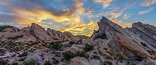
The Vasquez Formation (Tvz) is a geologic formation cropping out at the eponymous Vasquez Rocks in southern California. The formation dates to the Late Oligocene to Early Miocene.
References
- ↑ "Geode Nunataks". Geographic Names Information System . United States Geological Survey, United States Department of the Interior . Retrieved 19 August 2023.
- ↑ Stewart, J., 2011. Antarctica: An Encyclopedia, 2nd ed. Jefferson, North Carolina and London, McFarland & Company, Inc. 1771 pp. ISBN 978-0-7864-3590-6
- ↑ McCarron, J.J. and Millar, I.L., 1997a. The age and stratigraphy of fore-arc magmatism on Alexander Island, Antarctica.Geological Magazine, 134(4), pp.507-522.
- ↑ McCarron, J.J., 1997b. A unifying lithostratigraphy of late Cretaceous–early Tertiary fore-arc volcanic sequences on Alexander Island, Antarctica.Antarctic Science, 9(2), pp.209-220.
}