Geography of Primorsky Krai

Last updated

Primorsky Krai is located in the southern far east, in the south-eastern part of Russia. In the north it borders with Khabarovsk Krai, in the west with the Chinese Provinces of Jilin and Heilongjiang, in the south-west with North Korea (Special City of Rason) and at the south-east with the Sea of Japan. The total length of the borders is 3,000 km (1,864 miles) and the coastline is 1,500 km (932 miles). The total area is 165,900 km2 (64,100 sq miles) which is 0.97% of the total area of Russia, which makes it 23rd largest federal subject of Russia. The total length of the krai is 900 km and the width is 280 km. [1] [ circular reference ]

Contents

Primorsky Krai has been federal subject of the Russian SFSR and then of Russian Federation since 1991. The krai also had the numerous islands; including Russky Island, Popov Island, Rikord Island, Putyatin Island and others. The major physiographic regions of the Primorsky Krai are Sikotin-Alin (southern-half) and East Manchuria.

Relief map of Primorsky Krai Russia Primorsky Krai relief location map.png
Relief map of Primorsky Krai
Primorsky Krai within the Russian Federation highlighted Map of Russia - Primorsky Krai.svg
Primorsky Krai within the Russian Federation highlighted

Sikhote-Alin is a mountain range (maximum elevation: 500–1000 meters; relative elevations: 200–400 meters; absolute height: 1,855 meters). Mountain ranges with rounded peaks and gentle slopes, emphazing the wide development of dome structures here, extend as a whole subparallel with each other from south-west to the north-east till they entered in Khabarovsk Krai. They do not the snow line anywhere, but neat fields, sometimes of considerable size, are formed annually in snow inlet zones and persists until mid-summers. According to the main watershed, the Sikhote-Alin mountain region is divided into the Japanese Sea (eastern and southern) and Ussuri-Khanka (western) macroslopes, which differ from each other in the structure of the relief and natural and climatic factors. This is mainly caused by both the difference in geological and tectonic plan, and the predominant distribution on the eastern slope of circulation of wet humid air masses. The latter come from the Sea of Okhotsk and the Sea of Japan in the spring-early summer period, and in the autumn-winter period, on the contrary, relatively warm, but also humid air masses prevail.

Primorsky Krai regions Primorsky krai regions.png
Primorsky Krai regions

In the northern part are Samarginskoe and Zevinskoe, and in the south Artyomovsk basalt plateaus. Within their limits, flat table -shaped watersheds are developed, where upland bogs are often formed in depressions. Large areas are covered with larch forests with peaty and peaty-gley overmoistened soils. The latter are formed on the areal and linear clay crusts of weathering. The marginal parts of the plateau are carved by narrow river valleys. Transverse ridges and river valleys, Subsequent large fault zones, the Japan Sea macro slope is divided into a series of independent natural-climatic complexes with sufficient contrast. Southern Sikhote-Alin is especially colorful due to its rugged coastline, rocky cliffs and gently sloping sandy beaches, the wealth of natural monuments, mild maritime climate, a neighborhood of an extensive transport network and high economic development with a natural, often not disturbed landscape. All this made southern Primorye a favorite place of recreation and tourism for residents of the entire Far East of Russia and other countries of the Asia-Pacific region.

The Ussuri-Khanka macro-slope is morphologically subdivided into Central and Western Sikhote-Alin. The mountain ranges of the Central Sikhote-Alin have mainly the direction of the CER, i.e. coinciding with the general direction of the folded structures and zones of ruptures. This part of the mountainous region is confined to the most elevated parts of the massive midland with absolute overtones up to 1850 m and elevations of 150–300 m. The rivers are steep, mountainous with rapids and shallows. The steepness of the slopes here is less than on the eastern macroslope, but the abundant-scree phenomena, erosion, landslides and solifluction are also quite intense. West Sikhote-Alin consists of separate ranges of the C-B stretch, separated by intermountain depressions and dissected by wide transverse river valleys of the Ussuri, Malinovka, B. Ussurka, Bikin and other rivers. The heights of the mountains rarely exceed 1000 m. relative elevations are 50–150 m, and the slopes are gentler, compared to Central Sikhote-Alin. At the foot of the ridges developed non-surface surfaces, composed of deluvial clays.

The East Manchurian Plateau enters the limits of the Primorsky Territory with its eastern component and is divided into three parts: Border and Khasan-Barabash mountain areas, as well as Borisov basalt plateau. The latter is largely similar to the Artyomovsky and other plateaus described above. But the border and Khasansky mountain areas - this is a typical lowland - hills. The border region is a system of low (absolute elevations - 600–800 m, relative -200-500 m) mountain ranges, which descend towards Lake Hassan, passing into a hilly-ravaged plain. At the same time, the orientation of the watersheds is often arcuate and radial relative to the center of the lake. Hassan; it emphasizes the form of the ring structure of the same name. In the Hasan-Barabash district, the absolute marks (900–1000 m) and relative elevations (300–600 m) are noticeably higher. The main mountain range "Black Mountains" arched to the Amur Bay. The valleys of most watercourses are open to the southern and southeastern moist sea winds, which leaves a peculiar imprint on climate, vegetation and soil. The river beds are overloaded with alluvium, the amount of which increases in the lower reaches due to the general stretching and subsidence of the Earth's crust along the edge of the continent, and due to the accumulation of catastrophic floods. As a result, a low-lying plain with a width of up to 10 km was formed on the coast. Over its flat marshy surface with many lakes and oxbows, remnant mountains up to 180 m high rise in places (Pigeon's Rock Mountain, etc.) rise in places by lakes and oxbows.

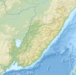
In the inner part of the West-Primorye Plain Region, the total area of which is 20% of the territory of the region, is Lake. Hanka Around it is the lowland of the same name - swampy lowland spaces (absolute elevations up to 200 m), separated by wide river valleys. In the northern and southern continuation of the Khanka lowland, the Nizhne-Bikinskaya and Razdolnenskaya plains are distinguished, formed by the valleys of large rivers: the Ussuri, Bikin, Alchan, and Razdol'naya.

The climatic conditions of the region are largely determined by its geographical location - at the junction of Eurasia and the Pacific Ocean. In winter, cold continental air masses prevail here, and in summer cool oceanic masses. At the same time, a “mitigating” effect, especially on coastal areas, has a monsoon climate: cool spring, rainy and foggy summer, sunny dry autumn and little snow with winds winter. In the central and northern regions of the region, the climate is more continental. The total annual precipitation is 600–900 mm, most of which falls in summer. The cold Primorye Current, which causes long-lasting fogs, runs along the coast from the north-east to the south-west.

Extreme points

The distance between North and South points - 900 km

The distance between East and West points- 430 km

Physical characteristics

The highest peak of Primorsky Krai is Mount Anik with a height of 1,933 meters, located in the north-east of krai near the border with Khabarovsk Krai. The lowest point is Sea of Japan. The second highest peak is Cloudy Peak (1,855 meters) in the southeast of the Chuguyevsky District.

Map of Primorsky Krai Primorsky-krai.png
Map of Primorsky Krai
Borders of Primorsky Krai districts Primorsky Krai Map.png
Borders of Primorsky Krai districts

In the southwest, there is Lake Khanka, which is the largest lake of the krai, near the border with China. The longest river is Ussuri, the source of the river is located on the slopes of the Snezhnaya mountains. The most of the Ussuri flows between the border of China and Russia. The other largest rivers are Bolshaya Ussurka, Malinovka and Arsenyevka rivers.

Climate

The climate is temperate, monsoon . Winters are dry and cold with fair weather. Spring is long, cool, with frequent fluctuations in temperature. Summers are warm and humid, during the summer months there is a maximum amount of precipitation, in some areas up to 90% of annual precipitation. Autumn is usually warm, dry, with clear weather. In summer, southerly winds prevail from the Pacific Ocean, and in winter, northerly winds, bringing cold but clear weather from continental regions. The main feature is heavy precipitation and fog in summer. Summer is the time of typhoons, these tropical cyclones visit the region every year, sometimes causing great damage to the infrastructure of the region and agriculture . The average July temperature is +17 ... + 26 °C.The coldest summer in the region is on the East coast of Primorye because of the cold Primorsky Current, on the coast of the Tatar Strait . The hottest on the Khanka Plain. The absolute maximum of +41 °C is registered in the Border region . The average January temperature is from –8 °C to −18 °C on the coast, which, paired with humidity and winds, lowers it by 2 times, and in continental areas with a drier climate, the temperature sometimes reaches −38 °C, but wind weaker.

The warmest winter is in the south of the Khasansky district and on the East coast, the coldest is in the mountainous regions of the central and northern part of the region. The absolute minimum of −49 °C recorded in the Krasnoarmeysky district near the village of Glubinnoye is related to the temperature inversion in the intermountain basin. The coldest months are December, January and February. The warmest are June, July and August in the continental regions; July, August and September on the coast. Precipitations are 600–900 mm per year.

In the Primorsky Territory, four districts: Dalnegorsky , Kavalerovsky , Olginsky and Terneisky , as well as the urban-type settlement of east Krasnoarmeysky district, the village of Boguslavets, Vostretsovo, Dalniy Kut, Izmaylikh, Mill, Roshchino and Taiga in the district are equal to the districts of the Extreme North.

Vegetation

Below are several systems that describe the flora and vegetation of the Primorsky Territory in one form or another . Used: floristic zoning, vegetation classification, bioclimatic zoning and landscape classification together with physiographic zoning. The natural area is an alternative name for the landscape area. [2] [3] [4]

Floristic areaFlorestic regionVegetation ClassMain informationBioclametic zoneLandscape area
East Asia Manchuria Blueberry spruceSpruce forestsSubalpine analogue of the borealSubtaiga
Mongolian OakCedar forestsCool moderateBroadleaf
Black Umber OakMongolian Oak forestCool moderateBroadleaf

See also

Related Research Articles

<span class="mw-page-title-main">Primorsky Krai</span> First-level administrative division of Russia

Primorsky Krai, informally known as Primorye, is a federal subject of Russia, located in the Far East region of the country and is a part of the Far Eastern Federal District. The city of Vladivostok on the southern coast of the krai is its administrative center, and is one of the two largest cities in the Russian Far East together with Khabarovsk. The krai has the largest economy among the federal subjects in the Russian Far East, and a population of 1,845,165 as of the 2021 Census.

<span class="mw-page-title-main">Arsenyev</span> Town in Primorsky Krai, Russia

Arsenyev is a town in Primorsky Krai, Russia, located about 160 kilometers (99 mi) northeast of Vladivostok, the administrative center of the krai. As of the 2010 Census, its population was 56,750. It was previously known as Semyonovka.

<span class="mw-page-title-main">Krasnoarmeysky District, Primorsky Krai</span> District in Primorsky Krai, Russia

Krasnoarmeysky District is an administrative and municipal district (raion), one of the twenty-two in Primorsky Krai, Russia. It is located in the center of the krai and borders with Pozharsky District in the northwest and north, Terneysky District in the east, the territory of Dalnegorsk Town Under Krai Jurisdiction in the south, and with Dalnerechensky District in the southwest and west. The area of the district is 20,603.4 square kilometers (7,955.0 sq mi). Its administrative center is the rural locality of Novopokrovka. Population: 18,537 (2010 Census); 20,820 (2002 Census); 27,555 (1989 Census). The population of Novopokrovka accounts for 19.7% of the district's total population.

<span class="mw-page-title-main">Ussuri</span> River in the Russian Far East and Northeast China

The Ussuri or Wusuli is a river that runs through Khabarovsk and Primorsky Krais, Russia and the southeast region of Northeast China. It rises in the Sikhote-Alin mountain range, flowing north and forming part of the Sino-Russian border, until it joins the Amur as a tributary to it near Khabarovsk. It is approximately 897 km (557 mi) long. The Ussuri drains the Ussuri basin, which covers 193,000 km2 (75,000 sq mi). Its waters come from rain (60%), snow (30–35%), and subterranean springs. The average discharge is 1,620 m3/s (57,000 cu ft/s), and the average elevation is 1,682 metres (5,518 ft).

<span class="mw-page-title-main">Sikhote-Alin</span> Mountain range in southeastern Russia

The Sikhote-Alin is a mountain range in Primorsky and Khabarovsk Krais, Russia, extending about 900 kilometres (560 mi) to the northeast of the Russian Pacific seaport of Vladivostok. The highest summits are Tordoki Yani at 2,077 metres (6,814 ft) above sea level, Ko Mountain in Khabarovsk Krai and Anik Mountain in Primorsky Krai.

<span class="mw-page-title-main">Arsenyevka</span> River in Russia

The Arsenyevka is a left tributary of the Ussuri in Anuchinsky and Yakovlevsky Districts of Primorsky Krai, Russia.

<span class="mw-page-title-main">Temperate rainforests of the Russian Far East</span>

The temperate rainforests of the Russian Far East are within the Russian federal subjects Primorsky Krai and Khabarovsk Krai and contains the Sikhote-Alin mountain range. Found within the Russian Federation, this area is one of the most productive and diverse forests in the world and also contains one of the highest endangered species densities on Earth. While most temperate rainforests around the world have retained only a fraction of their historical range, these forests maintain the majority of their former range and almost all of their historical biodiversity. The region is also notable for having what has become the last remaining large tract of viable habitat for the critically endangered Amur tiger and Amur leopard.

<span class="mw-page-title-main">Zov Tigra National Park</span> National Park in Russia

Zov Tigra National Park, is a mountainous refuge for the endangered Amur Tiger. The park encompasses an area of 83,384 hectares on the southeast coast of Russia's Far East in the federal district Primorsky Krai. The park is about 100 km northeast of Vladivostok, on both the eastern and western slopes of the southern Sikhote-Alin mountain range, a range that runs north-south through the Primorsky Krai. The relatively warm waters of the Sea of Japan are to the east, the Korean peninsula to the south, and China to the West. The terrain in rugged and difficult to access, with heavily forested taiga coexisting with tropical species of animals and birds. The park is relatively isolated from human development, and functions as a conservation reserve. Tourists may visit the portions of the park marked for recreation, but entry to the protected zones is only possible in the company of park rangers.

<span class="mw-page-title-main">Anyuysky National Park</span> National park in Khabarovsk Krai, Russia

Anyuysky National Park covers the basin of the Anyuy River, on the west slope of the Central Sikhote-Alin Mountain range in the Russian Far East. The Anyuy flows west into the Amur River, the main river of the region, as it flows northeast into the Sea of Okhotsk. The park is important because it creates an ecological corridor from the low floodplain of the Amur, to the high forested mountains of the Sikhote-Alin. The park is in the Nanaysky District in Khabarovsk Krai, about 50 miles downstream of the city of Khabarovsk. The area is remote, with few towns and sparse population. The area has historically depended on salmon fishing, logging, and hunting. The local indigenous people are the Nanai people, representing about a quarter of the nearby settlements.

<span class="mw-page-title-main">Udegeyskaya Legenda National Park</span> National park in Primorsky Krai, Russia

Udegeyskaya Legenda National Park covers the richest coniferous-deciduous forest on the western slope of the Central Sikhote-Alin mountains of the Russian Far East. The Sikhote-Alin is a range that runs north-south through Primorsky Krai. The park is designed to protect west-slope river valley habitat, and to support the remnant of the indigenous Udege people. The area is known for abundant fishing and boating on the streams and rivers. It is also a refuge for the endangered Amur tiger. The park is roughly midway between the city of Vladivostok, and Khabarovsk. The relatively warm waters of the Sea of Japan are to the east, the Korean peninsula to the south, and China to the West.

<span class="mw-page-title-main">Bikin National Park</span>

Bikin National Park was created on November 3, 2015 to protect the largest remaining old-growth mixed forest in the Northern Hemisphere, as well as the territory of 10% of all Amur tigers in the wild. The park was also created for the purpose of protecting the forest culture of the 600 indigenous inhabitants of the Bikin River Basin living in the territory - Udeghes and Nanai people. Because of its size for pristine forest, and its characterization as a "temperate rain forest", it has an important status as a center for biodiversity of both plants and animals. The park sits in the administrative region of Pozharsky District, in Primorsky Krai in the Russian Far East on the west slope of the Sikhote-Alin mountains. The Bikin River Valley is also a World Heritage site.

<span class="mw-page-title-main">Lazovsky Nature Reserve</span> Nature reserve in Primorsky Krai, Russia

Lazovski Nature Reserve is a Russian 'zapovednik' that sits on the southeastern slopes of the Sikhote-Alin mountain range, down to the coast of the Sea of Japan, in Primorsky Krai in the Russian Far East about 150 km due east of Vladivostok. The reserve is 95% forested, with the largest stand of yew trees in the Russian Far East, and has been the subject of scientific study since the 1800s for its rich communities of plants and animals found in the transition mountain to maritime zones in a temperate, rainy forest. Lazonvsky Reserve contains more species than any other reserve in the Russian Far East, and 60% of the species in the Priomorky region are found on the reserve. It is jointly managed with the Zov Tigra National Park, located about 50 km to the northwest. The reserve is situated entirely within the Lazovsky District of Primorsky Krai. The reserve was created in 1957, and covers an area of 120,989 ha (467.14 sq mi).

<span class="mw-page-title-main">Bastak Nature Reserve</span> Nature reserve in the Jewish Autonomous Oblast, Russia

Bastak Nature Reserve is a Russian 'zapovednik' located in the Amur River basin in the Russian Far East. The reserve's territory covers the south-eastern spurs Bureya Range and the northern outskirts of the Sredneamurskaya lowlands. The reserve is situated in about 10 km north of the city of Birobidzhan in the Birobidzhansky District, and is the only national reserve in the Jewish Autonomous Oblast.

<span class="mw-page-title-main">Bolon Nature Reserve</span> Nature reserve in Khabarovsk Krai, Russia

Bolon Nature Reserve is the oldest Russian 'zapovednik' in the Russian Far East. It is located on the Middle Amur River lowlands adjacent to the south-west of Lake Bolon. The reserve covers the wetlands of international importance. Large numbers of migratory waterfowl use the area for nesting and stopovers on long flights. The reserve is situated half way between the city of Khabarovsk and Komsomolsk-on-Amur, in the Amursky District of Khabarovsk Krai. The reserve was created in 1997, and covers an area of 100,000 ha (390 sq mi).

<span class="mw-page-title-main">Botcha Nature Reserve</span> Nature reserve in KhabarovskKrai, Russia

Botcha Nature Reserve is a Russian 'zapovednik'. It is the northernmost reserve inhabited by the endangered Amur Tiger. The reserve is located in the north-eastern part of the Sikhote-Alin mountain range; it includes the Botchi River basin on its eastern slopes. The reserve is about 120 km south of the port city of Sovetskaya Gavan in the Sovetsko-Gavansky District of Khabarovsk Krai. The reserve was created in 1994, and covers an area of 267,380 ha (1,032.4 sq mi).

<span class="mw-page-title-main">Ussurisky Nature Reserve</span> Strict nature reserve in Primorsky Krai, Russia

Ussurisky Nature Reserve is a Russian 'zapovednik' that protects one of the remaining virgin mixed deciduous-conifer forests in the Primorsky (Maritime) region of the Russian Far East. The mountainous terrain is located on a southern spur of the Sikhote-Alin Mountains, in the upper reaches of the Komarovka River, about 50 km northeast of the city of Vladivostok. The reserve is named after Vladimir L. Komarov, an important early botanist and early explorer of the Primorsky region. The Ussursisky Reserve is situated in the Shkotovsky District of Primorsky Krai.

<span class="mw-page-title-main">Khanka Nature Reserve</span> Nature reserve in Primorsky Krai, Russia

Khanka Nature Reserve is a Russian 'zapovednik' that covers portions of the shore and waters of Lake Khanka, the largest freshwater lake in the Russian Far East. It is an important area for nesting and migrating waterfowl and other birds. The reserve is divided into five distinct sectors on the southern and eastern shores of the lake. The reserve is situated in the Spassky District, in the southwest of Primorsky Krai. It was formally established in 1990, and covers an area of 437 km2 (169 sq mi). It is part of a UNESCO Biosphere Reserve.

<span class="mw-page-title-main">Okhotsk–Manchurian taiga</span> Ecoregion in the Russian Far East

The Okhotsk-Manchurian taiga ecoregion is an area of coniferous forests in the Russian Far East, covering the Amur River delta, the west coast of the Okhotsk Sea, and the rugged extension of the northern Sikhote-Alin Mountains that run southwest-to-northeast through the Primorsky and Khabarovsk regions. It is the southernmost taiga forest in Eurasia. The ecoregion is distinguished from surrounding ecoregions by the slightly warmer climate due to the maritime influence and the shield of the mountains to the west, and by the mixing of flora and fauna species from Okhotsk-Kamchatka communities to the north and Manchurian species from the south. The forest at lower altitudes is "light taiga", and "dark taiga" at higher altitudes.

<span class="mw-page-title-main">Ussuri broadleaf and mixed forests</span>

The Ussuri broadleaf and mixed forests ecoregion covers a mountainous areas above the lower Amur River and Ussuri River in Primorsky Krai and Khabarovsk Krai in the Russian Far East. The ecoregion is in the Palearctic realm, with a Humid Continental climate. It covers 187,357 km2 (72,339 sq mi).

<span class="mw-page-title-main">Suiphun–Khanka meadows and forest meadows</span> Ecoregion mostly in the Russian Far East

The Suiphun–Khanka meadows and forest meadows ecoregion is a relatively small ecoregion centered on Lake Khanka, a fresh water lake in the Russian Far East, with a portion in China. The terrain is unforested, flat, and marshy. The area is an important stopover spot for migratory birds, including many vulnerable species. It has an area of 33,929 square kilometres (13,100 sq mi), and is in the Flooded grasslands and savannas biome.

References

  1. Geographical positions of Primorsky Krai
  2. л Тахтаджян, А. "Floristic regions of earth".
  3. "Forests of Northeast Asia".
  4. "Botanica Pacifica, 2008" (PDF).