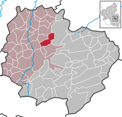
Gerbach

Last updated
Gerbach
Wappen Gerbach.png
Coat of arms
Location of Gerbach within Donnersbergkreis district
Gerbach in KIB.svg
Germany adm location map.svg
Red pog.svg
Gerbach
Rhineland-Palatinate location map.svg
Red pog.svg
Gerbach
Coordinates: 49°40′24.82″N7°52′14.4″E / 49.6735611°N 7.870667°E / 49.6735611; 7.870667 Coordinates: 49°40′24.82″N7°52′14.4″E / 49.6735611°N 7.870667°E / 49.6735611; 7.870667
Country Germany
State Rhineland-Palatinate
District Donnersbergkreis
Municipal assoc. Nordpfälzer Land
Government
   Mayor (201924) Daniel Heinz [1]
Area
  Total7.32 km2 (2.83 sq mi)
Elevation
257 m (843 ft)
Population
 (2020-12-31) [2]
  Total523
  Density71/km2 (190/sq mi)
Time zone UTC+01:00 (CET)
  Summer (DST) UTC+02:00 (CEST)
Postal codes
67813
Dialling codes 06361
Vehicle registration KIB

Gerbach is a municipality in the Donnersbergkreis district, in Rhineland-Palatinate, Germany.

Contents

Geography

The village is situated on the Appelbach in the North Palatinate Highlands northwest of the Donnersberg between Kaiserslautern and Bad Kreuznach. Gerbach also includes the residential areas Althof, Kahlenbergweiher, Köhlerhof and Schneebergerhof.[2] The Campingpark Pfalz is also located in the municipal area.

History

The first documentary mention was made in 1192. Until the end of the 18th century Gerbach belonged to the county of Falkenstein.

In 1794 the left bank of the Rhine was occupied in the First Coalition War. From 1798 to 1814 Gerbach belonged to the canton of Kirchheim (also called Kirchheimbolanden) in the department of Donnersberg. As a result of the Congress of Vienna he was Bavarian from 1816 to 1945. After the Second World War, Gerbach was part of the French occupation zone and was incorporated into the newly formed state of Rhineland-Palatinate in 1946.

Politics

The municipal council in Gerbach consists of twelve council members who were elected in a majority vote at the local elections on 26 May 2019, and the honorary local mayor as chairman.

Emblem

Blasonation: "In gold on a green shield foot a green frog, behind it a willow with brown trunk and green foliage."

Economy and Infrastructure

In Gerbach there is a primary school which is also responsible for Bayerfeld-Steckweiler, Dielkirchen, St. Alban, Ruppertsecken and Würzweiler.

The L 385 and L 400 intersect in the village. The A 63 in the southeast connects to long-distance traffic. In Rockenhausen there is a train station of the Alsenztalbahn.

Gerbach has a very traditional male choral society, founded in 1861. In 2011 there was an anniversary celebration (150 years). Furthermore, a carnival club is very active in the community as well as a sports club (Soccer, Table Tennis, Aerobic).

Buildings

In the village there is the catholic church St. Michael.

At Gerbach, there is the world's most powerful wind turbine, an Enercon E-126 with axis height of 135 metres and rotor diameter of 127 metres with a generation capacity of 7.5 MW. At the end of 2013, a rotor blade came loose and crashed to the ground. This was caused by several cracked bolts on the rotor blade attachment. In May 2014, the turbine was put back into operation after being repaired.

Sons and daughters of the community

Related Research Articles

The Donnersbergkreis is a district (Kreis) in the middle of Rhineland-Palatinate, Germany. Neighboring districts are Bad Kreuznach, Alzey-Worms, Bad Dürkheim, Kaiserslautern, Kusel.

Kirchheimbolanden Place in Rhineland-Palatinate, Germany

Kirchheimbolanden, the capital of Donnersbergkreis, is a town in Rhineland-Palatinate, south-western Germany. It is situated approximately 25 km west of Worms, and 30 km north-east of Kaiserslautern. The first part of the name, Kirchheim, dates back to 774. It became a town in 1368, and the Sponheim family improved its security with many towers and walls. William, Duke of Nassau, ancestor of the royal families of Belgium, Sweden, Denmark and Norway, and of the grand-ducal family of Luxembourg, was born in Kirchheimbolanden. It was also ruled by the First French Empire between 1792 and 1814, before passing to the Kingdom of Bavaria in 1815. It was a rural district centre in the Rheinkreis, which was renamed Pfalz (Palatinate) in 1835.

Rockenhausen Place in Rhineland-Palatinate, Germany

Rockenhausen is a town in the Donnersbergkreis, in Rhineland-Palatinate, Germany. It is situated on the river Alsenz, approx. 30 km (19 mi) north of Kaiserslautern.

Obermoschel Place in Rhineland-Palatinate, Germany

Obermoschel is a town and municipality in the district Donnersbergkreis, Rhineland-Palatinate, Germany. With around 1,000 residents, it is the smallest town in the Palatinate (Pfalz). It is part of the Verbandsgemeinde Nordpfälzer Land, which has its seat of administration in community of Rockenhausen and an administrative office in Alsenz. According to regional planning, Obermoschel is designated as lower-order center (Grundzentrum).

Vendersheim Place in Rhineland-Palatinate, Germany

Vendersheim is an Ortsgemeinde – a municipality belonging to a Verbandsgemeinde, a kind of collective municipality – in the Alzey-Worms district in Rhineland-Palatinate, Germany.

Ober-Flörsheim Place in Rhineland-Palatinate, Germany

Ober-Flörsheim is an Ortsgemeinde – a municipality belonging to a Verbandsgemeinde, a kind of collective municipality – in the Alzey-Worms district in Rhineland-Palatinate, Germany.

Hochstätten Place in Rhineland-Palatinate, Germany

Hochstätten is an Ortsgemeinde – a municipality belonging to a Verbandsgemeinde, a kind of collective municipality – in the Bad Kreuznach district in Rhineland-Palatinate, Germany. It belongs to the Verbandsgemeinde of Bad Kreuznach, whose seat is in the like-named town. Hochstätten is a winegrowing village. The municipality also markets itself as a recreational destination with the self-given nickname das Tor zur Pfalz im Erholungsgebiet Rheingrafenstein.

Lettweiler Place in Rhineland-Palatinate, Germany

Lettweiler is an Ortsgemeinde – a municipality belonging to a Verbandsgemeinde, a kind of collective municipality – in the Bad Kreuznach district in Rhineland-Palatinate, Germany. It belongs to the Verbandsgemeinde of Meisenheim, whose seat is in the like-named town. Lettweiler is a winegrowing village.

Rehborn Place in Rhineland-Palatinate, Germany

Rehborn is an Ortsgemeinde – a municipality belonging to a Verbandsgemeinde, a kind of collective municipality – in the Bad Kreuznach district in Rhineland-Palatinate, Germany. It belongs to the Verbandsgemeinde of Nahe-Glan.

Schmittweiler Place in Rhineland-Palatinate, Germany

Schmittweiler is an Ortsgemeinde – a municipality belonging to a Verbandsgemeinde, a kind of collective municipality – in the Bad Kreuznach district in Rhineland-Palatinate, Germany. It belongs to the Verbandsgemeinde of Meisenheim, whose seat is in the like-named town.

Brachtendorf Place in Rhineland-Palatinate, Germany

Brachtendorf is an Ortsgemeinde – a municipality belonging to a Verbandsgemeinde, a kind of collective municipality – in the Cochem-Zell district in Rhineland-Palatinate, Germany. It belongs to the Verbandsgemeinde of Kaisersesch, whose seat is in the like-named town.

Bennhausen Place in Rhineland-Palatinate, Germany

Bennhausen is a municipality in the Donnersbergkreis district, in Rhineland-Palatinate, Germany. It belongs to the Verbandsgemeinde of Kirchheimbolanden.

Gundersweiler Place in Rhineland-Palatinate, Germany

Gundersweiler is a village and a municipality in the Verbandsgemeinde Nordpfälzer Land and the Donnersbergkreis district, in Rhineland-Palatinate, Germany. It is located in the valley of Moschelbach in the North Palatine Uplands, southwest of Donnersberg and between Kaiserslautern and Bad Kreuznach.

Steinbach am Donnersberg Place in Rhineland-Palatinate, Germany

Steinbach am Donnersberg is a municipality in the Donnersbergkreis district, in Rhineland-Palatinate, Germany. The current mayor is Susanne Röß, elected in 2019.

Queidersbach Place in Rhineland-Palatinate, Germany

Queidersbach is a municipality in the district of Kaiserslautern, in Rhineland-Palatinate, western Germany.

Hillesheim, Mainz-Bingen Place in Rhineland-Palatinate, Germany

Hillesheim is an Ortsgemeinde – a municipality belonging to a Verbandsgemeinde, a kind of collective municipality – in the Mainz-Bingen district in Rhineland-Palatinate, Germany.

Horrweiler Place in Rhineland-Palatinate, Germany

Horrweiler is an Ortsgemeinde – a municipality belonging to a Verbandsgemeinde, a kind of collective municipality – in the Mainz-Bingen district in Rhineland-Palatinate, Germany.

Welgesheim Place in Rhineland-Palatinate, Germany

Welgesheim is an Ortsgemeinde – a municipality belonging to a Verbandsgemeinde, a kind of collective municipality – in the Mainz-Bingen district in Rhineland-Palatinate, Germany.

North Palatine Uplands Mountains in Germany

The North Palatine Uplands, sometimes shortened to Palatine Uplands, is a low mountain range and landscape unit in the German state of Rhineland-Palatinate and belongs mainly to the Palatinate region. It is part of the Saar-Nahe Uplands.

Zellertal (region)

The Zellertal is a valley region in the east of the North Palatine Uplands in the German state of Rhineland-Palatinate. Its western part belongs to Palatine Donnersbergkreis, its eastern part to Rhenish Hessian Alzey-Worms. The valley is named after the old municipality of Zell, which became part of the new Zellertal municipality in 1976.

References

  1. Direktwahlen 2019, Donnersbergkreis, Landeswahlleiter Rheinland-Pfalz, accessed 9 August 2021.
  2. "Bevölkerungsstand 2020, Kreise, Gemeinden, Verbandsgemeinden". Statistisches Landesamt Rheinland-Pfalz (in German). 2021.