Ottersheim | |
|---|---|
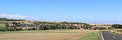 panoramic view | |
 Coat of arms | |
Location of Ottersheim within Donnersbergkreis district  | |
 Ottersheim  Ottersheim | |
| Coordinates: 49°37′32″N08°06′30″E / 49.62556°N 8.10833°E | |
| Country | Germany |
| State | Rhineland-Palatinate |
| District | Donnersbergkreis |
| Municipal assoc. | Göllheim |
| Government | |
| • Mayor (2019–24) | Rüdiger Kragl [1] |
| Area | |
• Total | 2.74 km2 (1.06 sq mi) |
| Elevation | 233 m (764 ft) |
| Population (2023-12-31) [2] | |
• Total | 356 |
| • Density | 130/km2 (337/sq mi) |
| Time zone | UTC+01:00 (CET) |
| • Summer (DST) | UTC+02:00 (CEST) |
| Postal codes | 67308 |
| Dialling codes | 06355 |
| Vehicle registration | KIB |
| Website | www.goellheim.de |
Ottersheim is a municipality in the Donnersbergkreis district, in Rhineland-Palatinate, Germany.

