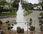
The Eifel is a low mountain range in western Germany, eastern Belgium and northern Luxembourg. It occupies parts of southwestern North Rhine-Westphalia, northwestern Rhineland-Palatinate and the southern area of the German-speaking Community of Belgium.
Vulkaneifel is a district (Kreis) in the northwest of the state Rhineland-Palatinate, Germany. It is the least densely populated district in the state and the fourth most sparsely populated district in Germany. The administrative centre of the district is in Daun. Neighboring districts are Euskirchen, Ahrweiler, Mayen-Koblenz, Cochem-Zell, Bernkastel-Wittlich, and Bitburg-Prüm.

Daun is a town in the Vulkaneifel district in Rhineland-Palatinate, Germany. It is the district seat and also the seat of the Verbandsgemeinde of Daun.

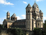
Laacher See, also known as Lake Laach or Laach Lake, is a volcanic caldera lake with a diameter of 2 km (1.2 mi) in Rhineland-Palatinate, Germany, about 24 km (15 mi) northwest of Koblenz, 37 km (23 mi) south of Bonn, and 8 km (5.0 mi) west of Andernach. It is in the Eifel mountain range, and is part of the East Eifel volcanic field within the larger Volcanic Eifel. The lake was formed by a Plinian eruption approximately 13,000 years BP with a Volcanic Explosivity Index (VEI) of 6, on the same scale as the Pinatubo eruption of 1991. The volcanic discharge observable as mofettas on the southeastern shore of the lake is a sign of dormant volcanism.
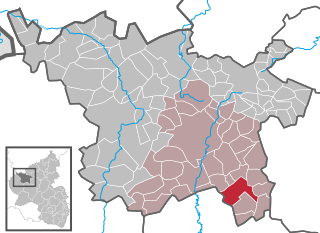
Gillenfeld is an Ortsgemeinde – a municipality belonging to a Verbandsgemeinde, a kind of collective municipality – in the Vulkaneifel district in Rhineland-Palatinate, Germany. It belongs to the Verbandsgemeinde of Daun, whose seat is in the like-named town.

Nitz is an Ortsgemeinde – a municipality belonging to a Verbandsgemeinde, a kind of collective municipality – in the Vulkaneifel district in Rhineland-Palatinate, Germany. It belongs to the Verbandsgemeinde of Kelberg, whose seat is in the like-named municipality.
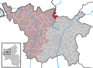
Nohn is an Ortsgemeinde – a municipality belonging to a Verbandsgemeinde, a kind of collective municipality – in the Vulkaneifel district in Rhineland-Palatinate, Germany. It belongs to the Verbandsgemeinde of Gerolstein, whose seat is in the like-named town.

Rockeskyll is an Ortsgemeinde – a municipality belonging to a Verbandsgemeinde, a kind of collective municipality – in the Vulkaneifel district in Rhineland-Palatinate, Germany. It belongs to the Verbandsgemeinde of Gerolstein, whose seat is in the like-named town.
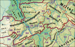
The Rhenish Massif, Rhine Massif or Rhenish Uplands is a geologic massif in western Germany, eastern Belgium, Luxembourg and northeastern France. It is drained centrally, south to north by the river Rhine and a few of its tributaries.

The Eifel hotspot is a volcanic hotspot in Western Germany. It is one of many recent volcanic formations in and around the Eifel mountain range and includes the volcanic field known as Volcanic Eifel. Although the last eruption occurred around 10,000 years ago, the presence of escaping volcanic gases in the region indicates that it is still weakly active.

The Volcanic Eifel or Vulkan Eifel, also known as the East Eifel Volcanic Field (EEVF), is a region in the Eifel Mountains in Germany that is defined to a large extent by its volcanic geological history. Characteristic of this volcanic field are its typical explosion crater lakes or maars, and numerous other signs of volcanic activity such as volcanic tuffs, lava streams and volcanic craters like the Laacher See. The Volcanic Eifel is still volcanically active today. One sign of this activity is the escaping gases in the Laacher See.

The Hohe Acht is the highest mountain in the Eifel mountains of Germany. It is located on the boundary between the districts of Ahrweiler and Mayen-Koblenz in Rhineland-Palatinate.

The Volcano Park in Mayen-Koblenz is a geopark in the rural district of Mayen-Koblenz in the eastern Vulkan Eifel, Germany. It was founded in 1996 and wraps around the Laacher See. Together with the Volcano Park, Brohltal/Laacher See and the Vulkan Eifel Nature and Geo-Park, it forms part of the national Eifel Volcano Land Geo-Park. The three parks are connected by the 280-kilometre-long German Volcano Route.
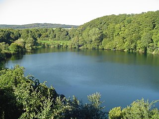
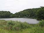
The Ulmener Maar is a maar in the Eifel mountains of Germany in the immediate vicinity of the town of Ulmen in the state of Rhineland-Palatinate. The lake is up to 37 metres deep and is surrounded by an embankment of tuff with an average height of 20 metres, which was formed from the erupted material of the former volcano. By the southern edge of the embankment are the ruins of a knight's castle, Ulmen Castle dating to the 11th century.
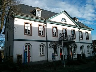
The Volcano Museum in the old district administrative office (Landratsamt) in Daun, Germany, was set up as an extension of the existing 'geopaths' at Hillesheim, Manderscheid and Gerolstein and is part of the Volcanic Eifel Nature and Geopark.
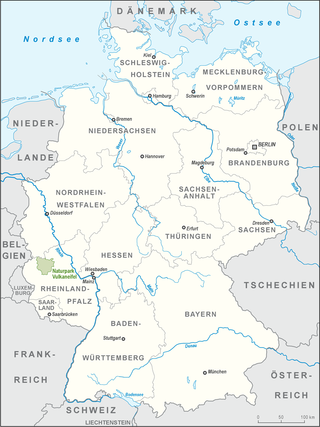
The Volcanic Eifel Nature Park lies in the counties of Bernkastel-Wittlich, Cochem-Zell and Vulkaneifel in the German state of Rhineland-Palatinate. The nature park, which is in the Eifel mountains, and which is also a geopark, was inaugurated on 31 May 2010 and has an area of 1,068.24 km2.> Its sponsor is the Natur- und Geopark Vulkaneifel GmbH.
The Vulkanland Eifel Geopark is a German national geopark in the Volcanic Eifel region that was established on 19 April 2005. Covering an area of 2,200 km2, the geopark extends from the Belgian border in the west over the Eifel mountains to the River Rhine in the east. The countryside here which has been shaped by the volcanism of the past contains numerous maars, cinder cones, lava flows lava domes calderas and bubbling springs. The largest caldera was formed by the Laacher See volcano that last erupted about 13,000 years ago. A sign of continuing volcanic activity in this region are the volcanic gases that are still visibly being discharged into the atmosphere.

The Dreiser Weiher near Dreis-Brück in the vicinity of Daun in the German state of Rhineland-Palatinate is a tub-shaped maar in the Eifel mountains. It is up to 1,360 metres long and 1,160 metres wide. It is the second largest maar in the Eifel.

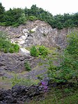
The Rockeskyller Kopf near Rockeskyll in the county of Vulkaneifel in the German state of Rhineland-Palatinate is a hill, 554.6 m above sea level (NHN), in the Eifel mountains. It is an extinct volcano complex from the Quaternary period, around 360,000 years old and is designated as a natural monument (ND-7233-420).

Ley is an old German word for rock, cliff or crag which often occurs in placenames.

