Sethrida Tawk Geagea, is a Lebanese politician and MP since July 2005 from the Bcharri district. She is also a member of the executive committee of the Lebanese Forces, headed by her husband, Samir Geagea. She contributed greatly to the management of the Lebanese Forces Party during Samir Geagea's Arrest between 1994 and 2005.

Yanouh is a village and municipality in the Byblos District of the Keserwan-Jbeil Governorate, Lebanon. It is located 94 kilometers north of Beirut. Yanouh's inhabitants are predominantly Maronite Catholics. Its average elevation is 1,120 meters above sea level and its total land area is 147 hectares. Yanouh stands on the slopes of Joubbat El Mnaitra, five miles east of Qartaba, on the right bank high up in the ravine carved out by the Adonis River, now known as Nahr Ibrahim.

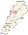
Byblos District, also called the Jbeil District, is a district (qadaa) of the Keserwan-Jbeil Governorate of Lebanon. It is located to the northeast of Lebanon's capital Beirut. The capital is Byblos. The rivers of al-Madfoun and Nahr Ibrahim form the district's natural northern and southern borders respectively, with the Mediterranean Sea bordering it from the west and Mount Lebanon from the east, separating it from the adjacent district of Baalbek in the Beqaa Valley.
Hsarat is a village in the Byblos District of the Keserwan-Jbeil Governorate, Lebanon. Its inhabitants are predominantly Maronite Catholics.

Yahchouch is a municipality in the Keserwan District of the Keserwan-Jbeil Governorate in Lebanon. It is located 42 kilometers north of Beirut. Its average elevation is 670 meters above sea level and its total land area is 636 hectares. Yahchouch's inhabitants are predominantly Maronite Catholics and Christians from other denominations.

Qartaba is a mountainous village in the Byblos District of the Keserwan-Jbeil Governorate, Lebanon. In Syriac, Qartaba means either " a good place ܟܘܪ ܛܒܐ " or " nice chillness ܩܪܛܒܐ " reflecting its good, curing, and balanced weather. The town is often referred to as "Byblos' Bride".
Mayfouq is a village and municipality in the Byblos District of Keserwan-Jbeil Governorate, Lebanon. It is located 64 km north of Beirut. Mayfouq has an average elevation of 860 meters above sea level and its total land area is 811 hectares. Its inhabitants are predominantly Maronite Catholics.
Jaj is a mountainous village in the Byblos District of Keserwan-Jbeil Governorate, Lebanon. It is 68 kilometers north of Beirut. Jaj has an average elevation of 1,220 meters above sea level and a total land area of 1,174 hectares. Its inhabitants are predominantly Maronite Catholics. Jaj is known for its cedar trees high in the mountains. The village is home to many families many of whom come up primarily on weekends.
Mitrit is a mixed Shia Muslim and Maronite village in the Koura District, Lebanon.
Tartej is a village in the Byblos District of the Keserwan-Jbeil Governorate, Lebanon. Its average elevation is 1,100 meters. Qornet Ain el-Deb is the highest peak in the mountain (1,859 meters), peak Ain al-Marbout (1,774 meters), Jouret al-Maktoul (1,715 meters), Jouret al-Touti (1,480 meters) and al-Wata (1,088 meters).

Jeddayel is a town in the Byblos District of the Keserwan-Jbeil Governorate, Lebanon. It is located 4 km north of Byblos. Its inhabitants are predominantly Greek Orthodox and Maronite Christians. Its population is about 1,500.

Aqoura is a mountainous village in the Byblos District of Keserwan-Jbeil Governorate, Lebanon. It is 68 kilometers north of Beirut. Aqoura has an average elevation of 1,600 meters above sea level and a total land area of around 10.5 square kilometers. Aqoura's inhabitants are Maronite Catholics.
Bejjeh, is a municipality in the Byblos District of Keserwan-Jbeil Governorate, Lebanon. It is 54 kilometers north of Beirut. Bejjeh has an average elevation of 560 meters above sea level and a total land area of 502 hectares. There were four companies with more than five employees operating in the village as of 2008. Its inhabitants are predominantly Maronite Catholics.

Blat is a municipality in the Byblos District of Keserwan-Jbeil Governorate, Lebanon. It is a suburb of Byblos and is 40 kilometers north of Beirut. Blat has an average elevation of 190 meters above sea level and a total land area of 683 hectares. Its inhabitants are predominantly Maronite Catholics. As of 2008, there were three private schools in the village enrolling 2,560 students, in addition to a campus of the Lebanese American University. There were 28 companies with more than five employees operating in Blat.
Halat is a municipality in the Byblos District of Keserwan-Jbeil Governorate, Lebanon. It is located along the Mediterranean coast, 32 kilometers north of Beirut. Its inhabitants are predominantly Maronite Catholics. Halat has an average elevation of 100 meters above sea level and a total land area of 957 hectares. The town has one public school, which had 112 students in 2008. There were 45 companies with more than five employees operating in Halat as of 2008. There is also a quarry in the town. Charles Bassil is the current municipality president.
Kfar Baal, also known as Annaya is a municipality in the Byblos District of Keserwan-Jbeil Governorate, Lebanon. It is 55 kilometers north of Beirut. Kfar Baal has an average elevation of 920 meters above sea level and a total land area of 303 hectares. There were six companies with more than five employees operating in the village as of 2008. Its inhabitants are predominantly Maronite Catholics.
Lehfed is a municipality in the Byblos District of Keserwan-Jbeil Governorate, Lebanon. It is 55 kilometers north of Beirut. Lehfed has an average elevation of 1000 meters above sea level and a total land area of 529 hectares. There were three companies with more than five employees operating in the village as of 2008. Its inhabitants are predominantly Maronite Catholics.
Lassa is a municipality in the Byblos District of Keserwan-Jbeil Governorate, Lebanon. It is 90 kilometers north of Beirut. Lassa has an average elevation of 1,130 meters above sea level and a total land area of 739 hectares. The village contains one public school, which enrolled 15 students in 2008. Its inhabitants are predominantly Shia Muslims.

Mghayreh is a municipality in the Byblos District of Keserwan-Jbeil Governorate, Lebanon. It is 82 kilometers north of Beirut. Mghayreh has an average elevation of 1,300 meters above sea level and a total land area of 263 hectares. Its inhabitants are predominantly Maronite Catholics and Shia Muslims.
Nahr Ibrahim is a town in the Byblos District of Keserwan-Jbeil Governorate, Lebanon. It is 47 kilometers north of Beirut. Nahr Ibrahim has an average elevation of 220 meters above sea level and a total land area of 341 hectares. The village has one public school, which enrolled 44 students in 2008 and a French university operating by the French and Lebanese governments Conservatoire National des arts et métiers cnam which enrolled 2913 students as of May 2017.the village include a large industrial area Its inhabitants are predominantly Maronite Catholics.