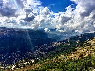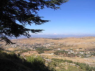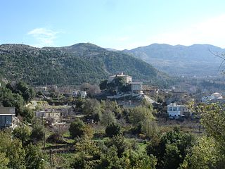
Baskinta is a Lebanese village situated at an altitude ranging from 1250 metres above sea level and climbs up to approximately 1800 meters of height at Qanat Bakish, making it one of the highest villages of Lebanon. It is located 43 kilometers north east of Beirut.
Yanouh is a village and municipality in the Byblos District of the Keserwan-Jbeil Governorate, Lebanon. It is located 94 kilometers north of Beirut. Yanouh's inhabitants are predominantly Maronite Catholics. Its average elevation is 1,120 meters above sea level and its total land area is 147 hectares. Yanouh stands on the slopes of Joubbat El Mnaitra, five miles east of Qartaba, on the right bank high up in the ravine carved out by the Adonis River, now known as Nahr Ibrahim.

Barouk is a village in the Chouf District of Mount Lebanon Governorate in Lebanon. Barouk is located 52 kilometers southeast of Beirut. Its average elevation is 1000 to 1200 meters above sea level and its total land area consists of 2,762 hectares. The village had 5,197 registered voters in 2010. Its inhabitants are predominantly Druze and Maronite and Melkite Christians.
Amsheet is a seaside town and municipality in the Byblos District of Keserwan-Jbeil Governorate, Lebanon, about 40 km north of Beirut. The town's average elevation is 140 meters above sea level and its total land area is 595 hectares. Its inhabitants are predominantly Maronites, although there is a Shia Muslim minority.

Toula is a small village in North Lebanon in Zgharta District. It is 1,150 meters above sea level and is primarily a recreational village. Descendants of the original full-time residents of Toula do not reside in Toula during the winter months. Heavy snow fall typically makes Toula's mountainous roads inaccessible. However, Toula's original families occupied the village on a year-round basis. Settling families and early residents developed a climatic tolerance and adapted to Toula's harsh winter months.

Beit Mery is a Lebanese town overlooking the capital Beirut. The town has been a summer mountain resort since the times of the Phoenicians and later the Romans. The name derives from Aramaic and means "The house of my Lord". On one of the three hills of Beit Mery along the Lebanon Western mountain range are the ruins of the old Phoenician and Roman temples that were erected in the same general area in what is now known as Deir El-Qala'a. At present, a Christian church and monastery sit on top of parts of the old Roman temple. Les Scouts Du Liban Groupe Sainte Marie Beit Mery is one of the biggest movement in town and it is located in College des Freres since 1969. Beit Mery is home to a Lebanese Red Cross First Aid Center.
Deir El Ahmar is a Lebanese town, located 100 km from Beirut and 22 km northwest of Baalbek in the Bekaa Valley in Lebanon.
Faitroun is a town in the Keserwan District of Keserwan-Jbeil Governorate. Located 33 kilometers north of Beirut and at an average altitude of 1,200 meters above sea level and its total land area of 743 hectares. Its inhabitants are predominantly Maronite Christians. Faitroun has a public school, which had 229 students as of 2008. The town is home to a number of hotels and restaurants.

Qartaba is a town in the mountains of the Byblos District of the Keserwan-Jbeil Governorate, Lebanon. It is located 57 kilometers north Beirut on the mountains above Byblos at an average altitude of 1,250 meters. Qartaba is surrounded by olive groves, apple orchards, and vineyards.

Hadath el Jebbeh, is a town located in Bsharri District in the North Governorate of Lebanon. It was originally settled in 400 A.D., and is situated on a hill at an altitude of 1500 meters, overlooking the Kadisha valley.
Mayfouq is a village and municipality in the Byblos District of Keserwan-Jbeil Governorate, Lebanon. It is located 64 km north of Beirut. Mayfouq has an average elevation of 860 meters above sea level and its total land area is 588 hectares. Its inhabitants are predominantly Maronite Catholics.

Niha is a village in the Bekaa Valley about 18 km (5.0 mi) north of Zahlé. It is famous for its Roman archeological ruins in the outskirts, and in particular two lower Roman temples that date back to the 1st century AD.

Ghabat is a village in Lebanon located in the Jurd area of the district of Byblos in the Mount Lebanon region, about 74 kilometres northeast of Beirut. Its inhabitants are predominantly Maronite Catholics.

Bteddine El Loqch, Btaddine El Loqsh, Btaddine Al Lokch, Btaddine Al Loqsh, is a village in South Lebanon Governorate, Lebanon. The number of registered citizens reaches 830 people, with the majority belonging to the Maronite confession. The town counts 80 houses and 10 shops and commercial institutions. The most common family names are: "Kattar", "Abou Sleiman", "Eid", "Sayegh", "Abou Samra", "Akl", "Abi Nader" ...
Tartej is a village in the Byblos District of the Keserwan-Jbeil Governorate, Lebanon. Its average elevation is 1,100 meters. Qornet Ain el-Deb is the highest peak in the mountain (1,859 meters), peak Ain al-Marbout (1,774 meters), Jouret al-Maktoul (1,715 meters), Jouret al-Touti (1,480 meters) and al-Wata (1,088 meters).

Ghosta is a municipality in the Keserwan District of the Keserwan-Jbeil Governorate of Lebanon. It is located 36 kilometers north of Beirut. Ghosta's average elevation is 950 meters above sea level and its total land area is 461 hectares. Its inhabitants are predominantly Maronite Catholics.

Aqoura is a mountainous village in the Byblos District of Keserwan-Jbeil Governorate, Lebanon. It is 68 kilometers north of Beirut. Aqoura has an average elevation of 1,600 meters above sea level and a total land area of around 10.5 square kilometers. Aqoura's inhabitants are mostly Maronite Catholics.
Ain el-Rihaneh is a town and municipality located in the Keserwan District of the Keserwan-Jbeil Governorate of Lebanon. The town is about 21 kilometres (13 mi) north of Beirut. It has an average elevation of 340 meters above sea level and a total land area of 2000 hectares. Ain el-Rihaneh's inhabitants are Maronites. The village contained two private schools enrolling a total of 201 students as of 2006. The biggest family in this town is the Kreidy family.
Bqaatouta (Bkaatouta) is a village located on the upper mountains of Keserwan District, Lebanon, at an average altitude of 1,300 metres aboved sea level. Its population is around 1,650 persons (Maronites). It is 45 kilometres from Beirut. It is known for its dry and healthy air as well as for its apple gardens. It has an historic monastery (1767) dedicated to St Mary and two other old churches. It is home for the Sannine bottled water company. Other important employers include the Hajj concrete and construction company. The village is surrounded by the highest peaks of Metn and Keserwan and lies at the sources of the dog river separating the two casas; Bqaatouta Municipality was created in 2009 and is working closely to transform the infrastructure of the village into a modern and environmentally friendly one. Among these improvements were changes to the houses drains, which are recuperated into a natural waste water treatment facility located on the lower part of the village and functioning only on Rheed beds; one of the largest of its type in Lebanon.. More recently, the municipality managed, through international donation, to secure photovoltaic systems to all the village houses. Bqaatouta falls also on the LMT trail in the midsection between Kfardebian and Baskinta. in 2020 it created a "Heritage trail" linking several archeological, natural and traditional points of interest.
Jouar el Haouz is a municipality in the Baabda District of the Mount Lebanon Governorate of Lebanon. It is located 36 kilometers east of Beirut. Its average elevation is 1,250 m (4,100 ft) above sea level, and its total land area is 377 hectares. The municipality is member of Federation of Matn El Aala Municipalities.


